


Summary
Bethania (/bɛθɑːniə/) is a suburb in the City of Logan, Queensland, Australia.[2] In the 2016 census, Bethania had a population of 5,385 people.[1]
| Bethania Logan City, Queensland | |||||||||||||||
|---|---|---|---|---|---|---|---|---|---|---|---|---|---|---|---|
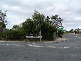 Albert Street, 2014 | |||||||||||||||
 Bethania | |||||||||||||||
| Coordinates | 27°41′13″S 153°09′27″E / 27.6869°S 153.1575°E | ||||||||||||||
| Population | 5,385 (2016 census)[1] | ||||||||||||||
| • Density | 928/km2 (2,405/sq mi) | ||||||||||||||
| Postcode(s) | 4205 | ||||||||||||||
| Elevation | 15 m (49 ft) | ||||||||||||||
| Area | 5.8 km2 (2.2 sq mi) | ||||||||||||||
| Time zone | AEST (UTC+10:00) | ||||||||||||||
| Location |
| ||||||||||||||
| LGA(s) | Logan City | ||||||||||||||
| State electorate(s) | Waterford | ||||||||||||||
| Federal division(s) | Forde | ||||||||||||||
| |||||||||||||||
Geography edit

Bethania lies south of the Logan River. The lower lying areas near the river occasionally suffer floods.[3]
Bethania is situated on the main Beenleigh railway line and the suburb is served by Bethania railway station (27°41′20″S 153°09′33″E / 27.6889°S 153.1592°E).[4]
Beaudesert railway line branches from the South Coast railway line just south of the Bethania railway station at (27°41′24″S 153°09′36″E / 27.6901°S 153.1600°E) and runs to Beaudesert. It has been out of commission since August 2004.
History edit

Bethania was founded by Germans during the 1860s and is home to many different nationalities. By 1866 a small township had developed. It is believed the name is derived from Bethany, the biblical village in Israel.[2][5]
A Lutheran church was built in 1864 made from slabs on what is now the railway line. A cemetery was established beside the church with graves from 1866. In 1872 the present church was built close to the first church (27°41′29″S 153°09′41″E / 27.691361°S 153.161392°E). The road to the church became known as Church Road.[6]
The first railway bridge was destroyed by flood in 1887. A new concrete, steel and timber bridge lasted until 1972 when it was replaced by a pre-stressed concrete bridge.[5]
The suburb was affected badly by the 1974 Brisbane flood. Duck Island became part of the suburb when part of the river was silted up.[5] Sand and gravel has been mined from the alluvial deposits in recent years.
Bethania Lutheran Primary School opened on 27 January 1976.[7]
Demographics edit
In the 2011 census, Bethania recorded a population of 4,590 people, 53.3% female and 46.7% male.[8] The median age of the Bethania population was 41 years, 4 years above the national median of 37.[8] 68.7% of the people living in Bethania were born in Australia. The other top responses for country of birth were England 6.6%, New Zealand 6%, Scotland 1.4%, Philippines 0.9% and Germany 0.9%.[8] 86.9% of the people spoke only English at home; the next most common languages were 0.8% Spanish, 0.5% German, 0.5% Hindi, 0.4% Tagalog, 0.3% Samoan.[8]
In the 2016 census, Bethania had a population of 5,385 people.[1]
Heritage listing edit
Bethania has a number of heritage-listed sites, including:
- Church Road: Bethania Lutheran Church[6]
Education edit
Bethania Lutheran Primary School is a private primary (Prep-6) school for boys and girls at 66 Glastonbury Drive (27°41′39″S 153°09′28″E / 27.6943°S 153.1578°E).[9][10] In 2018, the school had an enrolment of 287 students with 25 teachers (21 full-time equivalent) and 16 non-teaching staff (11 full-time equivalent).[11]
Amenities edit
Palm Lake Christian Fellowship conduct their services at the Palm Lake Resort at 43 Goodooga Drive; it is part of the Wesleyan Methodist Church.[12]
Transport edit
Bethania railway station provides access to regular Queensland Rail City network services to Brisbane and Beenleigh.
References edit
- ^ a b c Australian Bureau of Statistics (27 June 2017). "Bethania (SSC)". 2016 Census QuickStats. Retrieved 20 October 2018.
- ^ a b "Bethania – suburb in City of Logan (entry 47854)". Queensland Place Names. Queensland Government. Retrieved 27 December 2020.
- ^ "Natural Hazard (Flood) Management Areas - Overlay Map OM17-1" (PDF). Gold Coast City Council. 2008. Archived (PDF) from the original on 5 December 2017. Retrieved 5 December 2017.
- ^ "Bethania – railway station in Logan City (entry 2414)". Queensland Place Names. Queensland Government. Retrieved 2 April 2020.
- ^ a b c Howells, Mary (2003). Logan River Tinnie Trail. Logan City Council. pp. 42, 70–72. ISBN 0975051903.
- ^ a b "Bethania Lutheran Church (entry 600002)". Queensland Heritage Register. Queensland Heritage Council. Retrieved 10 July 2013.
- ^ Queensland Family History Society (2010), Queensland schools past and present (Version 1.01 ed.), Queensland Family History Society, ISBN 978-1-921171-26-0
- ^ a b c d Australian Bureau of Statistics (31 October 2012). "Bethania (State Suburb)". 2011 Census QuickStats. Retrieved 29 April 2013.
- ^ "State and non-state school details". Queensland Government. 9 July 2018. Archived from the original on 21 November 2018. Retrieved 21 November 2018.
- ^ "Bethania Lutheran Primary School". Archived from the original on 5 December 2018. Retrieved 21 November 2018.
- ^ "ACARA School Profile 2018". Australian Curriculum, Assessment and Reporting Authority. Archived from the original on 27 August 2020. Retrieved 28 January 2020.
- ^ "South Queensland". Wesleyan Methodist Church Australia. Archived from the original on 21 August 2021. Retrieved 23 August 2021.
External links edit
- "Bethania". Queensland Places. Centre for the Government of Queensland, University of Queensland.
- "Bethania". Logan City Council.