


Summary
Bheriganga (Nepali: भेरीगंगा) is an urban municipality located in Surkhet District of Karnali province of Nepal.
Bheriganga
भेरीगंगा नगरपालिका | |
|---|---|
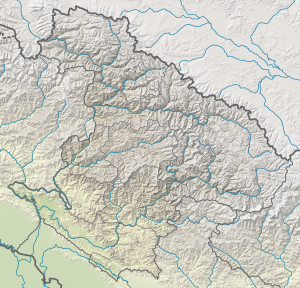 Bheriganga Location in province  Bheriganga Bheriganga (Nepal) | |
| Coordinates: 28°27′N 81°37′E / 28.45°N 81.61°E | |
| Country | |
| Province | Karnali |
| District | Surkhet |
| Total Wards | 13 |
| Established | 2 December 2014 |
| Government | |
| • Type | Mayor–council |
| • Body | Bheriganga Municipality |
| • Mayor | Mr. Bhupendra Bahadur Chand (NC) |
| • Deputy Mayor | Mrs. Renu Acharya (Dhakal) (NC) |
| Area of Municipality | |
| • Total | 256.20 km2 (98.92 sq mi) |
| Highest elevation | 1,400 m (4,600 ft) |
| Lowest elevation | 500 m (1,600 ft) |
| Population (2011) | |
| • Total | 42,987 |
| Languages | |
| • Official | Nepali |
| Time zone | UTC+5:45 (NST) |
| Website | official website |
According to 2011 Nepal census the total population of the municipality is 41,407 and the total area of the municipality is 256.20 square kilometres (98.92 sq mi). The municipality is divided into total 13 wards. Lekhparajul VDC was Incorporated with municipality in 2017 when government cancelled all old administration system and introduce new 753 local level administrative body.[1]
The municipality is surrounded by Gurbha Kot in east, Barahatal in west, Birendranagar and Lekbesi in north and Bardiya District in south.[2]
History edit
Bheriganga municipality was established on 2 December 2014 merging 3 VDC Chinchu, Maintada and Ramghat. Lekhparajul VDC Incorporated with municipality in 2017 when new administrative system came in force.[3]
Demographics edit
At the time of the 2011 Nepal census, Bheriganga Municipality had a population of 41,865. Of these, 96.1% spoke Nepali, 2.5% Magar, 0.5% Gurung, 0.3% Raji, 0.2% Hindi, 0.1% Urdu, 0.1% Newar, 0.1% Maithili and 0.1% other languages as their first language.[4]
In terms of ethnicity/caste, 42.8% were Chhetri, 23.5% Kami, 13.5% Magar, 4.9% Sarki, 4.2% Damai/Dholi, 4.1% Hill Brahmin, 2.6% Thakuri, 1.0% Sanyasi/Dasnami, 0.9% Badi, 0.7% Gurung, 0.4% Newar, 0.4% Raji, 0.3% Musalman, 0.2% Gaine, 0.1% Halwai, 0.1% Rai, 0.1% Tamang, 0.1% Tharu and 0.2% others.[5]
In terms of religion, 95.7% were Hindu, 3.6% Christian, 0.5% Buddhist and 0.3% Muslim.[6]
In terms of literacy, 70.9% could read and write, 2.7% could only read and 26.4% could neither read nor write.[7]
References edit
- ^ "स्थानीय तहहरुको विवरण". www.mofaga.gov.np. Ministry of Federal Affairs and General Administration (Nepal). Archived from the original on 31 August 2018. Retrieved 12 July 2018.
- ^ "District Corrected Last for RAJAPATRA" (PDF). www.mofald.gov.np. Retrieved 12 July 2018.
- ^ "Bheriganga Profile" (PDF). www.bherigangamun.gov.np. Retrieved 12 July 2018.
- ^ "NepalMap Language". Archived from the original on 2023-04-21. Retrieved 2023-04-21.
- ^ NepalMap Caste
- ^ "NepalMap Religion". Archived from the original on 2023-04-21. Retrieved 2023-04-21.
- ^ "NepalMap Literacy". Archived from the original on 2023-04-21. Retrieved 2023-04-21.
External links edit
- www.bherigangamun.gov.np