


Summary
Black Chew Head in Saddleworth in the Metropolitan Borough of Oldham is the highest point or county top of Greater Manchester in northern England. It stands on moorland on the edge of the Peak District at a height of 542 m (1,778 ft) above sea level, close to the border with the High Peak district of Derbyshire.[1]
| Black Chew Head | |
|---|---|
 Moorland just north of Black Chew Head | |
| Highest point | |
| Elevation | 542 m (1,778 ft)[1] |
| Prominence | 35 m (115 ft)[2] |
| Parent peak | Black Hill |
| Listing | County top, Dewey |
| Coordinates | 53°30′57.96″N 1°55′17.76″W / 53.5161000°N 1.9216000°W |
| Geography | |
 Black Chew Head Location in the Peak District 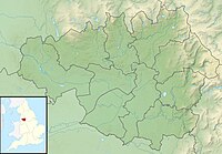 Black Chew Head Location in Greater Manchester | |
| Location | Saddleworth, Greater Manchester, England |
| Parent range | Peak District (Dark Peak) |
| OS grid | SE056019 |
Historically in the West Riding of Yorkshire (along with the rest of Saddleworth), it became a county top in 1974 on the creation of Greater Manchester following the Local Government Act 1972.
Location and access edit
Black Chew Head is an outlying part of Black Hill, meaning Kinder Scout is its parent peak. It overlooks the Chew Valley, which leads eastwards and northwards to Dovestones Reservoir, and the valley of Crowden Great Brook leading south to Longdendale. The hill is accessible by many routes: the most used and most obvious is from Dovestones Reservoir in Greenfield via the Chew Reservoir access road. The hill is also accessible from Crowden in Derbyshire and from the A635 to the north. The Pennine Way runs just to the east of the summit on its way from Crowden to Black Hill.[3] The summit lies a short distance east of the June 2018 wildfire on Saddleworth Moor, but was not within the burned area.[4]
References edit
- ^ a b Bathurst, David (2012). Walking the county high points of England. Chichester: Summersdale. pp. 208–217. ISBN 978-1-84-953239-6.
- ^ Black Chew Head at www.hill-bagging.co.uk. Retrieved 11 March 2016.
- ^ OL1 Dark Peak area (Map). 1:25000. Explorer. Ordnance Survey.
- ^ Wilkinson, Damon (28 June 2018). "Satellite image shows detailed map of Saddleworth Moor blaze". Manchester Evening News. Retrieved 14 July 2018.
External links edit
- Black Chew Head, England. Peakbagger.com.
- Black Chew Head. Fen Running and Fell Walking.
- Black Chew Head. My Pennines.