
KNOWPIA
WELCOME TO KNOWPIA

Blangy-sur-Bresle 
Summary
Blangy-sur-Bresle (French pronunciation: [blɑ̃ʒi syʁ bʁɛl], literally Blangy on Bresle) is a commune in the department of Seine-Maritime in the Normandy region of northern France.
Blangy-sur-Bresle | |
|---|---|
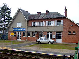 Blangy railway station | |
 Coat of arms | |
Location of Blangy-sur-Bresle .mw-parser-output .locmap .od{position:absolute}.mw-parser-output .locmap .id{position:absolute;line-height:0}.mw-parser-output .locmap .l0{font-size:0;position:absolute}.mw-parser-output .locmap .pv{line-height:110%;position:absolute;text-align:center}.mw-parser-output .locmap .pl{line-height:110%;position:absolute;top:-0.75em;text-align:right}.mw-parser-output .locmap .pr{line-height:110%;position:absolute;top:-0.75em;text-align:left}.mw-parser-output .locmap .pv>div{display:inline;padding:1px}.mw-parser-output .locmap .pl>div{display:inline;padding:1px;float:right}.mw-parser-output .locmap .pr>div{display:inline;padding:1px;float:left}html.skin-theme-clientpref-night .mw-parser-output .od,html.skin-theme-clientpref-night .mw-parser-output .od .pv>div,html.skin-theme-clientpref-night .mw-parser-output .od .pl>div,html.skin-theme-clientpref-night .mw-parser-output .od .pr>div{background:#000;color:#fff}html.skin-theme-clientpref-night .mw-parser-output .locmap{filter:grayscale(0.6)}@media(prefers-color-scheme:dark){html.skin-theme-clientpref-os .mw-parser-output .locmap{filter:grayscale(0.6)}html.skin-theme-clientpref-os .mw-parser-output .od,html.skin-theme-clientpref-os .mw-parser-output .od .pv>div,html.skin-theme-clientpref-os .mw-parser-output .od .pl>div,html.skin-theme-clientpref-os .mw-parser-output .od .pr>div{background:#000;color:#fff}}  Blangy-sur-Bresle  Blangy-sur-Bresle | |
| Coordinates: 49°55′57″N 1°37′46″E / 49.9325°N 1.6294°E | |
| Country | France |
| Region | Normandy |
| Department | Seine-Maritime |
| Arrondissement | Dieppe |
| Canton | Eu |
| Intercommunality | CC Aumale - Blangy-sur-Bresle |
| Government | |
| • Mayor (2020–2026) | Éric Arnoux[1] |
| Area 1 | 17.45 km2 (6.74 sq mi) |
| Population (2021)[2] | 2,862 |
| • Density | 160/km2 (420/sq mi) |
| Time zone | UTC+01:00 (CET) |
| • Summer (DST) | UTC+02:00 (CEST) |
| INSEE/Postal code | 76101 /76340 |
| Elevation | 42–216 m (138–709 ft) (avg. 49 m or 161 ft) |
| 1 French Land Register data, which excludes lakes, ponds, glaciers > 1 km2 (0.386 sq mi or 247 acres) and river estuaries. | |
Geography edit
Blangy is a small town situated in the valley of the river Bresle – which here forms the border between Normandy and Picardy – some 40 kilometres (25 mi) east of Dieppe in the Pays de Bray. Forestry, farming, and light industry are the main economic activities. The town lies on the D49 and the D928 roads close to junction 5 of the A29 motorway. Blangy-sur-Bresle station has rail connections to Beauvais and Le Tréport.
Heraldry edit
 |
The arms of Blangy-sur-Bresle are blazoned : Argent, a lion sable, armed and langued gules. |
Population edit
| Year | Pop. | ±% p.a. |
|---|---|---|
| 1968 | 3,336 | — |
| 1975 | 3,404 | +0.29% |
| 1982 | 3,456 | +0.22% |
| 1990 | 3,447 | −0.03% |
| 1999 | 3,405 | −0.14% |
| 2007 | 3,146 | −0.98% |
| 2012 | 2,939 | −1.35% |
| 2017 | 2,972 | +0.22% |
| Source: INSEE[3] | ||
Places of interest edit
- The church of Notre-Dame, dating from the thirteenth century.
- The Manoir de Fontaine (1607).
- The Manoir de Penthièvre (1636), built for la Grande Mademoiselle.
- The seventeenth century fulling mill at Hollande
- The Manoir de Grémontmesnil (1776).
- The mill at Hottineaux 1800).
- The remains of a medieval castle.
- Three museums.
Notable people edit
- Anne Marie Louise of Orléans (1627–1693), la Grande Mademoiselle.
See also edit
References edit
- ^ "Répertoire national des élus: les maires". data.gouv.fr, Plateforme ouverte des données publiques françaises (in French). 2 December 2020.
- ^ "Populations légales 2021". The National Institute of Statistics and Economic Studies. 28 December 2023.
- ^ Population en historique depuis 1968, INSEE
Wikimedia Commons has media related to Blangy-sur-Bresle.