


Summary
Blount Township is a township in Vermilion County, Illinois, USA. As of the 2010 census, its population was 3,428 and it contained 1,475 housing units.[2]
Blount Township | |
|---|---|
 Lake at Kennekuk County Park, in the western part of the township | |
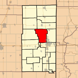 Location in Vermilion County | |
| Coordinates: 40°12′50″N 87°42′09″W / 40.21389°N 87.70250°W | |
| Country | United States |
| State | Illinois |
| County | Vermilion |
| Created | 1856 |
| Area | |
| • Total | 51.72 sq mi (134.0 km2) |
| • Land | 51.36 sq mi (133.0 km2) |
| • Water | 0.36 sq mi (0.9 km2) 0.70% |
| Elevation | 679 ft (207 m) |
| Population (2010) | |
| • Estimate (2016)[1] | 3,312 |
| • Density | 66.7/sq mi (25.8/km2) |
| Time zone | UTC-6 (CST) |
| • Summer (DST) | UTC-5 (CDT) |
| ZIP codes | 61811, 61831, 61832, 61834, 61858, 61865 |
| Area code | 217 |
| FIPS code | 17-183-06678 |
| GNIS feature ID | 0428686 |
History edit
Blount Township was established in 1856 from portions of Newell and Pilot townships. It was originally named after John C. Frémont, the Republican candidate for president that year. Democrats objected, and the township was named after early settler Abraham Blount.[3]
Geography edit
According to the 2010 census, the township has a total area of 51.72 square miles (134.0 km2), of which 51.36 square miles (133.0 km2) (or 99.30%) is land and 0.36 square miles (0.93 km2) (or 0.70%) is water.[2] The northwestern portion of the county seat of Danville extends into the southeast portion of the township, as does a portion of Lake Vermilion.
Cities and towns edit
- Danville, the county seat (northwest edge)
Extinct towns edit
- Grumle Corner
- Higginsville
- Jamesburg
- Johnsonville
- Moore's Corner
- Snider
- Vernal
Adjacent townships edit
- South Ross Township (northeast)
- Newell Township (east)
- Danville Township (southeast)
- Catlin Township (south)
- Oakwood Township (southwest)
- Pilot Township (west)
- Middlefork Township (northwest)
Cemeteries edit
The township contains eleven cemeteries: Bethel, Dodson, Fairchild, Gordon, Higginsville, Johnson, New Salem, Newell Grove, Pentecost, Porter, Snider and Thurman.
Major highways edit
Airports and landing strips edit
- Flying B Ranch Airport
- Melody Field
Demographics edit
| Census | Pop. | Note | %± |
|---|---|---|---|
| 2016 (est.) | 3,312 | [1] | |
| U.S. Decennial Census[4] | |||
School districts edit
- Bismarck Henning Consolidated Unit School District
- Danville Community Consolidated School District 118
- Oakwood Community Unit School District 76
Political districts edit
- Illinois' 15th congressional district
- State House District 104
- State Senate District 52
References edit
- U.S. Board on Geographic Names (GNIS)
- United States Census Bureau 2007 TIGER/Line Shapefiles
- ^ a b "Population and Housing Unit Estimates". Retrieved June 9, 2017.
- ^ a b "Population, Housing Units, Area, and Density: 2010 - County -- County Subdivision and Place -- 2010 Census Summary File 1". United States Census. Archived from the original on February 12, 2020. Retrieved May 28, 2013.
- ^ Callary, Edmund (2009). Place Names of Illinois. Urbana: University of Illinois Press. p. 38. ISBN 978-0-252-03356-8.
- ^ "Census of Population and Housing". Census.gov. Retrieved June 4, 2016.
External links edit
- US-Counties.com
- City-Data.com
- Illinois State Archives