
KNOWPIA
WELCOME TO KNOWPIA

Bluie 
Summary
Bluie was the United States military code name for Greenland during World War II. It is remembered by the numbered sequence of base locations identified by the 1941 United States Coast Guard South Greenland Survey Expedition, and subsequently used in radio communications by airmen unfamiliar with pronunciation of the Greenlandic Inuit and Danish names of those locations. These were typically spoken BLUIE (direction) (number), with direction being east or west along the Greenland coast from Cape Farewell.[1]
- Bluie East One: Torgilsbu[1] radio and weather station[2] at 60°9′N 43°53′W / 60.150°N 43.883°W near Aqissiat on Prince Christian Sound
- Bluie East Two: Ikateq airfield with radio and weather station[1] at 65°56′43″N 36°39′45″W / 65.94528°N 36.66250°W
- Bluie East Three: Gurreholm radio and weather station[2] at 71°14′43″N 24°35′01″W / 71.24528°N 24.58361°W[3] on Scoresby Sund[1]
- Bluie East Four: Ella Island[1] radio, weather, and sledge patrol station[2] at 72°51′N 25°00′W / 72.850°N 25.000°W
- Bluie East Five: Eskimonæs radio and weather station[2] captured by German troops in 1943 and later reestablished at Myggbukta[1] 73°29′28″N 21°32′26″W / 73.49111°N 21.54056°W
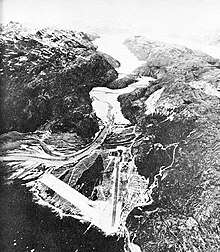
- Bluie West One: Narsarsuaq Air Base[1] at 61°10′N 45°26′W / 61.167°N 45.433°W
- Bluie West Two: Kipisako[1] unused alternative airfield location[2] on Coppermine Bay
- Bluie West Three: Simiutak HF/DF station[1] at 60°41′N 46°34′W / 60.683°N 46.567°W
- Bluie West Four: Marrak Point airfield,[citation needed] radio and weather station[2] at 63°27′N 51°11′W / 63.450°N 51.183°W[1]
- Bluie West Five: Aasiaat radio and weather station[2] at 68°42′35″N 52°52′10″W / 68.70972°N 52.86944°W on Disko Island[1]
- Bluie West Six: Thule[1] radio and weather station[2] at 76°31′52″N 068°42′11″W / 76.53111°N 68.70306°W
- Bluie West Seven: Kangilinnguit base at 61°14′00″N 48°05′55″W / 61.23333°N 48.09861°W to defend the Ivittuut cryolite mine[1]
- Bluie West Eight: Sondrestrom Air Base[1] at 67°00′38″N 50°42′33″W / 67.01056°N 50.70917°W
- Bluie West Nine: Cruncher Island light and radio beacon at 66°03′N 53°36′W / 66.050°N 53.600°W[2]
Notes edit
Sources edit
- Morison, Samuel Eliot (1975). History of United States Naval Operations in World War II, Volume 1: The Battle of the Atlantic September 1939 – May 1943. Boston: Little, Brown and Company.