


Summary
Bolton-by-Bowland is a village and civil parish in the Ribble Valley district of Lancashire, England. Before 1974, the village was part of Bowland Rural District in the West Riding of Yorkshire. According to the census of 2001, the parish had a population of just 498,[2][3] rising marginally to 499 at the census of 2011.[1]
| Bolton-by-Bowland | |
|---|---|
 | |
 Bolton-by-Bowland Location in Ribble Valley 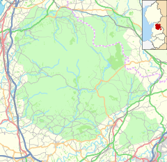 Bolton-by-Bowland Location in the Forest of Bowland  Bolton-by-Bowland Location within Lancashire | |
| Population | 499 (2011 census)[1] |
| OS grid reference | SD785495 |
| Civil parish |
|
| District | |
| Shire county | |
| Region | |
| Country | England |
| Sovereign state | United Kingdom |
| Post town | CLITHEROE |
| Postcode district | BB7 |
| Dialling code | 01200 |
| Police | Lancashire |
| Fire | Lancashire |
| Ambulance | North West |
| UK Parliament | |
| Website | www.bolton-by-bowland.com |
History edit
In medieval times, it was known as Bolton-in-Bowland, reflecting the shifting boundaries of the ancient Forest of Bowland on whose south east flank the village sits. The manor of Bolton-by-Bowland, however, was not included within the Lordship of Bowland, being a part of the Percy family fee from earliest times.[4]
It is thought that there has been a church on the site of St Peter and St Paul's Church since around 1190.[5]
The village is on Skirden Beck, near its confluence with the River Ribble. The village has a car park, toilet facilities and a tourist information centre, is the starting point for many of the area's walks.
Governance edit
Bolton-by-Bowland was an ancient parish, part of the Western Division of Staincliffe Wapentake. It became a civil parish, probably in the middle of the 19th century, becoming part of Bowland Rural District when it was formed in 1894. In 1938 an 146-hectare (361-acre) area toward the northern end of the parish, that had formed a detached part of Tosside, was transferred to Bolton-by-Bowland.[6] In 1974 the civil parish was transferred from the West Riding of Yorkshire to the Ribble Valley district of Lancashire.
Bolton-by-Bowland shares a parish council with two other parishes, Sawley and Gisburn Forest.[7] Along with Bowland Forest Low, Slaidburn, Newton-in-Bowland, and Easington, the parish forms the Bowland, Newton and Slaidburn ward of Ribble Valley Borough Council.[8][9]
Pubs edit
The village also has two pubs, the first, the Coach and Horses is situated in the middle of the village, and is the centre of village life. The second, The Copy Nook, is a bar and restaurant and is situated a short distance from the centre of the village.
See also edit
References edit
- ^ a b UK Census (2011). "Local Area Report – Bolton-by-Bowland Parish (1170215096)". Nomis. Office for National Statistics. Retrieved 23 February 2018.
- ^ Lancashire Parish Council headcounts Archived 10 December 2006 at the Wayback Machine. URL accessed 5 May 2008.
- ^ National Statistics - Bolton-by-Bowland CP (Parish). URL accessed 5 May 2008.
- ^ Forest of Bowland official website
- ^ A short history of Bolton By Bowland Church, Church of England, retrieved 20 January 2022
- ^ "Bolton By Bowland AP/CP through time". visionofbritain.org.uk. GB Historical GIS / University of Portsmouth. Retrieved 20 January 2022.
- ^ "Bolton-by-Bowland, Gisburn Forest and Sawley Parish Council". Bolton-by-Bowland, Gisburn Forest and Sawley Parish Council. Retrieved 20 January 2022.
- ^ "Bowland, Newton and Slaidburn". MARIO. Lancashire County Council. Retrieved 25 March 2016.
- ^ "Bowland, Newton and Slaidburn". Ordnance Survey Linked Data Platform. Ordnance Survey. Retrieved 25 March 2016.
External links edit
- http://www.bolton-by-bowland.com
- Bolton by Bowland Conservation Area Appraisal
- New Ing Meadow SSSI