


Summary
Borj El Amri or Bordj El Amri (Arabic: برج العامري) is a town in the Manouba Governorate of Tunisia. It is located 30 kilometres (19 mi) southwest of Tunis.
Borj El Amri | |
|---|---|
Town | |
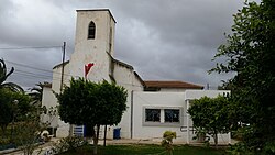 Saint Vincent de Paul Church | |
 Borj El Amri | |
| Coordinates: 36°42′10″N 009°53′16″E / 36.70278°N 9.88778°E | |
| Country | |
| Governorate | Manouba |
| Time zone | UTC+1 (CET) |
The town of Borj El Amri municipality contains 6,458 inhabitants and is the main town (chef-lieu) of the Borj El Amri delegation which has 18,977 inhabitants.
Borj El Amri is home to the School of the Tunisian Air Force and is served by the Borj El Amri Airport.
History edit
The town was created by a decree of the Bey of Tunis in 1904. At that time it was known as Massicault in honor of Justin Massicault, the Resident General of France in Tunisia from 1886 to 1892. It was renamed in 1961 after Borj El Amri, an ancient fortress (borj).
During World War II, from January to April 1943, the Germans operated a forced labour camp for Jews in the town.[1]
Climate edit
| Climate data for Borj El Amri (1961–1990, extremes 1985–1994) | |||||||||||||
|---|---|---|---|---|---|---|---|---|---|---|---|---|---|
| Month | Jan | Feb | Mar | Apr | May | Jun | Jul | Aug | Sep | Oct | Nov | Dec | Year |
| Record high °C (°F) | 25.5 (77.9) |
25.6 (78.1) |
29.6 (85.3) |
31.6 (88.9) |
43.0 (109.4) |
43.5 (110.3) |
48.2 (118.8) |
46.5 (115.7) |
44.0 (111.2) |
37.4 (99.3) |
29.6 (85.3) |
25.0 (77.0) |
48.2 (118.8) |
| Mean daily maximum °C (°F) | 15.7 (60.3) |
17.3 (63.1) |
19.0 (66.2) |
22.8 (73.0) |
27.3 (81.1) |
31.8 (89.2) |
35.8 (96.4) |
36.1 (97.0) |
32.5 (90.5) |
27.7 (81.9) |
20.5 (68.9) |
17.1 (62.8) |
25.3 (77.5) |
| Daily mean °C (°F) | 10.6 (51.1) |
11.3 (52.3) |
12.9 (55.2) |
15.5 (59.9) |
19.8 (67.6) |
23.8 (74.8) |
27.3 (81.1) |
28.0 (82.4) |
25.3 (77.5) |
21.7 (71.1) |
15.3 (59.5) |
11.9 (53.4) |
18.6 (65.5) |
| Mean daily minimum °C (°F) | 5.4 (41.7) |
5.3 (41.5) |
6.8 (44.2) |
8.3 (46.9) |
12.3 (54.1) |
15.8 (60.4) |
18.7 (65.7) |
19.8 (67.6) |
18.0 (64.4) |
15.6 (60.1) |
10.1 (50.2) |
6.7 (44.1) |
11.9 (53.4) |
| Record low °C (°F) | −2.2 (28.0) |
−3.6 (25.5) |
−1.2 (29.8) |
1.0 (33.8) |
2.8 (37.0) |
7.6 (45.7) |
9.6 (49.3) |
12.6 (54.7) |
9.0 (48.2) |
5.4 (41.7) |
−1.6 (29.1) |
−3.6 (25.5) |
−3.6 (25.5) |
| Average precipitation mm (inches) | 48.5 (1.91) |
37.1 (1.46) |
38.2 (1.50) |
34.9 (1.37) |
18.7 (0.74) |
9.2 (0.36) |
12.2 (0.48) |
21.7 (0.85) |
25.6 (1.01) |
40.2 (1.58) |
42.8 (1.69) |
45.9 (1.81) |
375 (14.76) |
| Average precipitation days (≥ 1.0 mm) | 6.9 | 7.6 | 6.0 | 5.0 | 4.0 | 1.3 | 1.3 | 1.4 | 2.9 | 5.1 | 5.4 | 6.4 | 53.3 |
| Average relative humidity (%) | 76 | 72 | 70 | 65 | 62 | 59 | 53 | 55 | 59 | 67 | 72 | 75 | 65 |
| Mean monthly sunshine hours | 124.0 | 145.6 | 189.1 | 213.0 | 241.8 | 264.0 | 313.1 | 285.2 | 234.0 | 186.0 | 150.0 | 142.6 | 2,488.4 |
| Source: Institut National de la Météorologie (precipitation days/humidity/sun 1961–1990)[2][3][4][note 1] | |||||||||||||
References edit
- ^ Megargee, Geoffrey P.; Overmans, Rüdiger; Vogt, Wolfgang (2022). The United States Holocaust Memorial Museum Encyclopedia of Camps and Ghettos 1933–1945. Volume IV. Indiana University Press, United States Holocaust Memorial Museum. p. 585. ISBN 978-0-253-06089-1.
- ^ "Les normales climatiques en Tunisie entre 1981 2010" (in French). Ministère du Transport. Archived from the original on 19 December 2019. Retrieved 25 January 2020.
- ^ "Données normales climatiques 1961-1990" (in French). Ministère du Transport. Archived from the original on 21 December 2019. Retrieved 25 January 2020.
- ^ "Les extrêmes climatiques en Tunisie" (in French). Ministère du Transport. Archived from the original on 21 December 2019. Retrieved 25 January 2020.
- ^ "Réseau des stations météorologiques synoptiques de la Tunisie" (in French). Ministère du Transport. Retrieved 25 January 2020.