


Summary
Botolan, officially the Municipality of Botolan, is a 1st class municipality in the province of Zambales, Philippines. According to the 2020 census, it has a population of 66,739 people.[4]
Botolan | |
|---|---|
| Municipality of Botolan | |
 Poblacion, Botolan | |
 Flag  Seal | |
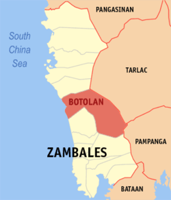 Map of Zambales with Botolan highlighted | |
OpenStreetMap .mw-parser-output .locmap .od{position:absolute}.mw-parser-output .locmap .id{position:absolute;line-height:0}.mw-parser-output .locmap .l0{font-size:0;position:absolute}.mw-parser-output .locmap .pv{line-height:110%;position:absolute;text-align:center}.mw-parser-output .locmap .pl{line-height:110%;position:absolute;top:-0.75em;text-align:right}.mw-parser-output .locmap .pr{line-height:110%;position:absolute;top:-0.75em;text-align:left}.mw-parser-output .locmap .pv>div{display:inline;padding:1px}.mw-parser-output .locmap .pl>div{display:inline;padding:1px;float:right}.mw-parser-output .locmap .pr>div{display:inline;padding:1px;float:left}html.skin-theme-clientpref-night .mw-parser-output .od,html.skin-theme-clientpref-night .mw-parser-output .od .pv>div,html.skin-theme-clientpref-night .mw-parser-output .od .pl>div,html.skin-theme-clientpref-night .mw-parser-output .od .pr>div{background:#000;color:#fff}html.skin-theme-clientpref-night .mw-parser-output .locmap{filter:grayscale(0.6)}@media(prefers-color-scheme:dark){html.skin-theme-clientpref-os .mw-parser-output .locmap{filter:grayscale(0.6)}html.skin-theme-clientpref-os .mw-parser-output .od,html.skin-theme-clientpref-os .mw-parser-output .od .pv>div,html.skin-theme-clientpref-os .mw-parser-output .od .pl>div,html.skin-theme-clientpref-os .mw-parser-output .od .pr>div{background:#000;color:#fff}}  Botolan Location within the Philippines | |
| Coordinates: 15°17′23″N 120°01′28″E / 15.2896°N 120.0245°E | |
| Country | Philippines |
| Region | Central Luzon |
| Province | Zambales |
| District | 2nd district |
| Founded | 1572[1] |
| Founded by | Governor-General Juan de Salcedo |
| Barangays | 31 (see Barangays) |
| Government | |
| • Type | Sangguniang Bayan |
| • Mayor | Jun Omar Ebdane |
| • Vice Mayor | Doris D. Ladines |
| • Representative | Doris E. Maniquiz |
| • Municipal Council | Members |
| • Electorate | 44,728 voters (2022) |
| Area | |
| • Total | 735.28 km2 (283.89 sq mi) |
| Elevation | 28 m (92 ft) |
| Highest elevation | 1,486 m (4,875 ft) |
| Lowest elevation | 0 m (0 ft) |
| Population (2020 census)[4] | |
| • Total | 66,739 |
| • Density | 91/km2 (240/sq mi) |
| • Households | 17,547 |
| Economy | |
| • Income class | 1st municipal income class |
| • Poverty incidence | 12.75 |
| • Revenue | ₱ 317.4 million (2020) |
| • Assets | ₱ 867 million (2020) |
| • Expenditure | ₱ 348.5 million (2020) |
| • Liabilities | ₱ 328.6 million (2020) |
| Service provider | |
| • Electricity | Zambales 1 Electric Cooperative (ZAMECO 1) |
| Time zone | UTC+8 (PST) |
| ZIP code | 2202 |
| PSGC | 037101000 |
| IDD : area code | +63 (0)47 |
| Native languages | Botolan Sambal Ilocano Tagalog Abellen Mag-antsi |
| Major religions | |
| Feast date | January 24 |
| Ecclesiastical dioceses | Diocese of Iba (Roman Catholic) Diocese of Zambales (Aglipayan Church) |
| Patron saint | Our Lady of Poon Bato |
The municipality was founded by Spanish Governor-General Juan de Salcedo in 1572.[1] Botolan is known for its larger Aeta population, wide gray sand beaches, and as the location of Mount Pinatubo.
Etymology edit
The name Botolan came from the a native variety of banana common in the area called "Boto-an". The word "Boto-an" is a Sambal word which combines the word botol which means "seeds" and the locative prefix -an, referring to a place with many seeded bananas.[6]
Geography edit
Located just south of the provincial capital of Iba, Botolan has the largest land area of the municipalities in Zambales.
Botolan is 7 kilometres (4.3 mi) from Iba, 71 kilometres (44 mi) from Olongapo, and 197 kilometres (122 mi) from Manila.
Barangays edit
Botolan is politically subdivided into 31 barangays.[7] Each barangay consists of puroks and some have sitios.
- Bancal
- Bangan
- Batonlapoc
- Belbel
- Beneg
- Binuclutan
- Burgos
- Cabatuan
- Capayawan
- Carael
- Danacbunga
- Maguisguis
- Malomboy
- Mambog
- Moraza
- Nacolcol
- Owaog-Nibloc
- Paco (poblacion)
- Palis
- Panan
- Parel
- Paudpod
- Poonbato
- Porac
- San Isidro
- San Juan
- San Miguel
- Santiago
- Tampo (poblacion)
- Taugtog
- Villar
Climate edit
| Climate data for Botolan, Zambales | |||||||||||||
|---|---|---|---|---|---|---|---|---|---|---|---|---|---|
| Month | Jan | Feb | Mar | Apr | May | Jun | Jul | Aug | Sep | Oct | Nov | Dec | Year |
| Mean daily maximum °C (°F) | 31 (88) |
32 (90) |
33 (91) |
34 (93) |
32 (90) |
31 (88) |
29 (84) |
29 (84) |
29 (84) |
30 (86) |
31 (88) |
31 (88) |
31 (88) |
| Mean daily minimum °C (°F) | 20 (68) |
20 (68) |
21 (70) |
23 (73) |
25 (77) |
25 (77) |
25 (77) |
25 (77) |
24 (75) |
23 (73) |
22 (72) |
20 (68) |
23 (73) |
| Average precipitation mm (inches) | 16 (0.6) |
18 (0.7) |
28 (1.1) |
51 (2.0) |
200 (7.9) |
253 (10.0) |
301 (11.9) |
293 (11.5) |
246 (9.7) |
171 (6.7) |
70 (2.8) |
28 (1.1) |
1,675 (66) |
| Average rainy days | 6.2 | 7.1 | 10.4 | 15.5 | 24.4 | 26.4 | 28.2 | 27.5 | 26.2 | 23.6 | 15.9 | 8.7 | 220.1 |
| Source: Meteoblue (modeled/calculated data, not measured locally)[8] | |||||||||||||
Demographics edit
|
|
| ||||||||||||||||||||||||||||||||||||||||||||||||||||||
| Source: Philippine Statistics Authority[9][10][11][12] | ||||||||||||||||||||||||||||||||||||||||||||||||||||||||
In the 2020 census, the population of Botolan was 66,739 people,[4] with a density of 91 inhabitants per square kilometre or 240 inhabitants per square mile.
Economy edit
Government edit

Elected officials edit
Municipal officials (2019-2022)
- Mayor: Omar Ebdane
- Vice Mayor: Doris Ladines
Tourism edit

The barangay of Binoclutan is the "Beach Capital" of Botolan, featuring several first class resorts. The area is a habitat of sea turtles, as is all of the Zambales coastline. Olive Ridley, Green turtles and Hawksbill turtles nest along the beaches of Botolan every year between September and January. A turtle hatchery located is located in Binoklutan. The area also has many other attractions, beach resorts, waterfalls, hiking paths, views of the lahar fields left by the 1991 eruption of Mount Pinatubo, and views of Mount Pinatubo itself.
The Fiesta Poon Bato, held January 23–24, is a religious festival that attracts up to 500,000 devotees. Features include cultural dancing from local Aeta tribes in the town plaza on the first night.
The Domorokdok Festival, held May 3–4, includes street parades, street dancing, a beauty pageant and displays of Botolan products and industries.
Ina Poon Bato edit

The Ina Poón Bató is a purportedly miraculous, syncretised image of the Blessed Virgin Mary.[20] Legend has it that before the arrival of the Spanish in the area sometime in the 17th century, local Aeta peoples had discovered a carved wooden statue on a large rock and began worshipping the image. On the arrival of Recollect missionaries in 1607, the natives associated the statue with the Roman Catholic depictions of the Virgin Mary, and the image was subsequently Christianised as Ina Poonbato (Our Lady of Poonbato) .[20] The original image was previously in the Recollect missionaries’ custody. During the Philippine Revolution, the Filipino revolutionaries took the image and enshrined it in an Aglipayan Church.
The Catholic image was canonically blessed by Pope John Paul II in 1985 at a ceremony in Vatican City.[21] After the 1991 eruption of Mount Pinatubo destroyed the original village of Poonbato, the patio image (which was found intact and buried chest-deep in lahar)[22] and its shrine were moved to the nearby resettlement area of Loob-Bunga.[23] The feast of Ina Poón Bató is celebrated every late January, with devotees flocking to the original image inside a chapel belonging to the Aglipayan Church, and the 1976 replica enshrined in the Catholic chapel.[22]
References edit
- ^ a b "Municipalities" Archived 2013-02-09 at the Wayback Machine. Zambales Now, Official Website of Zambales. Retrieved on 2012-05-24.
- ^ Municipality of Botolan | (DILG)
- ^ "2015 Census of Population, Report No. 3 – Population, Land Area, and Population Density" (PDF). Philippine Statistics Authority. Quezon City, Philippines. August 2016. ISSN 0117-1453. Archived (PDF) from the original on May 25, 2021. Retrieved July 16, 2021.
- ^ a b c Census of Population (2020). "Region III (Central Luzon)". Total Population by Province, City, Municipality and Barangay. Philippine Statistics Authority. Retrieved 8 July 2021.
- ^ "PSA Releases the 2018 Municipal and City Level Poverty Estimates". Philippine Statistics Authority. 15 December 2021. Retrieved 22 January 2022.
- ^ Valencia, Minda (2000). "Botolan and Its People in Botolan". Continuity and Change. Cesar Inc.
- ^ "Philippine Standard Geographic Code listing for Botolan"[permanent dead link]. National Statistical Coordination Board. Retrieved on 2007-12-09.
- ^ "Botolan: Average Temperatures and Rainfall". Meteoblue. Retrieved 26 April 2020.
- ^ Census of Population (2015). "Region III (Central Luzon)". Total Population by Province, City, Municipality and Barangay. Philippine Statistics Authority. Retrieved 20 June 2016.
- ^ Census of Population and Housing (2010). "Region III (Central Luzon)" (PDF). Total Population by Province, City, Municipality and Barangay. National Statistics Office. Retrieved 29 June 2016.
- ^ Censuses of Population (1903–2007). "Region III (Central Luzon)". Table 1. Population Enumerated in Various Censuses by Province/Highly Urbanized City: 1903 to 2007. National Statistics Office.
{{cite encyclopedia}}: CS1 maint: numeric names: authors list (link) - ^ "Province of Zambales". Municipality Population Data. Local Water Utilities Administration Research Division. Retrieved 17 December 2016.
- ^ "Poverty incidence (PI):". Philippine Statistics Authority. Retrieved December 28, 2020.
- ^ "Estimation of Local Poverty in the Philippines" (PDF). Philippine Statistics Authority. 29 November 2005.
- ^ "2003 City and Municipal Level Poverty Estimates" (PDF). Philippine Statistics Authority. 23 March 2009.
- ^ "City and Municipal Level Poverty Estimates; 2006 and 2009" (PDF). Philippine Statistics Authority. 3 August 2012.
- ^ "2012 Municipal and City Level Poverty Estimates" (PDF). Philippine Statistics Authority. 31 May 2016.
- ^ "Municipal and City Level Small Area Poverty Estimates; 2009, 2012 and 2015". Philippine Statistics Authority. 10 July 2019.
- ^ "PSA Releases the 2018 Municipal and City Level Poverty Estimates". Philippine Statistics Authority. 15 December 2021. Retrieved 22 January 2022.
- ^ a b "Our Lady of Poon Bato". dacopofoundation.com. Retrieved 21 August 2011.
- ^ "The Story of Ina PoonBato". Ina Poon Bato "The Miraculous Blessed Mother". Retrieved 10 July 2015.
- ^ a b Macatuno, Allan (24 March 2014). "Wooden Marian image draws devotees to Zambales". Philippine Daily Inquirer. Philippine Daily Inquirer. Retrieved 10 July 2015.
- ^ "Ina Poonbato Shrine". Botolan Official Website. Retrieved 21 August 2011.[permanent dead link]
External links edit
- Philippine Standard Geographic Code
- Philippine Census Information