
KNOWPIA
WELCOME TO KNOWPIA

Boueilh-Boueilho-Lasque 
Summary
Boueilh-Boueilho-Lasque (French pronunciation: [bwɛj bwɛjo lask]; Occitan: Buelh, Buelhòu e Lasque) is a commune in the Pyrénées-Atlantiques department in southwestern France.
Boueilh-Boueilho-Lasque | |
|---|---|
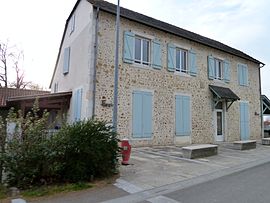 The school of Boueilh-Boueilho-Lasque | |
Location of Boueilh-Boueilho-Lasque .mw-parser-output .locmap .od{position:absolute}.mw-parser-output .locmap .id{position:absolute;line-height:0}.mw-parser-output .locmap .l0{font-size:0;position:absolute}.mw-parser-output .locmap .pv{line-height:110%;position:absolute;text-align:center}.mw-parser-output .locmap .pl{line-height:110%;position:absolute;top:-0.75em;text-align:right}.mw-parser-output .locmap .pr{line-height:110%;position:absolute;top:-0.75em;text-align:left}.mw-parser-output .locmap .pv>div{display:inline;padding:1px}.mw-parser-output .locmap .pl>div{display:inline;padding:1px;float:right}.mw-parser-output .locmap .pr>div{display:inline;padding:1px;float:left}html.skin-theme-clientpref-night .mw-parser-output .od,html.skin-theme-clientpref-night .mw-parser-output .od .pv>div,html.skin-theme-clientpref-night .mw-parser-output .od .pl>div,html.skin-theme-clientpref-night .mw-parser-output .od .pr>div{background:#000;color:#fff}html.skin-theme-clientpref-night .mw-parser-output .locmap{filter:grayscale(0.6)}@media(prefers-color-scheme:dark){html.skin-theme-clientpref-os .mw-parser-output .locmap{filter:grayscale(0.6)}html.skin-theme-clientpref-os .mw-parser-output .od,html.skin-theme-clientpref-os .mw-parser-output .od .pv>div,html.skin-theme-clientpref-os .mw-parser-output .od .pl>div,html.skin-theme-clientpref-os .mw-parser-output .od .pr>div{background:#000;color:#fff}}  Boueilh-Boueilho-Lasque  Boueilh-Boueilho-Lasque | |
| Coordinates: 43°32′36″N 0°18′42″W / 43.5433°N 0.3117°W | |
| Country | France |
| Region | Nouvelle-Aquitaine |
| Department | Pyrénées-Atlantiques |
| Arrondissement | Pau |
| Canton | Terres des Luys et Coteaux du Vic-Bilh |
| Intercommunality | Luys en Béarn |
| Government | |
| • Mayor (2020–2026) | Pierre Costadoat[1] |
| Area 1 | 17.35 km2 (6.70 sq mi) |
| Population (2021)[2] | 387 |
| • Density | 22/km2 (58/sq mi) |
| Time zone | UTC+01:00 (CET) |
| • Summer (DST) | UTC+02:00 (CEST) |
| INSEE/Postal code | 64141 /64330 |
| Elevation | 117–263 m (384–863 ft) (avg. 227 m or 745 ft) |
| 1 French Land Register data, which excludes lakes, ponds, glaciers > 1 km2 (0.386 sq mi or 247 acres) and river estuaries. | |
See also edit
References edit
- ^ "Répertoire national des élus: les maires" (in French). data.gouv.fr, Plateforme ouverte des données publiques françaises. 13 September 2022.
- ^ "Populations légales 2021". The National Institute of Statistics and Economic Studies. 28 December 2023.
Wikimedia Commons has media related to Boueilh-Boueilho-Lasque.