
KNOWPIA
WELCOME TO KNOWPIA

Boulogne-sur-Helpe 
Summary
Boulogne-sur-Helpe (French pronunciation: [bulɔɲ syʁ ɛlp], literally Boulogne on Helpe) is a commune in the Nord department in northern France.[3]
Boulogne-sur-Helpe | |
|---|---|
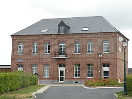 The town hall in Boulogne-sur-Helpe | |
 Coat of arms | |
Location of Boulogne-sur-Helpe .mw-parser-output .locmap .od{position:absolute}.mw-parser-output .locmap .id{position:absolute;line-height:0}.mw-parser-output .locmap .l0{font-size:0;position:absolute}.mw-parser-output .locmap .pv{line-height:110%;position:absolute;text-align:center}.mw-parser-output .locmap .pl{line-height:110%;position:absolute;top:-0.75em;text-align:right}.mw-parser-output .locmap .pr{line-height:110%;position:absolute;top:-0.75em;text-align:left}.mw-parser-output .locmap .pv>div{display:inline;padding:1px}.mw-parser-output .locmap .pl>div{display:inline;padding:1px;float:right}.mw-parser-output .locmap .pr>div{display:inline;padding:1px;float:left}html.skin-theme-clientpref-night .mw-parser-output .od,html.skin-theme-clientpref-night .mw-parser-output .od .pv>div,html.skin-theme-clientpref-night .mw-parser-output .od .pl>div,html.skin-theme-clientpref-night .mw-parser-output .od .pr>div{background:#000;color:#fff}html.skin-theme-clientpref-night .mw-parser-output .locmap{filter:grayscale(0.6)}@media(prefers-color-scheme:dark){html.skin-theme-clientpref-os .mw-parser-output .locmap{filter:grayscale(0.6)}html.skin-theme-clientpref-os .mw-parser-output .od,html.skin-theme-clientpref-os .mw-parser-output .od .pv>div,html.skin-theme-clientpref-os .mw-parser-output .od .pl>div,html.skin-theme-clientpref-os .mw-parser-output .od .pr>div{background:#000;color:#fff}}  Boulogne-sur-Helpe  Boulogne-sur-Helpe | |
| Coordinates: 50°04′47″N 3°53′47″E / 50.0797°N 3.8964°E | |
| Country | France |
| Region | Hauts-de-France |
| Department | Nord |
| Arrondissement | Avesnes-sur-Helpe |
| Canton | Avesnes-sur-Helpe |
| Intercommunality | CC Cœur de l'Avesnois |
| Government | |
| • Mayor (2020–2026) | Nadine Majka[1] |
| Area 1 | 8.7 km2 (3.4 sq mi) |
| Population (2021)[2] | 310 |
| • Density | 36/km2 (92/sq mi) |
| Time zone | UTC+01:00 (CET) |
| • Summer (DST) | UTC+02:00 (CEST) |
| INSEE/Postal code | 59093 /59440 |
| Elevation | 144–207 m (472–679 ft) (avg. 177 m or 581 ft) |
| 1 French Land Register data, which excludes lakes, ponds, glaciers > 1 km2 (0.386 sq mi or 247 acres) and river estuaries. | |
Population edit
| Year | Pop. | ±% p.a. |
|---|---|---|
| 1968 | 387 | — |
| 1975 | 346 | −1.59% |
| 1982 | 315 | −1.33% |
| 1990 | 319 | +0.16% |
| 1999 | 317 | −0.07% |
| 2009 | 330 | +0.40% |
| 2014 | 328 | −0.12% |
| 2020 | 325 | −0.15% |
| Source: INSEE[4] | ||
Heraldry edit
 |
The arms of Boulogne-sur-Helpe are blazoned : Argent, 3 fesses gules. (Boulogne-sur-Helpe and Petit-Fayt use the same arms.) |
See also edit
References edit
- ^ "Répertoire national des élus: les maires". data.gouv.fr, Plateforme ouverte des données publiques françaises (in French). 9 August 2021.
- ^ "Populations légales 2021". The National Institute of Statistics and Economic Studies. 28 December 2023.
- ^ INSEE commune file
- ^ Population en historique depuis 1968, INSEE
Wikimedia Commons has media related to Boulogne-sur-Helpe.