
KNOWPIA
WELCOME TO KNOWPIA

Bourges Airport 
Summary
Bourges Airport (French: Aéroport de Bourges[2]) (IATA: BOU[5], ICAO: LFLD) is an airport serving Bourges, a commune in the Cher department[1] of the Centre-Val de Loire region of France. It is located 3 km (1.6 NM) southwest of Bourges.[1]
Bourges Airport Aéroport de Bourges | |||||||||||||||
|---|---|---|---|---|---|---|---|---|---|---|---|---|---|---|---|
| Summary | |||||||||||||||
| Airport type | Public | ||||||||||||||
| Operator | CCI du Cher | ||||||||||||||
| Serves | Bourges, France | ||||||||||||||
| Elevation AMSL | 529 ft / 161 m | ||||||||||||||
| Coordinates | 47°03′39″N 002°22′12″E / 47.06083°N 2.37000°E | ||||||||||||||
| Maps | |||||||||||||||
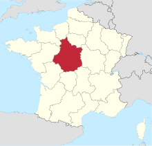 Location of Centre-Val de Loire region in France | |||||||||||||||
 LFLD Location of airport in Centre-Val de Loire region | |||||||||||||||
| Runways | |||||||||||||||
| |||||||||||||||
Facilities edit
Bourges Airport resides at an elevation of 529 feet (161 m) above mean sea level. It has an asphalt paved runway designated 06/24 which measures 1,550 by 45 metres (5,085 ft × 148 ft) and a parallel grass runway measuring 915 by 60 metres (3,002 ft × 197 ft).[1][2]
Statistics edit
Annual passenger traffic at BOU airport.
See Wikidata query.
References edit
- ^ a b c d LFLD – Bourges. AIP from French Service d'information aéronautique, effective 18 April 2024.
- ^ a b c "Aéroport de Bourges (BOU / LFLD)" (in French). Union des Aéroports Français. Archived from the original on 24 February 2010. Retrieved 13 May 2010.
- ^ Airport information for LFLD[usurped] from DAFIF (effective October 2006)
- ^ Airport information for BOU at Great Circle Mapper. Source: DAFIF (effective October 2006).
- ^ "Bourges Airport (BOU / LFLD)". Aviation Safety Network. Retrieved 13 May 2010.
External links edit