


Summary
Bowers Gifford and North Benfleet is a civil parish in the Basildon district, located within the county of Essex, England. The parish includes the villages of Bowers Gifford and North Benfleet. The parish was formed on 1 April 2010.[1] In 2021 the parish had a census recorded population of 1962.[2] There are 7 listed buildings in Bowers Gifford and North Benfleet.[3] The local council is Bowers Gifford and North Benfleet Parish Council.
Bowers Gifford and North Benfleet | |
|---|---|
Civil parish | |
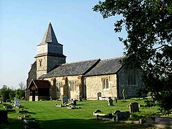 St Margaret's | |
| Bowers Gifford and North Benfleet boundaryCoordinates: .mw-parser-output .geo-default,.mw-parser-output .geo-dms,.mw-parser-output .geo-dec{display:inline}.mw-parser-output .geo-nondefault,.mw-parser-output .geo-multi-punct,.mw-parser-output .geo-inline-hidden{display:none}.mw-parser-output .longitude,.mw-parser-output .latitude{white-space:nowrap}51°33′36″N 0°31′43″E / 51.559944°N 0.52873616°E | |
| Country | England |
| Primary council | Basildon |
| County | Essex |
| Region | East of England |
| Created | 2010 |
| Status | Civil parish |
| Main settlements | Bowers Gifford and North Benfleet |
| Government | |
| • Type | Parish council |
| • Body | Bowers Gifford and North Benfleet Parish Council |
| Area | |
| • Total | 9.81 km2 (3.79 sq mi) |
| Population (2011) | |
| • Total | 1,936 |
| • Density | 200/km2 (510/sq mi) |
| Website | https://e-voice.org.uk/bgnb-parishcouncil/ |
History edit
Bowers Gifford had been an ancient parish, that included an exclave on Canvey Island.[4] The parish was originally under the Hundred of Barstable, and became part of the Billericay sanitary district in 1872.[5][6] From 1894, the parish became part of the Billericay Rural District,[7] North Benfleet has a similar history. It was an ancient parish with four distinct exclaves on Canvey Island. The five exclaves of Bowers Gifford and North Benfleet on the island were eliminated in 1880 when the civil parish of Canvey Island was created. North Benfeet parish became part of Billericay Rural District in 1894. The rural district, parish and parish council were abolished in 1937 when the area became part of Billericay Urban District.[8]
Billericay Urban District was renamed Basildon in 1955. When the Basildon District was created in 1974 to replace Basildon Urban District the new district was entirely unparished. The civil parish of Bowers Gifford and North Benfleet was created on 1 April 2010 following a community governance review. The local council of Bowers Gifford and North Benfleet Parish Council was created for the new parish. The area comes under the ward of Pitsea South East in Basildon Borough Council.
Geography edit
The northern boundary is the A127 road. In the east it follows the A1245 road, the A130 road and East Haven Creek. The southern boundary, also formed by East Haven Creek, is with the civil parish of Canvey Island.[9] The western boundary is Vange Creek, Pitseahall Fleet and an irregular boundary mostly aligned to fields.
References edit
- ^ "The Basildon (Reorganisation of Community Governance) Order 2010" (PDF). Local Government Boundary Commission for England. Retrieved 10 October 2020.
- ^ "Bowers Gifford and North Benfleet". City Population De. Retrieved 10 October 2020.
- ^ "Listed buildings in Bowers Gifford and North Benfleet, Basildon, Essex". British Listed Buildings. Retrieved 20 November 2020.
- ^ "Bowers Gifford". Vision of Britain. Retrieved 14 May 2023.
- ^ "Guardians' minutes (1835-1915, 1920-30); Ledgers (1835-1930)". Essex Record Office. G/Bi Title BILLERICAY UNION.
- ^ "Bowers Gifford". Vision of Britain. Retrieved 15 May 2023.
- ^ "Billericay Rural District". Vision of Britain. Retrieved 15 May 2023.
- ^ "Relationships and changes Bowers Gifford AP/CP through time". A Vision of Britain through Time. Retrieved 25 December 2021.
- ^ "Bowers Gifford and North Benfleet". Ordnance Survey. Retrieved 10 October 2020.
External links edit
- Parish Council