


Summary
Bradshaw is a village in York County, Nebraska, United States. The population was 273 at the 2010 census.
Bradshaw, Nebraska | |
|---|---|
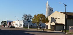 Downtown Bradshaw, October 2011 | |
 Location of Bradshaw, Nebraska | |
| Coordinates: 40°53′01″N 97°44′49″W / 40.88361°N 97.74694°W | |
| Country | United States |
| State | Nebraska |
| County | York |
| Area | |
| • Total | 0.31 sq mi (0.81 km2) |
| • Land | 0.31 sq mi (0.81 km2) |
| • Water | 0.00 sq mi (0.00 km2) |
| Elevation | 1,719 ft (524 m) |
| Population (2020) | |
| • Total | 273 |
| • Density | 869.43/sq mi (335.43/km2) |
| Time zone | UTC-6 (Central (CST)) |
| • Summer (DST) | UTC-5 (CDT) |
| ZIP code | 68319 |
| Area code | 402 |
| FIPS code | 31-06050[3] |
| GNIS feature ID | 2398166[2] |
History edit
Bradshaw was platted in 1879 when the Burlington and Missouri River Railroad was extended to that point.[4][5] Bradshaw was the maiden name of the wife of the original owner of the town site.[6]
In 1890, a tornado struck Bradshaw, killing twelve people and doing great damage.[7][8]
On May 5, 1964 an F5 tornado hit Bradshaw, killing 4 people and injuring 50.[9] It was the only official F5 tornado in Nebraska history.[10]
Geography edit
According to the United States Census Bureau, the village has a total area of 0.33 square miles (0.85 km2), all land.[11]
Demographics edit
| Census | Pop. | Note | %± |
|---|---|---|---|
| 1890 | 434 | — | |
| 1900 | 365 | −15.9% | |
| 1910 | 359 | −1.6% | |
| 1920 | 391 | 8.9% | |
| 1930 | 340 | −13.0% | |
| 1940 | 339 | −0.3% | |
| 1950 | 352 | 3.8% | |
| 1960 | 306 | −13.1% | |
| 1970 | 347 | 13.4% | |
| 1980 | 373 | 7.5% | |
| 1990 | 330 | −11.5% | |
| 2000 | 336 | 1.8% | |
| 2010 | 273 | −18.7% | |
| 2020 | 273 | 0.0% | |
| U.S. Decennial Census[12] | |||
2010 census edit
As of the census[13] of 2010, there were 273 people, 119 households, and 84 families residing in the village. The population density was 827.3 inhabitants per square mile (319.4/km2). There were 143 housing units at an average density of 433.3 per square mile (167.3/km2). The racial makeup of the village was 95.2% White, 1.5% Native American, 0.4% Asian, 0.7% from other races, and 2.2% from two or more races. Hispanic or Latino of any race were 5.5% of the population.
There were 119 households, of which 30.3% had children under the age of 18 living with them, 58.0% were married couples living together, 5.0% had a female householder with no husband present, 7.6% had a male householder with no wife present, and 29.4% were non-families. 25.2% of all households were made up of individuals, and 10.1% had someone living alone who was 65 years of age or older. The average household size was 2.29 and the average family size was 2.67.
The median age in the village was 42.8 years. 23.1% of residents were under the age of 18; 3.6% were between the ages of 18 and 24; 25.3% were from 25 to 44; 28.9% were from 45 to 64; and 19% were 65 years of age or older. The gender makeup of the village was 49.5% male and 50.5% female.
2000 census edit
As of the census[3] of 2000, there were 336 people, 138 households, and 101 families residing in the village. The population density was 1,009.4 inhabitants per square mile (389.7/km2). There were 150 housing units at an average density of 450.6 per square mile (174.0/km2). The racial makeup of the village was 97.02% White, 1.19% Native American, 0.89% from other races, and 0.89% from two or more races. Hispanic or Latino of any race were 0.89% of the population.
There were 138 households, out of which 30.4% had children under the age of 18 living with them, 60.1% were married couples living together, 5.8% had a female householder with no husband present, and 26.8% were non-families. 23.9% of all households were made up of individuals, and 11.6% had someone living alone who was 65 years of age or older. The average household size was 2.43 and the average family size was 2.85.
In the village, the population was spread out, with 25.9% under the age of 18, 9.5% from 18 to 24, 26.2% from 25 to 44, 25.0% from 45 to 64, and 13.4% who were 65 years of age or older. The median age was 38 years. For every 100 females, there were 96.5 males. For every 100 females age 18 and over, there were 99.2 males.
As of 2000 the median income for a household in the village was $37,969, and the median income for a family was $40,000. Males had a median income of $28,611 versus $16,125 for females. The per capita income for the village was $15,660. About 7.0% of families and 9.0% of the population were below the poverty line, including 11.8% of those under age 18 and 4.8% of those age 65 or over.
Notable person edit
- Ken Brondell, baseball player
See also edit
References edit
- ^ "ArcGIS REST Services Directory". United States Census Bureau. Retrieved September 18, 2022.
- ^ a b U.S. Geological Survey Geographic Names Information System: Bradshaw, Nebraska
- ^ a b "U.S. Census website". United States Census Bureau. Retrieved January 31, 2008.
- ^ "Bradshaw, York County". Center for Advanced Land Management Information Technologies. University of Nebraska. Retrieved August 24, 2014.
- ^ Burr, George L. (1921). History of Hamilton and Clay Counties, Nebraska, Volume 1. S.J. Clarke Publishing Company. p. 142.
- ^ Fitzpatrick, Lillian L. (1960). Nebraska Place-Names. University of Nebraska Press. p. 147. ISBN 0-8032-5060-6. A 1925 edition is available for download at University of Nebraska—Lincoln Digital Commons.
- ^ "Bradshaw" historical marker text.[usurped] Nebraska State Historical Society.[usurped] Retrieved 2013-03-15.
- ^ "Bradshaw--York County". Nebraska... Our Towns. Archived 2011-11-23 at the Wayback Machine Retrieved 2013-03-15.
- ^ "Archived copy". Archived from the original on February 26, 2014. Retrieved January 7, 2014.
{{cite web}}: CS1 maint: archived copy as title (link) - ^ "Tornado History Project: Maps and Statistics". Archived from the original on February 26, 2014. Retrieved January 7, 2014.
- ^ "US Gazetteer files 2010". United States Census Bureau. Archived from the original on January 25, 2012. Retrieved June 24, 2012.
- ^ "Census of Population and Housing". Census.gov. Retrieved June 4, 2015.
- ^ "U.S. Census website". United States Census Bureau. Retrieved June 24, 2012.
External links edit
![]() Media related to Bradshaw, Nebraska at Wikimedia Commons
Media related to Bradshaw, Nebraska at Wikimedia Commons