


Summary
Breivikbotn is the administrative centre of Hasvik Municipality in Finnmark county, Norway. It is an old trading post and fishing village that is located on the western end of the island of Sørøya, looking out across the Lopphavet Sea. The village lies along Norwegian County Road 822 in the central part of the municipality. The village of Hasvik lies about 15 kilometres (9.3 mi) to the south, the former village of Dønnesfjord lies about 13 kilometres (8.1 mi) to the northeast, and the village of Sørvær lies about 20 kilometres (12 mi) to the west.[3]
Breivikbotn | |
|---|---|
Village | |
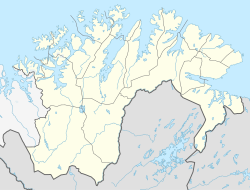 Breivikbotn Location in Finnmark  Breivikbotn Breivikbotn (Norway) | |
| Coordinates: 70°35′19″N 22°17′05″E / 70.58861°N 22.28472°E | |
| Country | Norway |
| Region | Northern Norway |
| County | Finnmark |
| District | Vest-Finnmark |
| Municipality | Hasvik Municipality |
| Area | |
| • Total | 0.32 km2 (0.12 sq mi) |
| Elevation | 5 m (16 ft) |
| Population (2017)[1] | |
| • Total | 320 |
| • Density | 1,000/km2 (3,000/sq mi) |
| Time zone | UTC+01:00 (CET) |
| • Summer (DST) | UTC+02:00 (CEST) |
| Post Code | 9593 Breivikbotn |

The 0.32-square-kilometre (79-acre) village has a population (2017) of 320 which gives the village a population density of 1,000 inhabitants per square kilometre (2,600/sq mi).[1] Breivikbotn Chapel is located in this village as well as much of the commercial activity in the municipality.[3]
References edit
- ^ a b c Statistisk sentralbyrå (1 January 2017). "Urban settlements. Population and area, by municipality".
- ^ "Breivikbotn" (in Norwegian). yr.no. Retrieved 2013-01-11.
- ^ a b Askheim, Svein, ed. (2011-11-19). "Breivikbotn". Store norske leksikon (in Norwegian). Kunnskapsforlaget. Retrieved 2018-06-23.