


Summary
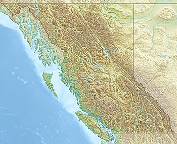
The British Columbia Shore Station Oceanographic Program is a sea surface temperature and salinity monitoring program on the Canadian coast of the northeast Pacific Ocean.[1] The program is administered by Fisheries and Oceans Canada, and regroups 12 lighthouse stations in British Columbia. Most lighthouses are staffed by the Department of Fisheries and Oceans, but some have independent contractors instead.[2]
The practice of recording ocean water temperature and salinity levels in the area was initiated in 1914 at the Pacific Biological Station in Nanaimo. Data is collected daily around the time of the daytime high tide. The methodology of the sampling was originally designed by oceanographer John P. Tully, and was never modified in order to maintain the homogeneity of the data. The program expanded to 12 stations in the 1930s. Over time, more stations joined the programs while others stopped reporting. Currently, twelve stations remain in the program.[3][4]
Data from the Amphitrite point and Kains island lightstations, which started reporting in the mid-1930s, show an increase in coastal water temperatures of 0.08 °C per decade. On the other hand, data from the Entrance Island station, which started reporting around the same time, show an increase in coastal water temperatures of 0.15°C per decade. These trends are a result of anthropogenic climate change.[5]
The stations currently being monitored as part of the program are:[3]
| Lightstation / location | Active since |
| Amphitrite point lightstation | 1934 |
| Bonilla island lightstation | 1960 |
| Chrome island lightstation | 1961 |
| Departure bay (PBS) | 1914 |
| Egg island lightstation | 1970 |
| Entrance island lightstation | 1936 |
| Kains island lightstation | 1935 |
| Langara point lightstation | 1936 |
| Mcinnes island lightstation | 1954 |
| Nootka point lightstation | 1934 |
| Pine island lightstation | 1937 |
| Race Rocks Light | 1921 |
See also edit
References edit
- ^ Finnis, Stephen; Krstic, Nikolas; McIntyre, Lorraine; Nelson, Trisalyn A.; Henderson, Sarah B. (2017-07-01). "Spatiotemporal patterns of paralytic shellfish toxins and their relationships with environmental variables in British Columbia, Canada from 2002 to 2012". Environmental Research. 156: 190–200. doi:10.1016/j.envres.2017.03.012. ISSN 0013-9351. PMID 28359039. S2CID 24638887.
- ^ "Data from BC lightstations". www.dfo-mpo.gc.ca. Fisheries and Oceans Canada. 2019-03-21. Archived from the original on 2019-06-19. Retrieved 2021-02-11.
- ^ a b "British Columbia Lightstation Sea-Surface Temperature and Salinity Data (Pacific), 1914-present - Open Government Portal". open.canada.ca. Treasury Board of Canada. Retrieved 2021-02-11.
- ^ "British Columbia Lightstation Sea-Surface Temperature and Salinity Data (Pacific), 1914-present". zoology.ubc.ca. 2017-03-27. Archived from the original on 2021-02-11. Retrieved 2021-02-11.
- ^ "Canada's Changing Climate Report (CCCR)". 2019. p. 358. Archived from the original on 2019-04-01. Retrieved 2021-02-10.
There is only a 1% possibility that the trend is due to chance