


Summary
Brumstead (or Brunstead) is a village and a civil parish in the English county of Norfolk.[1] The village is 15.3 miles (24.6 km) north-east of Norwich, 17.6 miles (28.3 km) south-south-east of Cromer and 134 miles (216 km) north-east of London. The village lies 1.2 miles (1.9 km) north of the town of Stalham.
| Brumstead | |
|---|---|
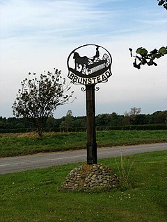 Brumstead village sign | |
 Brumstead Location within Norfolk | |
| Area | 3.22 km2 (1.24 sq mi) |
| Population | 84 (parish, 2001 census) |
| • Density | 26/km2 (67/sq mi) |
| OS grid reference | TG374273 |
| • London | 134 miles (216 km) |
| Civil parish |
|
| District | |
| Shire county | |
| Region | |
| Country | England |
| Sovereign state | United Kingdom |
| Post town | NORWICH |
| Postcode district | NR12 |
| Dialling code | 01692 |
| Police | Norfolk |
| Fire | Norfolk |
| Ambulance | East of England |
History edit
Brumstead's name is of Anglo-Saxon origin and derives from the Old English for a settlement or estate near thorny bushes or shrubs.[2]
In the Domesday Book, Brumstead is recorded as a settlement of 21 households belonging to Roger Bigod. The survey mentions the village also held 30 goats, a church and a mill alongside pannage or woodland for 16 pigs.
The village has also been known for hundreds of years as Brunstead as old maps demonstrate.[3] The village is known locally as Brunstead, as demonstrated by the village sign.
Geography edit
The parish had in 2001 census, a population of 84. At the 2011 census the population remained less than 100 and was included in the civil parish of East Ruston.
St. Peter's Church edit
Brumstead's Parish Church is dedicated to Saint Peter and is of Norman origin.[4]
Transport edit
The nearest railway station is at North Walsham for the Bittern Line which runs between Cromer and Norwich. The nearest airport is Norwich.
For the purposes of local government, the parish falls within the district of North Norfolk. The village is situated on the route of the B1159 that runs between the town of Cromer and the town of Stalham.[5]
War memorial edit
Brumstead's War Memorial is located inside St. Peter's Church and is a white marble plaque. It lists the following names for the First World War:
- Second-Lieutenant Percy C. H. Bird (d.1916), 10th Battalion, Royal Norfolk Regiment
- Leading-Seaman Stanley Ellis (1892–1918), S.S. Tyrhang
- Lance-Corporal George R. Parnacott (d.1914), 1st Battalion, Hampshire Regiment
- Private J. C. Lacey (1891–1919), 58th Battalion, Canadian Army
- Private Ernest B. Bullock (d.1916), 2nd Battalion, Royal Norfolk Regiment
- Private Jesse Sutton (d.1918), 9th Battalion, Royal Norfolk Regiment
- Private B. H. Ellis DCM (1888–1918), 2nd Battalion, Northamptonshire Regiment
- Private J. R. Plummer (1887–1918), 7th Battalion, Royal Sussex Regiment[6]
References edit
- ^ Ordnance Survey (2005). OS Explorer Map OL40 - The Broads. ISBN 0-319-23769-9.
- ^ University of Nottingham. (2022). Retrieved November 13, 2022. http://kepn.nottingham.ac.uk/map/place/Norfolk/Brumstead
- ^ Rye, J. (2000). A popular guide to Norfolk place-names. Dereham: Larks Press.
- ^ Knott, S. (2019). Retrieved November 13, 2022. http://www.norfolkchurches.co.uk/brumstead/brumstead.htm
- ^ County A to Z Atlas, Street & Road maps Norfolk, page 229 ISBN 978-1-84348-614-5
- ^ Knott, S. (2019). Retrieved November 13, 2022. https://www.flickr.com/photos/norfolkodyssey/48657829646/in/album-72157608563785496/