


Summary
Buggenhout (Dutch pronunciation: [ˈbʏɣə(n)ɦʌu̯t] ⓘ) is a municipality in the Belgian province of East Flanders in the Denderstreek. The municipality comprises the towns of Buggenhout proper, Briel, Opdorp, and Opstal. In 2021, Buggenhout had a total population of 14,689. The total area is 25.25 square kilometres.[2]
Buggenhout | |
|---|---|
 | |
 Flag  Coat of arms | |
Location of Buggenhout .mw-parser-output .locmap .od{position:absolute}.mw-parser-output .locmap .id{position:absolute;line-height:0}.mw-parser-output .locmap .l0{font-size:0;position:absolute}.mw-parser-output .locmap .pv{line-height:110%;position:absolute;text-align:center}.mw-parser-output .locmap .pl{line-height:110%;position:absolute;top:-0.75em;text-align:right}.mw-parser-output .locmap .pr{line-height:110%;position:absolute;top:-0.75em;text-align:left}.mw-parser-output .locmap .pv>div{display:inline;padding:1px}.mw-parser-output .locmap .pl>div{display:inline;padding:1px;float:right}.mw-parser-output .locmap .pr>div{display:inline;padding:1px;float:left}html.skin-theme-clientpref-night .mw-parser-output .od,html.skin-theme-clientpref-night .mw-parser-output .od .pv>div,html.skin-theme-clientpref-night .mw-parser-output .od .pl>div,html.skin-theme-clientpref-night .mw-parser-output .od .pr>div{background:#000;color:#fff}html.skin-theme-clientpref-night .mw-parser-output .locmap{filter:grayscale(0.6)}@media(prefers-color-scheme:dark){html.skin-theme-clientpref-os .mw-parser-output .locmap{filter:grayscale(0.6)}html.skin-theme-clientpref-os .mw-parser-output .od,html.skin-theme-clientpref-os .mw-parser-output .od .pv>div,html.skin-theme-clientpref-os .mw-parser-output .od .pl>div,html.skin-theme-clientpref-os .mw-parser-output .od .pr>div{background:#000;color:#fff}}  Buggenhout Location in Belgium
Location of Buggenhout in East Flanders  | |
| Coordinates: 51°00′N 04°12′E / 51.000°N 4.200°E | |
| Country | |
| Community | Flemish Community |
| Region | Flemish Region |
| Province | East Flanders |
| Arrondissement | Dendermonde |
| Government | |
| • Mayor | Pierre Claeys (CD&V) |
| • Governing party/ies | CD&V |
| Area | |
| • Total | 25.64 km2 (9.90 sq mi) |
| Population (2018-01-01)[1] | |
| • Total | 14,475 |
| • Density | 560/km2 (1,500/sq mi) |
| Postal codes | 9255 |
| NIS code | 42004 |
| Area codes | 052 |
| Website | www.buggenhout.be |
Buggenhout is also known for its forest, the "Buggenhoutbos", which is the largest forest of East Flanders.[3]
The geographic centre of Flanders lies in Opdorp.[4]
Buggenhout has two breweries, Bosteels Brewery (known for the "Tripel Karmeliet", "Deus" (a champagne beer), "Kwak") and De Landtsheer, now called Brouwerij Malheur (known for "Malheur").
Etymology edit
The original meaning of the name is "beechwood" or "beech forest" (in modern Dutch: Beukenhout). The name is derived from the Middle Dutch Bucghenhout from Old Dutch Bukenholt. Buken comes from Proto-Germanic *bokjon (Modern Dutch: beuken, Old English: becen (beeches)), holt from *hulta (Modern Dutch: hout (bos), Old English: holt (forest)). Buggenhout still contains a forested area called Buggenhoutbos.[5]
History edit
The village was first mention in 1125. It used to belong to the Duchy of Brabant. Due to internal feuds, the area was confiscated. The forest was declared crown land, and the village of Buggenhout became two heerlijkheden (landed estates). After the French Revolution, Buggenhout was transferred to East Flanders.[5]
Gallery edit
-
 Forest chapel
 -
 Town hall
 -
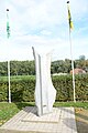 Geographical centre of Flanders
 -
 Cruysveltstede


References edit
- ^ "Wettelijke Bevolking per gemeente op 1 januari 2018". Statbel. Retrieved 9 March 2019.
- ^ "Bevolking per statistische sector - Sector 42004". Statistics Belgium. Retrieved 9 May 2022.
- ^ "Buggenhout bosgemeente". Boeiend Belgie (in Dutch). Retrieved 9 May 2022.
- ^ "Middelpuntwandeling te Opdorp". Pasar (in Dutch). Retrieved 9 May 2022.
- ^ a b "Buggenhout". Agentschap Onroerend Erfgoed (in Dutch). Retrieved 9 May 2022.
External links edit
 Media related to Buggenhout at Wikimedia Commons
- Official website (in Dutch)