


Summary
Buriram (Thai: บุรีรัมย์, RTGS: Buri Ram, pronounced [bū.rīː rām]; Northern Khmer: มฺืงแปะ) is a town (thesaban mueang) in Thailand, capital of Buriram Province, about 300 km (190 mi) northeast of Bangkok. The town occupies tambon Nai Mueang of Mueang Buriram District. In 2012 it had a population of 27,862.
Buriram
บุรีรัมย์ (Thai) มฺืงแปะ (Northern Khmer) | |
|---|---|
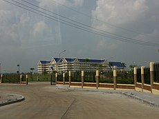
     (From top, left to right): Phanom Rung Historical Park, Buriram Hospital, Municipality Office, Chang Arena, and the moat with defunct Saeng Rung Hotel | |
 Buriram Location in Thailand | |
| Coordinates: 14°59′39″N 103°06′08″E / 14.99417°N 103.10222°E | |
| Country | |
| Province | Buriram Province |
| District | Mueang Buriram |
| Founded | 1936 |
| Named for | บุรี buri – "Town, City" รัมย์ ram – "Happiness" lit. 'Town of Happiness' |
| Government | |
| • Type | Thesaban |
| • Mayor | Kamon Rueangsuksiwong |
| Area | |
| • Total | 2 sq mi (6 km2) |
| Elevation | 535 ft (163 m) |
| Population | |
| • Total | 200,000 |
| • Metro density | 11,720/sq mi (4,525/km2) |
| Time zone | UTC+7 (ICT) |
| Postal code | 31000 |
| Area code | 044 |
| Airport | IATA: BFV – ICAO: VTUO |
| Website | www |
History edit
Almost a thousand years ago, the present-day Buriram was part of the Khmer Empire. Ruins from that time attest to its destruction. The most significant of them is on an extinct volcano and is protected in the Phanom Rung Historical Park. According to inscriptions found, Buriram's ruler recognized the hegemony of the Khmer Empire's emperor. Before the ascent of Bangkok, little was known about Buriram. In the early Bangkok Period, in the early-19th century, the town originally called Muang Pae was renamed Buriram. After administrative reforms in the late 19th century, Buriram was incorporated into Siam as a province.[citation needed]
Administration divisions edit
There are 18 chumchons (villages) (Thai: ชุมชน) in Buriram.[1]
| Rank | English Name | Thai Name |
|---|---|---|
| 1 | Chum Het | ชุมชนชุมเห็ด |
| 2 | Lang Sathani Rotfai | ชุมชนหลังสถานีรถไฟ |
| 3 | Nah Sathani Rotfai | ชุมชนหน้าสถานีรถไฟ |
| 4 | Prapa Kao | ชุมชนประปาเก่า |
| 5 | Bu Lamduan Nuea | ชุมชนบุลำดวนเหนือ |
| 6 | Bu Lamduan Tai | ชุมชนบุลำดวนใต้ |
| 7 | Lang Rajabhat | ชุมชนหลังราชภัฏ |
| 8 | Ton Sak | ชุมชนต้นสัก |
| 9 | Lak Mueang | ชุมชนหลักเมือง |
| 10 | Saphan Yao | ชุมชนสะพานยาว |
| 11 | Khok Klang | ชุมชนโคกกลาง |
| 12 | Lalom | ชุมชนละลม |
| 13 | Talat Bokhoso | ชุมชนตลาด บ.ข.ส. |
| 14 | Lang San | ชุมชนหลังศาล |
| 15 | Thetsaban | ชุมชนเทศบาล |
| 16 | Talat Sot | ชุมชนตลาดสด |
| 17 | Wat Isan | ชุมชนวัดอิสาณ |
| 18 | Nong Prue | ชุมชนหนองปรือ |
Geography edit

Buriram is in the centre of Buriram Province. Buriram has no significant waterways. It has a creek, Huai Chorakhe Mak, the Buriram moat (or Khlong Lalom), Nong Prue, and Huai Chorakhe Mak and Huai Talat reservoirs.
Infrastructure edit
Communications edit
Buriram has a post office, TOT, the national telecom company, a CAT office and two radio stations: Radio Thailand AM and Radio Thailand FM.
Electricity edit
All of the houses in Buriram area (6,097 in total) have access to electricity. The Buriram Provincial Electricity Authority (Buriram PEA) is the main supplier.
Water supply edit
There are 6,097 houses which use municipal water in Buriram. Total consumption is 18,000-19,000 cubic meters a day. Huai Chorakhe Reservoir is the source of Buriram's water. Huai Talat Reservoir is the reserve water supply.
Health edit
The main hospital in Buriram is Buriram Hospital, operated by the Ministry of Public Health.
Climate edit
Weather edit
| Climate data for Buriram (1981-2010) | |||||||||||||
|---|---|---|---|---|---|---|---|---|---|---|---|---|---|
| Month | Jan | Feb | Mar | Apr | May | Jun | Jul | Aug | Sep | Oct | Nov | Dec | Year |
| Mean daily maximum °C (°F) | 31.7 (89.1) |
34.0 (93.2) |
36.0 (96.8) |
36.5 (97.7) |
33.9 (93.0) |
34.4 (93.9) |
33.6 (92.5) |
33.1 (91.6) |
32.6 (90.7) |
31.3 (88.3) |
30.5 (86.9) |
29.8 (85.6) |
33.1 (91.6) |
| Mean daily minimum °C (°F) | 17.7 (63.9) |
20.1 (68.2) |
22.7 (72.9) |
24.5 (76.1) |
24.5 (76.1) |
24.8 (76.6) |
24.4 (75.9) |
24.2 (75.6) |
24.2 (75.6) |
23.3 (73.9) |
20.9 (69.6) |
18.3 (64.9) |
22.5 (72.5) |
| Average precipitation mm (inches) | 0.1 (0.00) |
7.1 (0.28) |
42.0 (1.65) |
113.8 (4.48) |
241.9 (9.52) |
100.8 (3.97) |
176.1 (6.93) |
109.9 (4.33) |
288.9 (11.37) |
177.5 (6.99) |
94.3 (3.71) |
6.0 (0.24) |
1,358.4 (53.47) |
| Source: Buriram Meteorological Department | |||||||||||||
Economy edit
The bulk of the local economy is agricultural and the tourist industry that is a prominent feature in much of the rest of the country has yet to make a significant impact. Key agricultural crops include rice and cassava. The main languages spoken in Buriram are central Thai, Lao, and Khmer.
Sports edit


Buriram has a football club, Buriram United F.C., which plays at Chang Arena.
The construction of top-tier racetrack Chang International Circuit started in March 2013[2] and opened on 4 October 2014.[3][4] The track is an FIA Grade I certified circuit, suitable for Formula One racing,[5][6] and hosted a Japanese Super GT round in 2014. From 2018 on, the circuit will host MotoGP for the first time.[7] It also hosts rounds of the World Superbike Championship (WSBK). Other racetracks are being planned, such as a motocross circuit.
The Buriram Marathon, a silver label class event, is held in January every year. Over 25,000 participants are expected in 2023.
In 2013, Newin Chidchob, developer of the Buriram's new CIC F1 racetrack, has said that, "Buriram doesn't have the sea like Pattaya, doesn't have mountains like Chiang Mai, so we will make Buriram the city of sports."[8]
Transport edit
Airports edit
Buriram Airport is the only airport in Buriram Province. Thai AirAsia serves Buriram from Don Mueang International Airport (DMK).
Highways edit
Highways 218, 219, 226, and 2074 pass through Buriram.
Intercity transit edit

The State Railway of Thailand (SRT), the national rail system, provides service from the Buriram Railway Station. Buriram is on the northeastern railway line.
The national bus company, The Transport Co., Ltd., operates a bus depot at Buriram Bus Station. Nakhonchai Air has its bus terminal adjacent to the bus station.
Demography edit
As of 30 April 2010.
- Male 13,555
- Female 14,620
Total population of 28,283 and 6,097 family units.[1]
Education edit

|
|
References edit
- ^ a b c d "ที่ตั้งและประชากร". Archived from the original on 2012-11-18. Retrieved 2012-05-23.
- ^ Paritta Wangkiat (2014-10-05). "Buri Ram on fast track for F1 races". Bangkok Post. Retrieved 2014-10-11.
- ^ "ช้างเซอร์กิต บุรีรัมย์ สู่F1ระดับโลก" [Chang Circuit Buriram towards F1 and world-class]. Daily News (Thailand) (in Thai). 2014-10-03. Archived from the original on 2014-10-09. Retrieved 2014-10-10.
- ^ Buriram International Circuit(subscription required)
- ^ Nick Mulvenney (2014-10-08). "Formula One grade circuit opens in Thailand". Reuters. Archived from the original on 2014-10-11. Retrieved 2014-10-10.
- ^ "Super GT race all set to blast down Buriram circuit". The Nation (Thailand). 2014-09-19. Archived from the original on 2014-10-17. Retrieved 2014-10-10.
- ^ "Thailand to sign 3-year MotoGP deal". Autosport. 28 August 2017. Retrieved 13 September 2017.
- ^ ""เนวิน" ติดปีกเมืองบุรีรัมย์ ติด 1 ใน 5 เมืองที่มีนักท่องเที่ยวมากที่สุด". Prachachat Business. 25 November 2014. Archived from the original on 15 June 2015. Retrieved 17 June 2019.
External links edit
 Buriram travel guide from Wikivoyage
- Buriram Times