


Summary
Bussell Highway is a generally north–south highway in the South West region of Western Australia. The highway links the city of Bunbury with the town of Augusta and is approximately 140 kilometres (87 mi) in length.[1] The highway is signed State Route 10, except in Busselton where the construction of the Busselton Bypass in 2000 resulted in this stretch being changed to Alternate State Route 10 with the Bypass signed State Route 10.
Bussell Highway | |
|---|---|
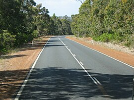 | |
| Bussell Highway in Forest Grove | |
 | |
| General information | |
| Type | Highway |
| Length | 140 km (87 mi) |
| Opened | 1894 |
| Route number(s) | |
| Major junctions | |
| North end | Blair Street, Bunbury |
| |
| South end | Blackwood Avenue, Augusta |
| Location(s) | |
| Major settlements | Capel, Busselton, Vasse, Cowaramup, Margaret River, Karridale |
| Highway system | |
The highway is sealed dual carriageway from Bunbury to Capel and in the town of Busselton; and is single carriageway from Capel to Busselton and from Vasse to Augusta with regular overtaking lanes.
History edit
Bussell Highway was built in 1894 after successful lobbying by M. C. Davies, a timber miller, as a road connecting Busselton with his mill at Karridale.[2] The tender had been let to Davies by the State government under John Forrest. In 1932, the road from Busselton to Augusta was completed and named Bussell Highway after the Bussell family, some of the region's first settlers, on the suggestion of Premier James Mitchell in consultation with historian James Battye; the name, which incorporated a portion of Quindalup Road, was announced on 8 April of that year to coincide with Busselton's centenary celebrations.[3] In 1946 Bunbury Road and Vasse Road were incorporated into Bussell highway, thus extending the highway to Bunbury.[3] By the early 1960s, the road had been completely sealed.[4] In 1995, the Ludlow deviation, a replacement of part of the highway that bypasses the Tuart Forest National Park, was opened; the old route through the forest is now named Tuart Drive.[5][6] The Busselton Bypass was completed in December 2000, while the Vasse bypass was completed in January 2016.[7][8]
In 2016, Main Roads asked the local government Shire of Capel to clear land along the final stretch for the proposed dual carriageway between Capel and Busselton.[9]
In 2019, the Perimeter Road, which diverts heavy traffic from Bussell Highway around, rather than through, Margaret River, was completed.[10]
In 2020, funding was brought forward for the dual carriageway to support jobs during the COVID-19 pandemic.[11][12] The south-bound section of the first of two stages, between Capel and Hutton Road, was opened in December 2021.[13]

Route description edit
Departing Bunbury, the highway commences at the intersection of Blair Street and Parade Road outside the Bunbury Racecourse in Carey Park. After about 500 metres (1,600 ft), it intersects at a large roundabout with Bunbury's ring road, Robertson Drive, connecting the highway to several major routes: Australind Bypass and Forrest Highway lead to Perth via Mandurah; South Western Highway north-eastbound to Harvey, and to Collie via Coalfields Highway; and South Western Highway south-westbound to Donnybrook.
It exits Bunbury as a sealed dual carriageway, bypassing the town of Capel before becoming a single carriageway to Busselton. This section was considered the most dangerous road in regional Western Australia according to a 2019 survey by the Royal Automobile Club of Western Australia.[14][15]
At a large roundabout, it intersects with the Busselton Bypass and changes its name to Causeway Road, then turns left into Albert Street in Busselton's CBD. After one block it reverts to Bussell Highway, proceeding for 9 kilometres (6 mi) as a dual carriageway through Busselton's western suburbs before turning left at Abbey. The road then proceeds as a single carriageway with regular overtaking lanes to Augusta through small dairy and crop farms, orchards and wineries – the only slow point on this entire journey is when it becomes the main street of the popular tourist and seachange town of Margaret River. The linked Perimeter Road bypasses the town.[10]
The highway ends at the entrance to Augusta, but the road continues as Blackwood Avenue through the town and then as Leeuwin Road for 9 kilometres (6 mi) before reaching Cape Leeuwin, the southwestern tip of Western Australia.
Major towns edit
Major intersections edit
| LGA | Location | km[1] | mi | Destinations | Notes |
|---|---|---|---|---|---|
| Bunbury | Carey Park, South Bunbury | 0 | 0.0 | Blair Street north / Nuytsia Avenue east – Bunbury city centre | Northern highway terminus: continues as Blair Street |
| Carey Park, Withers, College Grove | 1.4 | 0.87 | Roundabout intersection; State Route 10 northern concurrency terminus: continues east | ||
| Capel | Dalyellup, Gelorup | 5.1 | 3.2 | Norton Promenade – Dalyellup | Traffic light controlled intersection |
| Stratham | 14.6 | 9.1 | Boyanup West Road – Boyanup | ||
| Capel | 23.2 | 14.4 | Capel Drive – Capel, Donnybrook | Northern loop road intersection | |
| 24.5 | 15.2 | Capel Drive – Capel, Donnybrook | Southern loop road intersection | ||
| 28.3 | 17.6 | Tuart Drive (Ludlow Tuart Forest Tourist Drive) – Busselton (alternate route) | Old Bussell Highway route; Bussell Highway southbound is the main route to Busselton | ||
| Busselton | Yalyalup | 41.9 | 26.0 | Sues Road – Nannup, Pemberton, Augusta | |
| 43.5 | 27.0 | Tuart Drive (Ludlow Tuart Forest Tourist Drive) – Capel (alternate route) | Bussell Highway northbound is the main route to Capel | ||
| Yalyalup, Bovell, Reinscourt | 46.9 | 29.1 | |||
| Bovell, Reinscourt, Busselton | 47.8 | 29.7 | Roundabout intersection; State Route 10 concurrency terminus: continues south | ||
| Busselton | 49.7 | 30.9 | Albert Street (Bussell Highway) west / Causeway Road (Bussell Highway) south / Albert Street east / Queen Street north – Busselton town centre | Traffic light controlled intersection | |
| Abbey | 57.7 | 35.9 | Roundabout intersection | ||
| Vasse | 59.4 | 36.9 | Roundabout intersection; State Route 10 concurrency terminus: continues east | ||
| Augusta–Margaret River | Cowaramup | 87.2 | 54.2 | Cowaramup Bay Road – Gracetown | |
| Margaret River | 97.4 | 60.5 | Wallcliffe Road west / Forrest Street east – Prevelly | ||
| Karridale | 126 | 78 | State Route 10 also continues south along Bussell Highway to Augusta as a spur route | ||
| Augusta | 140 | 87 | Highway terminus: Continues south as Blackwood Avenue towards Cape Leeuwin; State Route 10 southern terminus | ||
1.000 mi = 1.609 km; 1.000 km = 0.621 mi
| |||||
See also edit
References edit
- ^ a b Google (16 March 2013). "Bussell Highway" (Map). Google Maps. Google. Retrieved 16 March 2013.
- ^ "Bridgefield Monument". Heritage Council of Western Australia. Retrieved 1 August 2019.
- ^ a b "Bunbury Public Roads Street Name Register" (PDF). City of Bunbury. Archived from the original (PDF) on 6 March 2019. Retrieved 1 August 2019.
- ^ "Thematic History". Municipal Heritage Inventory (PDF). City of Busselton. 2013. p. 14. Retrieved 20 October 2022.
- ^ "Official opening of $12M deviation on Bussell Highway". Government of Western Australia. 5 April 1995. Archived from the original on 5 October 2021. Retrieved 24 August 2019.
- ^ "management plan 792014: Tuart Forest National Park" (PDF). Parks and Wildlife Service. August 2014. Retrieved 24 August 2019.
- ^ "Busselton Bypass open to traffic four months ahead of schedule". Government of Western Australia. 19 December 2000. Archived from the original on 1 August 2019. Retrieved 1 August 2019.
- ^ "Safety boosted with opening of Vasse Bypass". Government of Western Australia. 29 January 2016. Archived from the original on 26 August 2019. Retrieved 26 August 2019.
- ^ "Pre-construction work to start this year for Bussell Highway revamp". ABC News. Retrieved 26 April 2016.
- ^ a b "Margaret River Perimeter Road reaches practical completion". Government of Western Australia. 28 February 2019. Archived from the original on 25 August 2019. Retrieved 25 August 2019.
- ^ "Premier Mark McGowan defends hard border as $223 million for WA roads unveiled". ABC News. 21 June 2020. Retrieved 22 June 2020.
- ^ "Bussell Highway crash victim welcomes lane duplication funding for risky road". ABC South West WA. 22 June 2020. Retrieved 22 June 2020.
- ^ Stephens, Kate; Loney, Georgia (1 December 2021). "Part of the Bussell Highway duplication opened ahead of busy tourist period". ABC South West WA. Retrieved 1 December 2021.
- ^ Kirk, Emma (17 April 2019). "2019 RAC Risky Roads Survey". Busselton-Dunsborough Mail. Retrieved 21 November 2020.
- ^ "RAC Risky Roads Survey results 2018/19" (PDF). Royal Automobile Club of Western Australia. Retrieved 21 November 2020.
External links edit
![]() Media related to Bussell Highway at Wikimedia Commons
Media related to Bussell Highway at Wikimedia Commons