


Summary
Buthidaung (Burmese: ဘူးသီးတောင်မြို့; MLCTS: bu:si:taung mrui., pronounced [búðídàʊɰ̃ mjo̰]) is a town in Rakhine State, in the westernmost part of Myanmar (Burma). It is the administrative seat of the Buthidaung Township. Buthidaung lies on the west bank of the Mayu river, and experienced severe flooding in June 2010 and July 2011.[2] Buthidaung is 16 miles east from Maungdaw. The two towns are connected by two tunnels through the Mayu mountains that were built in 1918.
Busidaung
ဘူးသီးတောင်မြို့ | |
|---|---|
Town | |
| Buthidaung | |
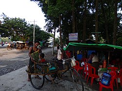 Buthidaung in 2016 | |
 Busidaung Location in Myanmar (Burma) | |
| Coordinates: 20°52′08″N 92°31′41″E / 20.8690°N 92.528°E | |
| Country | |
| Division | |
| District | Maungdaw District |
| Township | Buthidaung Township |
| Population (2021) | |
| • Total | 55,545[1] |
| • Ethnicities | 93% Rohingya 6% Rakhine <1% Others |
| • Religions | Islam Buddhism hindus & others |
| Time zone | UTC+6.30 (MMT) |
| Area code(s) | 42, 43 |
During the 2016–17 Northern Rakhine State clashes, three police stations in Buthidaung were reportedly surrounded by Rohingya insurgents.[3] As a result of the clashes in Buthidaung and much of the surrounding area, many Rohingyas have left their homes.[4]
Geography edit
Buthidaung is one of the 16 towns in Rakhine state. Buthidaung is situated about 16 miles from Maungdaw, and similarly to this town has no train station or airport.
History edit
Buthidaung has a majority Rohingya population, of which many have fled since the 2012 Rakhine State riots. Buthidaung has the second largest population of Rohingya after Maung Daw.
It was the birthplace of Famous ruler, King Min Razagyi.
References edit
- ^ "Buthidaung (Township, Myanmar) - Population Statistics and Location in Maps and Charts". www.citypopulation.de. Retrieved 27 September 2016.
- ^ Kha, Kyaw (22 July 2011). "Seven townships in Arakan State flooded by record heavy rain". mizzima.com. Archived from the original on 2012-02-11. Retrieved 2024-03-01.
- ^ Ruma Paul (August 28, 2017). "Myanmar Army Battles Rohingya Insurgents; Thousands Flee". The New York Times. Archived from the original on September 4, 2017.
A Buthidaung-based reporter, citing police sources directly involved in events, said three police posts in northern Buthidaung had been surrounded by Rohingya insurgents.
- ^ "The book that foresaw the assault on the Rohingyas". The Economist. 12 October 2017.
External links edit
- Satellite map at Maplandia.com
20°52′N 92°32′E / 20.867°N 92.533°E