
KNOWPIA
WELCOME TO KNOWPIA

California Historical Landmarks in Inyo County 
Summary
This list includes properties and districts listed on the California Historical Landmark listing in Inyo County, California. Click the "Map of all coordinates" link to the right to view a Google map of all properties and districts with latitude and longitude coordinates in the table below.
| Image | [1] | Landmark name | Location | City or town | Summary |
|---|---|---|---|---|---|
 |
209 | Bend City | Mazourka Canyon Rd. 36°49′09″N 118°07′50″W / 36.819167°N 118.130556°W | Independence | |
 |
444 | Bennett-Arcane Long Camp | Death Valley National Park 36°09′48″N 116°51′48″W / 36.163404°N 116.863351°W | Just west of the Badwater Basin. | |
 |
811 | Bishop Creek Battleground | State Hwy 168 and Bishop Creek Rd. 37°20′29″N 118°28′52″W / 37.341517°N 118.4812°W | Bishop | |
 |
441 | Burned Wagons Point | Death Valley National Park 36°36′24″N 117°08′46″W / 36.606753°N 117.146181°W | Stovepipe Wells | |
 |
349 | Camp Independence | Miller Ln. & Salvabell Ln. 36°49′59″N 118°13′21″W / 36.833183°N 118.222567°W | Independence, California | |
 |
537 | Cottonwood Charcoal Kilns | State Hwy 395 36°24′55″N 118°00′43″W / 36.4152°N 118.012033°W | Cartago | |
 |
442 | Death Valley 49ers Gateway | California Route 190, near Badwater Rd. 36°26′55″N 116°51′10″W / 36.448583°N 116.8527°W | Furnace Creek | |
 |
848 | Eichbaum Toll Road | Death Valley National Park 36°36′20″N 117°08′51″W / 36.605501°N 117.147497°W | Stovepipe Wells | |
 |
796 | Farley's Olancha Mill Site | State Hwy 395 36°16′30″N 118°00′10″W / 36.274944°N 118.002900°W | Olancha | |
 |
752 | Furnace of Owens Lake Silver-Lead Company | State Hwy 136 36°31′49″N 117°54′49″W / 36.53014°N 117.913556°W | Keeler | |
 |
507 | Grave of 1872 Earthquake Victims | State Hwy 395 36°37′06″N 118°04′07″W / 36.61835°N 118.068517°W | Lone Pine | |
 |
953 | Laws Station | Silver Canyon Rd. 37°24′04″N 118°20′46″W / 37.401°N 118.346°W | Bishop | |
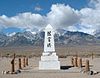 |
850 | Manzanar Relocation Center | State Hwy 395 36°43′34″N 118°08′41″W / 36.7262°N 118.144783°W | Independence | Also on the NRHP list as NPS-76000484 |
 |
229 | Mary Austin's Home | 253 Market St. 36°48′06″N 118°12′07″W / 36.8017°N 118.2019°W | Independence | |
 |
211 | Mayfield Canyon Battlefield | Mayfield Canyon 37°26′49″N 118°38′14″W / 37.446876°N 118.637344°W | Bishop | |
 |
773 | Old Harmony Borax Works | Death Valley National Park 36°28′48″N 116°52′24″W / 36.48°N 116.873472°W | Furnace Creek | Also on the NRHP list as NPS-74000339 |
 |
826 | Old Stovepipe Wells | Death Valley National Park 36°39′33″N 117°04′44″W / 36.659167°N 117.078889°W | Stovepipe Wells | |
 |
230 | Owensville | State Hwy 6 & Silver Canyon Rd. 37°23′59″N 118°21′09″W / 37.399600°N 118.352600°W | Bishop | Also called "First Permanent White Habitation in Owens Valley" |
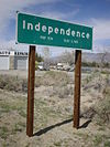 |
223 | Putnam's Stone Cabin | 139 Edwards St. 36°48′11″N 118°12′00″W / 36.802933°N 118.200033°W | Independence | |
 |
208 | San Francis Ranch | Red Hill Rd. & State Hwy 168 37°21′41″N 118°27′12″W / 37.361317°N 118.4532°W | Bishop | |
 |
443 | Valley Wells | Trona Wildrose Rd. & Valley Wells Rd. 35°49′42″N 117°19′54″W / 35.828333°N 117.331667°W | Valley Wells |
References edit
- ^ "California Historical Landmarks By County". Ohp.parks.ca.gov. Retrieved 2019-04-03.
See also edit
Wikimedia Commons has media related to California Historical Landmarks in Inyo County, California.
- List of California Historical Landmarks
- National Register of Historic Places listings in Inyo County, California