
KNOWPIA
WELCOME TO KNOWPIA

California Historical Landmarks in Los Angeles County 
Summary
List table of the properties and districts — listed on the California Historical Landmarks in Los Angeles County, Southern California.
- Note: Click the "Map of all coordinates" link to the right to view a Google map of all properties and districts with latitude and longitude coordinates in the table below.
| Image | [1] | Landmark name | Location | City or town | Summary |
|---|---|---|---|---|---|
 |
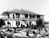
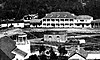
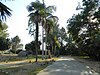
966 | Adamson House | Adamson House 34°02′04″N 118°40′51″W / 34.034486°N 118.680733°W | Malibu | 23200 Pacific Coast Hwy, Malibu, CA |
 |
372 | Adobe de Palomares | 491 East Arrow Highway 34°05′26″N 117°44′35″W / 34.0904674°N 117.74297029°W | Pomona | |
 |
717 | Angeles National Forest | Angeles National Forest 34°16′11″N 118°10′06″W / 34.269856°N 118.168241°W | multiple cities | |
 |
145 | Avila Adobe | El Pueblo de Los Angeles Historic Monument 34°03′26″N 118°14′16″W / 34.057222°N 118.237778°W | Los Angeles | Also on the NRHP list as NPS-72000231 |
 |
147 | Banning Park | 401 East M St. 33°47′23″N 118°15′32″W / 33.789752°N 118.258845°W | Wilmington | |
 |
1041 | Beach Boys Historic Landmark | 3701 W. 119th St. 33°55′31″N 118°20′15″W / 33.925229°N 118.337517°W | Hawthorne | |
 |
1006 | Beale's Cut Stagecoach Pass | Sierra Hwy and Clampitt Rd. 34°20′32″N 118°30′34″W / 34.342133°N 118.509517°W | Santa Clarita | |
 |
656 | Bella Union Hotel site | Fletcher Bowron Square 34°03′17″N 118°14′27″W / 34.054668°N 118.240925°W | Los Angeles | |
 |
150 | Brand Park | 15174 San Fernando Mission Blvd. 34°16′21″N 118°27′26″W / 34.2725°N 118.457222°W | Los Angeles | |
 |
151 | Campo de Cahuenga | 3919 Lankershim Blvd 34°08′24″N 118°21′42″W / 34.14°N 118.361667°W | North Hollywood | Also on the NRHP list as NPS-72001602 |
 |
235 | Casa Adobe De San Rafael | 1330 Dorothy St. 34°09′58″N 118°15′50″W / 34.166037°N 118.263835°W | Glendale | |
 |
127 | Casa De Governor Pio Pico | Pio Pico State Historic Park 33°59′37″N 118°04′16″W / 33.993636°N 118.071075°W | Whittier | Also on the NRHP list as NPS-73000408 |
 |
920 | Casa De San Pedro | Meyler and Quartermaster Rds. 33°43′15″N 118°17′06″W / 33.7208833333333°N 118.285011111111°W | San Pedro | |
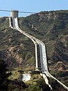 |
653 | The Cascades | Foothill Blvd. & Balboa Blvd. 34°19′22″N 118°29′51″W / 34.322767°N 118.497467°W | Sylmar | |
 |
637 | Catalina Adobe | 2211 Bonita Dr. 34°10′48″N 118°13′57″W / 34.1800916666667°N 118.232544444444°W | Glendale | Also on the NRHP list as NPS-76000487 |
 |
554 | Cecil B. DeMille Studio Barn | 2100 N. Highland Ave. 34°06′31″N 118°20′10″W / 34.108508°N 118.336101°W | Hollywood | Also on the NRHP list as 14000034 |
 |
363 | Centinela Springs | Centinela Park, 700 Warren Ln. 33°58′29″N 118°20′33″W / 33.974657°N 118.342388°W | Inglewood | |
 |
911 | Chatsworth Calera | Woolsey Canyon Rd. & Valley Circle Blvd. 34°14′05″N 118°38′31″W / 34.2347222222222°N 118.641944444444°W | Chatsworth | |
 |
990 | Christmas Tree Lane | Santa Rosa Ave. 34°11′25″N 118°08′09″W / 34.190278°N 118.135833°W | Altadena | Also on the NRHP list as NPS-90001444 |
 |
152 | Dominguez Ranch House | 18127 S Alameda 33°52′01″N 118°13′03″W / 33.866944°N 118.2175°W | Compton | Also on the NRHP list as NPS-76000486 |
 |
169 | Drum Barracks | 1053 Cary St. 33°47′05″N 118°15′24″W / 33.784722°N 118.256667°W | Wilmington | Also on the NRHP list as NPS-71000161 |
 |
367 | E.J. Baldwin's Queen Anne Cottage | Los Angeles State and County Arboretum 34°08′27″N 118°03′09″W / 34.140833°N 118.0525°W | Arcadia | Also on the NRHP list as NPS-80000804 |
 |
1011 | Ennis House | 2655 Glendower Ave. 34°06′58″N 118°17′34″W / 34.116222°N 118.2929°W | Los Angeles | Also on the NRHP list as NPS-71000145 |
 |
947 | Fred C. Nelles Youth Correctional Facility | Fred C. Nelles Youth Correctional Facility 33°58′34″N 118°03′04″W / 33.975974°N 118.050982°W | Whittier | |
 |
289 | First home of Pomona College | Mission Blvd. & S White St. 34°03′17″N 117°45′32″W / 34.054833°N 117.7588°W | Pomona | |
 |
822 | First Jewish site in Los Angeles | Chavez Ravine 34°04′11″N 118°14′28″W / 34.069591°N 118.241161°W | Los Angeles | |
 |
718 | First United States Air Meet | 18501 South Wilmington Avenue 33°51′42″N 118°14′06″W / 33.86165°N 118.234967°W | Carson | |
 |
1011 | Freeman House | 1962 Glencoe Way 34°06′20″N 118°20′19″W / 34.105664°N 118.338603°W | Los Angeles | Also on the NRHP list as NPS-71000146 |
 |
871 | Gamble House | 4 Westmoreland Pl. 34°09′06″N 118°09′39″W / 34.151561°N 118.1608°W | Pasadena | Also on the NRHP list as NPS-71000155 |
 |
912 | Glendora Bougainvillea | E Bennett Ave. at N. Minnesota Ave. 34°08′23″N 117°51′38″W / 34.139697°N 117.860556°W | Glendora | Also on the NRHP list as NPS-78000683 |
 |
669 | Governor Stoneman Adobe, Los Robles | 1912 Montrobles Pl. 34°06′51″N 118°08′10″W / 34.114252°N 118.136196°W | San Marino | |
 |
646 | Grave of George Caralambo | Founders' Memorial Park 33°59′12″N 118°02′47″W / 33.9868°N 118.046416666667°W | Whittier | |
 |
716 | Griffith Ranch | 12685 Foothill Blvd at Vaughn St. 34°17′24″N 118°24′41″W / 34.290017°N 118.411283°W | San Fernando | |
 |
170 | Hancock Park | 5801 Wilshire Blvd 34°03′49″N 118°21′25″W / 34.063632°N 118.356823°W | Los Angeles | |
 |
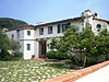
961 | Harold Lloyd Estate | 1740 Green Acres Place 34°05′17″N 118°25′37″W / 34.088106°N 118.426939°W | Beverly Hills | Also known as Greenacres. Also on the NRHP list as NPS-84000876 |
 |
1038 | Hay Tree | 16475 Paramount Blvd. 33°53′03″N 118°09′38″W / 33.8842°N 118.160605555556°W | Paramount | |
 |
984 | Henry Gage Mansion | 7000 E. Gage 33°58′19″N 118°08′04″W / 33.971854°N 118.134548°W | Bell Gardens | |
Upload Photo |
664 | Heritage House | Willowbrook Ave. & Myrrh St. 33°53′34″N 118°13′28″W / 33.892833°N 118.22455°W | Compton | |
 |
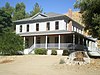
368 | Hugo Reid Adobe | Los Angeles State and County Arboretum 34°08′27″N 118°03′11″W / 34.1407805555556°N 118.053008333333°W | Arcadia | |
 |
383 | Jose Dolores Sepulveda Adobe | Madison St. & Courtney Way 33°47′49″N 118°20′53″W / 33.796878°N 118.347945°W | Torrance | |
Upload Photo |
386 | La Casa de Carrión | 919 Puddingstone Dr. 34°05′46″N 117°47′20″W / 34.096018°N 117.789021°W | La Verne | |
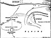 |
167 | La Mesa Battlefield | 4490 Exchange Ave at Downey Rd. 34°00′09″N 118°12′17″W / 34.002367°N 118.204768°W | Vernon | |
 |
590 | Lang Southern Pacific Station | Soledad Canyon 34°25′52″N 118°22′44″W / 34.43115°N 118.378883°W | Santa Clarita | |
 |
1021 | Liberty Hill site | 5th St. & Harbor Blvd. 33°44′26″N 118°16′50″W / 33.74065°N 118.28055°W | San Pedro | |
 |
933 | Llano del Rio | State Hwy 138 34°30′23″N 117°49′37″W / 34.506472°N 117.827083°W | Llano | |
 |
1014 | Long Beach Marine Stadium | Pete Archer Rowing Center 33°46′09″N 118°07′58″W / 33.76905°N 118.132767°W | Long Beach | |
 |
960 | Los Angeles Memorial Coliseum | University of Southern California 34°00′51″N 118°17′16″W / 34.014167°N 118.287778°W | Los Angeles | Also on the NRHP list as NPS-84003866 |
 |
156 | Los Angeles Plaza | El Pueblo de Los Angeles Historic Monument 34°03′25″N 118°14′16″W / 34.056944°N 118.237778°W | Los Angeles | |
 |
689 | Los Encinos State Historic Park | Los Encinos State Historic Park 34°09′38″N 118°29′58″W / 34.160556°N 118.499444°W | Encino | |
 |
301 | Lugo Adobe | El Pueblo de Los Angeles Historic Monument 34°03′23″N 118°14′18″W / 34.0562916666667°N 118.23825033°W | Los Angeles | |
 |
531 | Lummis Home | 200 E. Ave 43 and Pasadena Freeway 34°05′35″N 118°12′22″W / 34.093056°N 118.206111°W | Los Angeles | Also on the NRHP list as NPS-71000148 |
 |
688 | Lyons Station Stagecoach Stop | Eternal Valley Memorial Park, 23287 N Sierra Hwy 34°21′46″N 118°30′27″W / 34.3627°N 118.5074°W | Newhall | |
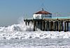 |
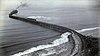
1018 | Manhattan Beach pier | Manhattan Beach 33°53′01″N 118°24′49″W / 33.88374°N 118.41361°W | Manhattan Beach | |
 |
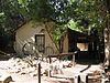
516 | Mentryville | 27201 W. Pico Canyon Rd. 34°22′45″N 118°36′40″W / 34.379158°N 118.611006°W | Newhall | |
 |
171 | Merced Theatre | El Pueblo de Los Angeles Historic Monument 34°03′22″N 118°14′23″W / 34.0561138888889°N 118.239761111111°W | Los Angeles | |
 |
744 | Mirror Building | 145 S. Spring St. 34°03′07″N 118°14′43″W / 34.0518583333333°N 118.245247222222°W | Los Angeles | |
 |
157 | Mission San Fernando Rey de España | 15151 San Fernando Mission Blvd. 34°16′23″N 118°27′40″W / 34.2731°N 118.4612°W | Mission Hills | Also on the NRHP list as NPS-71001076 |
 |
158 | Mission San Gabriel Arcángel | 537 W Mission Dr. 34°05′51″N 118°06′23″W / 34.097386°N 118.1063°W | San Gabriel | Also on the NRHP list as NPS-71000158 |
 |
161 | Mission Vieja | N. Gabriel Blvd. & N. Lincoln Ave. 34°01′51″N 118°04′24″W / 34.0308805555556°N 118.073227777778°W | Montebello | |
|
963 | The Mojave Road | Drum Barracks to Route 66 crosses LA County line into San Bernardino County 33°47′05″N 118°15′29″W / 33.78466666°N 118.258163°W | ||
 |
972 | Naval and Marine Corps Reserve Center | 1700 Stadium Way 34°04′10″N 118°14′33″W / 34.069444°N 118.2425°W | Los Angeles | |
 |
144 | Nuestra Señora Reina de los Angeles | 535 N Main St. 34°03′25″N 118°14′22″W / 34.05698°N 118.23939°W | Los Angeles | |
 |
168 | Oak of the Golden Dream | I-5 and Lyons Ave. 34°23′N 118°35′W / 34.39°N 118.58°W | Newhall | |
 |
302 | Old Mill | 1120 Old Mill Rd. 34°07′08″N 118°07′41″W / 34.119°N 118.128°W | San Marino | Also on the NRHP list as NPS-71000154 |
 |
730 | Old Plaza Firehouse | El Pueblo de Los Angeles Historic Monument 34°03′22″N 118°14′20″W / 34.056033°N 118.238767°W | Los Angeles | |
 |
373 | Old Salt Lake | Harbor Dr. & Yacht Club Way 33°51′07″N 118°23′49″W / 33.852017°N 118.396933°W | Redondo Beach | |
 |
840 | Old Santa Monica Forestry Station | Rustic Canyon 34°02′13″N 118°30′54″W / 34.0370416666667°N 118.515008333333°W | Los Angeles | |
 |
632 | Old Short Cut | Angeles National Forest 34°19′36″N 118°00′21″W / 34.326791°N 118.005888°W | La Cañada Flintridge | |
 |
939.5 | Old Trapper's Lodge | Los Angeles Pierce College 34°11′06″N 118°35′00″W / 34.185016°N 118.5832°W | Woodland Hills | |
 |
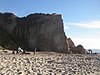
381 | Old Whaling Station | Portuguese Bend 33°44′05″N 118°21′16″W / 33.73472222°N 118.35456111°W | Rancho Palos Verdes | |
 |
536 | Original building of the University of Southern California | University of Southern California 34°01′11″N 118°16′58″W / 34.0196°N 118.2828°W | Los Angeles | |
Upload Photo |
451 | Ortega-Vigare Adobe | 616 S. Ramona St. 34°05′41″N 118°06′28″W / 34.094841°N 118.107888°W | San Gabriel | |
 |
988 | Pacific Asia Museum | 46 North Los Robles Ave. 34°08′48″N 118°08′28″W / 34.1467°N 118.1411°W | Pasadena | Also on the NRHP list as NPS-77000300 |
 |
681 | Paradox Hybrid Walnut Tree | 12300 Whittier Blvd. and Mar Vista 33°58′26″N 118°02′45″W / 33.973755°N 118.045939°W | Whittier | |
 |
887 | Pasadena Playhouse | 39 El Molino Ave. 34°08′43″N 118°08′14″W / 34.145139°N 118.137222°W | Pasadena | Also on the NRHP list as NPS-75000435 |
 |
159 | Pico House | El Pueblo de Los Angeles Historic Monument 34°03′24″N 118°14′22″W / 34.056564°N 118.239464°W | Los Angeles | Also on the NRHP list as NPS-72000231 |
 |
172 | Pioneer Oil Refinery | 23802 Pine Street 34°22′42″N 118°33′50″W / 34.378267°N 118.563833°W | Santa Clarita | Also on the National Register of Historic Places. |
 |
160 | Plummer House and oldest house in Hollywood | 23537 Calabasas Rd. 34°09′27″N 118°38′23″W / 34.1576166666667°N 118.639769444444°W | Calabasas | |
 |
965 | Point Dume | Point Dume 34°00′03″N 118°48′25″W / 34.000872°N 118.806839°W | Malibu | |
 |
514 | Pomona Water Powerplant | San Antonio Canyon, Camp Baldy Rd. 34°12′44″N 117°40′34″W / 34.21225°N 117.676067°W | Claremont | |
 |
881 | Port of Los Angeles Long Wharf in Santa Monica | Will Rogers State Beach 34°01′53″N 118°31′38″W / 34.031333°N 118.5272°W | Pacific Palisades | |
 |
655 | Portolá Trail Campsite 1 | Elysian Park 34°04′19″N 118°13′38″W / 34.071858°N 118.227332°W | Los Angeles | |
 |
665 | Portolá Trail Campsite 2 | 325 South La Cienega Blvd. 34°03′41″N 118°22′33″W / 34.061490°N 118.375937°W | Beverly Hills | |
 |
978 | Rancho Los Cerritos Historic Site | 4600 Virginia Rd. 33°50′11″N 118°11′40″W / 33.836389°N 118.194444°W | Long Beach | Also on the NRHP list as NPS-70000135 |
 |
556 | Rancho San Francisco | The Old Road & Henry Mayo Dr. 34°26′25″N 118°36′19″W / 34.440283°N 118.605239°W | Valencia | |
 |
385 | Rio San Gabriel Battlefield | Washington Blvd. & Bluff Rd. 33°59′31″N 118°06′40″W / 33.992059°N 118.11122°W | Montebello | |
 |
362 | Rómulo Pico Adobe | 10940 N Sepulveda Blvd. 34°16′08″N 118°28′03″W / 34.268889°N 118.4675°W | Mission Hills | Also on the NRHP list as NPS-66000211 |
 |
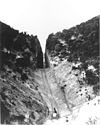
919 | St. Francis Dam Disaster Site | San Francisquito Canyon 34°32′49″N 118°30′45″W / 34.546944°N 118.5125°W | Santa Clarita (unincorporated) | |
 |
567 | St. Vincent's Place | St. Vincent Court 34°02′44″N 118°15′13″W / 34.0456844°N 118.253744°W | Los Angeles | |
 |
753 | San Fernando Cemetery | San Fernando Cemetery, Bledsoe & Foothill 34°19′15″N 118°26′53″W / 34.320833°N 118.448056°W | Sylmar | |
 |
975 | Santa Fe Trail Historical Park | 3675 Santa Anita Ave, El Monte, CA 34°04′28″N 118°02′31″W / 34.0744388888889°N 118.041825°W | El Monte | |
 |
1046 | Savannah Memorial Park | 9263 Valley Blvd. 34°04′52″N 118°04′04″W / 34.081158°N 118.067711°W | Rosemead | |
 |
522 | Serra Springs | University High School 34°02′42″N 118°27′29″W / 34.044925°N 118.458175°W | Los Angeles | |
 |
380 | Site of Home of Diego Sepúlveda | 700 block of Channel St. 33°45′14″N 118°17′33″W / 33.753830°N 118.292638°W | San Pedro | |
 |
789 | Site of the Los Angeles Star | Fletcher Bowron Square 34°03′16″N 118°14′28″W / 34.054437°N 118.24114°W | Los Angeles | |
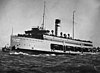 |
894 | SS Catalina | 33°44′55″N 118°16′29″W / 33.748626°N 118.274689°W | Ensenada, Baja California | It was scrapped in 2009. Also on the NRHP list as NPS-76000495. |
 |
934.01 | Temporary detention camp for Japanese Americans Pomona assembly center | 1101 W McKinley Ave 34°04′53″N 117°45′59″W / 34.081322°N 117.7664555°W | Pomona | |
 |
934.07 | Temporary detention camp for Japanese Americans Santa Anita assembly center | 285 W. Huntington 34°08′19″N 118°02′46″W / 34.138480555°N 118.04611944°W | Arcadia | |
 |
384 | Timm's Point and Landing | Sampson Way at Southern Pacific Slip 33°43′42″N 118°16′31″W / 33.72835°N 118.275317°W | San Pedro | |
 |
997 | Tuna Club of Avalon | 100 St. Catherine Way 33°21′18″N 118°19′53″W / 33.354967°N 118.3315°W | Avalon | |
 |
993 | Watts Towers | 1765 East 107th St. 33°56′20″N 118°14′30″W / 33.938808°N 118.241664°W | Los Angeles | Also on the NRHP list as NPS-77000297 |
 |
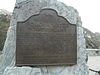
580 | Well, Alamitos #1 | Temple Ave. & Hill St. 33°47′50″N 118°09′32″W / 33.797222°N 118.158809°W | Signal Hill | Discovery well in the Signal Hill oil field, June 23, 1921. |
 |
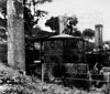
516 | Well, CSO 4 | W. Pico Canyon Rd. 34°22′10″N 118°37′49″W / 34.369444°N 118.630278°W | Stevenson Ranch | Also on the NRHP list as NPS-66000212 |
 |
658 | Western Hotel | 557 W. Lancaster Blvd. 34°41′54″N 118°08′20″W / 34.698283°N 118.139°W | Lancaster | |
 |
874 | Workman Home and Family Cemetery | 15415 E Don Julian Rd 34°01′12″N 117°57′51″W / 34.02°N 117.964166°W | City of Industry | |
Upload Photo |
1063 | Black Cat Tavern | 3909 Sunset Blvd 34°05′31″N 118°16′47″W / 34.092004°N 118.279809°W | Los Angeles |
See also edit
References edit
Wikimedia Commons has media related to California Historical Landmarks in Los Angeles County, California.
- ^ "California Historical Landmarks By County". Ohp.parks.ca.gov. Retrieved 2019-04-03.