


Summary
Callander Bay (French: baie Callander) is a bay at the extreme east of Lake Nipissing in the municipality of Callander, Parry Sound District, Ontario, Canada.[1][3][4][5][6] It is approximately four kilometres (2.5 mi) in diameter. The community of Callander is located on its east side.
| Callander Bay | |
|---|---|
| baie Callander | |
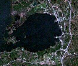 Satellite image of Callander Bay | |
 Callander Bay Location in southern Ontario  Callander Bay Location in Ontario | |
| Location | Parry Sound District, Ontario |
| Coordinates | 46°12′46″N 79°23′20″W / 46.21278°N 79.38889°W[1] |
| Part of | Lake Nipissing |
| Basin countries | Canada |
| Surface elevation | 196 m (643 ft)[2] |
| Settlements | Callander |

Geology edit
Callander Bay is an eroded Proterozoic volcanic pipe[7] formed by the violent, supersonic eruption of a deep-origin volcano. These volcanoes originate at least three times as deep as most other volcanoes, and the resulting magma that is pushed toward the surface is high in magnesium and volatile compounds such as water and carbon dioxide. As the body of magma rises toward the surface, the volatile compounds transform to gaseous phase as pressure is reduced with decreasing depth. This sudden expansion propels the magma upward at rapid speeds, resulting in a shallow supersonic eruption.
Callander Bay contains uncommon rocks such as nepheline syenite and carbonatite and the minerals: aegirine, amphibole, analcime, apatite, barite, biotite, calcite, cancrinite, chalcopyrite, chlorite, diopside, dolomite, fluorite, garnet, hematite, kaersutite, magnetite, muscovite, nepheline, olivine, perthite, pyrite, pyroxene and pyrrhotite.[8]
See also edit
References edit
- ^ a b "Callander Bay". Geographical Names Data Base. Natural Resources Canada. Retrieved 2021-02-13.
- ^ Inferred from Lake Nipissing. Retrieved 2021-02-13.
- ^ "Toporama (on-line map and search)". Atlas of Canada. Natural Resources Canada. Retrieved 2021-02-13.
- ^ "Ontario Geonames GIS (on-line map and search)". Ontario Ministry of Natural Resources and Forestry. 2014. Retrieved 2021-02-13.
- ^ Restructured municipalities - Ontario map #4 (Map). Restructuring Maps of Ontario. Ontario Ministry of Municipal Affairs and Housing. 2006. Archived from the original on 2014-04-10. Retrieved 2021-02-13.
- ^ Map 8 (PDF) (Map). 1 : 700,000. Official road map of Ontario. Ministry of Transportation of Ontario. 2020-01-01. Retrieved 2021-02-13.
- ^ "Background Geology of the North Bay area". Archived from the original on 2014-06-15. Retrieved 2007-09-24.
- ^ "Other localities - Canada". Retrieved 2007-09-28. Site information taken from Woolley, Alan R (1987). Alkaline rocks and carbonatites of the world. Part 1, North and South America. London: British Museum (Natural History). ISBN 978-0-565-00971-7. OCLC 220114352.