
KNOWPIA
WELCOME TO KNOWPIA

Cambiac 
Summary
Cambiac (French pronunciation: [kɑ̃bjak]) is a village and commune in the Haute-Garonne department in southwestern France. It is best known for the castle which dominates the village.
Cambiac | |
|---|---|
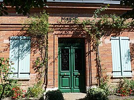 The town hall in Cambiac | |
Location of Cambiac .mw-parser-output .locmap .od{position:absolute}.mw-parser-output .locmap .id{position:absolute;line-height:0}.mw-parser-output .locmap .l0{font-size:0;position:absolute}.mw-parser-output .locmap .pv{line-height:110%;position:absolute;text-align:center}.mw-parser-output .locmap .pl{line-height:110%;position:absolute;top:-0.75em;text-align:right}.mw-parser-output .locmap .pr{line-height:110%;position:absolute;top:-0.75em;text-align:left}.mw-parser-output .locmap .pv>div{display:inline;padding:1px}.mw-parser-output .locmap .pl>div{display:inline;padding:1px;float:right}.mw-parser-output .locmap .pr>div{display:inline;padding:1px;float:left}html.skin-theme-clientpref-night .mw-parser-output .od,html.skin-theme-clientpref-night .mw-parser-output .od .pv>div,html.skin-theme-clientpref-night .mw-parser-output .od .pl>div,html.skin-theme-clientpref-night .mw-parser-output .od .pr>div{background:#000;color:#fff}html.skin-theme-clientpref-night .mw-parser-output .locmap{filter:grayscale(0.6)}@media(prefers-color-scheme:dark){html.skin-theme-clientpref-os .mw-parser-output .locmap{filter:grayscale(0.6)}html.skin-theme-clientpref-os .mw-parser-output .od,html.skin-theme-clientpref-os .mw-parser-output .od .pv>div,html.skin-theme-clientpref-os .mw-parser-output .od .pl>div,html.skin-theme-clientpref-os .mw-parser-output .od .pr>div{background:#000;color:#fff}}  Cambiac  Cambiac | |
| Coordinates: 43°29′23″N 1°47′35″E / 43.4897°N 1.7931°E | |
| Country | France |
| Region | Occitania |
| Department | Haute-Garonne |
| Arrondissement | Toulouse |
| Canton | Revel |
| Government | |
| • Mayor (2021–2026) | Sophie Adroit[1] |
| Area 1 | 7.74 km2 (2.99 sq mi) |
| Population (2021)[2] | 231 |
| • Density | 30/km2 (77/sq mi) |
| Time zone | UTC+01:00 (CET) |
| • Summer (DST) | UTC+02:00 (CEST) |
| INSEE/Postal code | 31102 /31460 |
| Elevation | 195–261 m (640–856 ft) (avg. 249 m or 817 ft) |
| 1 French Land Register data, which excludes lakes, ponds, glaciers > 1 km2 (0.386 sq mi or 247 acres) and river estuaries. | |
Geography edit
The commune is bordered by four other communes: Caraman to the northwest, Auriac-sur-Vendinelle to the northeast, Maurens to the southeast, and finally by Beauville to the southwest.
Population edit
| Year | Pop. | ±% |
|---|---|---|
| 1962 | 122 | — |
| 1968 | 139 | +13.9% |
| 1975 | 115 | −17.3% |
| 1982 | 149 | +29.6% |
| 1990 | 188 | +26.2% |
| 1999 | 170 | −9.6% |
| 2008 | 201 | +18.2% |
Sights edit
Originally a 15th-century castle, the privately-owned castle Château de Cambiac has been much altered and is listed as a historic site by the French Ministry of Culture in 2001.
See also edit
References edit
- ^ "Répertoire national des élus: les maires". data.gouv.fr, Plateforme ouverte des données publiques françaises (in French). 9 August 2021.
- ^ "Populations légales 2021". The National Institute of Statistics and Economic Studies. 28 December 2023.
Wikimedia Commons has media related to Cambiac.