


Summary
Camden Council is a local government area in the Macarthur region of Sydney, in the state of New South Wales, Australia. The area is located south west of the Sydney central business district and comprises 201 square kilometres (78 sq mi) with an estimated population at the 2021 census of 119,325. The mayor of Camden is Cr. Ashleigh Cagney, a member of the Labor Party.
| Camden Council New South Wales | |||||||||||||||
|---|---|---|---|---|---|---|---|---|---|---|---|---|---|---|---|
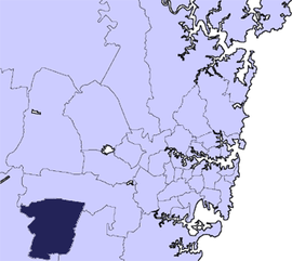 Location in Metropolitan Sydney | |||||||||||||||
 | |||||||||||||||
| Coordinates | 34°03′S 150°42′E / 34.050°S 150.700°E | ||||||||||||||
| Population | 119,325 (2021 census)[1] | ||||||||||||||
| • Density | 593.7/km2 (1,538/sq mi) | ||||||||||||||
| Established | 6 February 1889[2] | ||||||||||||||
| Area | 201 km2 (77.6 sq mi) | ||||||||||||||
| Mayor | Ashleigh Cagney (Labor) | ||||||||||||||
| Council seat | Oran Park | ||||||||||||||
| Region | Greater Western Sydney | ||||||||||||||
| State electorate(s) | Camden | ||||||||||||||
| Federal division(s) | |||||||||||||||
| Website | Camden Council | ||||||||||||||
| |||||||||||||||
Suburbs in the local government area edit
Suburbs serviced by Camden Council are:
Demographics edit
At the 2021 census there were 119,325 people in the Camden local government area, of these 49.1 per cent were male and 50.9 per cents were female. Aboriginal and Torres Strait Islander people made up 3.2 per cent of the population; similar to the NSW and Australian averages of 3.4 and 3.2 per cent respectively. The median age of people in the Camden Council area was 33 years, which is significantly lower than the national median of 38 years. Children aged 0 – 14 years made up 25.3 per cent of the population and people aged 65 years and over made up 9.9 per cent of the population. Of people in the area aged 15 years and over, 54.0 per cent were married and 10.9 per cent were either divorced or separated.[3]
Population growth in the Camden Council area between the 2001 census and the 2006 census was 13.35 per cent; in the subsequent five years to the 2011 census, population growth was 14.25 per cent. At the 2016 census, the population in the Camden local government area increased by 37.9 per cent. When compared with total population growth of Australia for the same period, being 8.8 per cent, population growth in Camden local government area was in excess of four times the national average.[4][5][6][3] The median weekly income for residents within the Camden Council area was generally slightly higher than the national average.[3]
At the 2021 census, the proportion of residents in the Camden local government area who stated their ancestry as Australian or Anglo-Saxon approached 70% of all residents. In excess of 58.0% of residents in the Camden Council area nominated a religious affiliation with Christianity at the 2021 census, compared with the national average of 43.9%; and the proportion of residents with no religion was about half the national average. Meanwhile, as at the 2021 census date, compared to the national average, households in the Camden local government area had a slighter higher proportion (22.5 per cent) where two or more languages are spoken (national average was 22.3 per cent); and had a similar proportion (74.0 per cent) where English only was spoken at home (national average was 72.0 per cent).[1]
| Selected historical census data for Camden local government area | |||||||
|---|---|---|---|---|---|---|---|
| Census year | 2001[4] | 2006[5] | 2011[6] | 2016[3] | 2021[1] | ||
| Population | Estimated residents on census night | 43,799 | |||||
| LGA rank in terms of size within New South Wales | 39th | ||||||
| % of New South Wales population | 0.82% | ||||||
| % of Australian population | 0.23% | ||||||
| Median weekly incomes | |||||||
| Personal income | Median weekly personal income | A$566 | A$690 | A$821 | A$984 | ||
| % of Australian median income | 121.5% | 119.6% | 124.0% | 122.2% | |||
| Family income | Median weekly family income | A$1,353 | A$1,865 | A$2,161 | A$2,487 | ||
| % of Australian median income | 131.7% | 125.9% | 124.6% | 117.3% | |||
| Household income | Median weekly household income | A$1,465 | A$1,727 | A$2,047 | A$2,353 | ||
| % of Australian median income | 125.1% | 140.0% | 142.4% | 134.8% | |||
| Selected historical census data for Camden local government area | |||||||||
|---|---|---|---|---|---|---|---|---|---|
| Ancestry, top responses | |||||||||
| 2001[4] | 2006[5] | 2011[6] | 2016[3] | 2021[1] | |||||
| No Data | No Data | Australian | 31.1% | Australian | Australian | ||||
| English | 27.2% | English | English | ||||||
| Irish | 7.2% | Irish | Irish | ||||||
| Scottish | 6.1% | Scottish | Italian | ||||||
| Italian | 4.6% | Italian | Scottish | ||||||
| Country of Birth, top responses | |||||||||
| 2001[4] | 2006[5] | 2011[6] | 2016[3] | 2021[1] | |||||
| Australia | 79.8% | Australia | Australia | Australia | Australia | ||||
| England | 4.9% | England | England | England | India | ||||
| New Zealand | 1.3% | New Zealand | New Zealand | New Zealand | England | ||||
| Italy | 0.9% | Italy | Italy | India | New Zealand | ||||
| Scotland | 0.9% | Scotland | Scotland | Philippines | Philippines | ||||
| China | 0.5% | China | China | Fiji | Iraq | ||||
| Language, top responses (other than English) | |||||||||
| 2001[4] | 2006[5] | 2011[6] | 2016[3] | 2021[1] | |||||
| Italian | 1.7% | Italian | Italian | Arabic | Arabic | ||||
| Spanish | 0.7% | Spanish | Spanish | Italian | Spanish | ||||
| Cantonese | 0.7% | Arabic | Arabic | Spanish | Hindi | ||||
| Arabic | 0.6% | Cantonese | Cantonese | Hindi | Punjabi | ||||
| Maltese | 0.5% | Croatian | 0.5% | Maltese | Mandarin | Italian | |||
| Religious affiliation, top responses | |||||||||
| 2001[4] | 2006[5] | 2011[6] | 2016[3] | 2021[1] | |||||
| Catholic | 33.5% | Catholic | Catholic | Catholic | Catholic | ||||
| Anglican | 30.9% | Anglican | Anglican | Anglican | No Religion | ||||
| No Religion | 9.6% | No Religion | No Religion | No Religion | Anglican | ||||
| United Church | 4.8% | United Church | United Church | Not Stated | Islam | ||||
| Presbyterian and Reformed |
3.0% | Presbyterian and Reformed |
Presbyterian and Reformed |
Uniting Church | Not Stated | ||||
Council edit
Current composition and election method edit
Camden Council is composed of nine councillors elected proportionally as three separate wards, each electing three councillors. All councillors are elected for a fixed four-year term of office. The mayor is elected by the councillors at the first meeting of the council. The most recent election was held on 4 December 2021, and the makeup of the council is as follows:[7][8][9]

| Party | Councillors | |
|---|---|---|
| Liberal Party | 4 | |
| Labor | 3 | |
| Independents | 2 | |
| Total | 9 | |
The current Council, elected in 2021, in order of election by ward, is:
| Ward | Councillor | Party | Notes | |
|---|---|---|---|---|
| Central Ward[7] | Therese Fedeli | Liberal | Deputy Mayor[10] | |
| Ashleigh Cagney | Labor | Mayor[10] | ||
| Peter McLean | Independent | |||
| North Ward[8] | Lara Symkowiak | Liberal | ||
| Cindy Cagney | Labor | |||
| Usha Dommaraju | Liberal | |||
| South Ward[9] | Eva Campbell | Independent | ||
| Paul Farrow | Labor | |||
| Russel Zammit | Liberal | |||
2021 election results edit
| Party | Votes | % | Swing | Seats | Change | ||
|---|---|---|---|---|---|---|---|
| Liberal | 27,148 | 44.0 | +12.0 | 4 | |||
| Labor | 20,351 | 33.0 | +8.0 | 4 | |||
| Independent | 13,913 | 22.5 | −20.5 | 2 | |||
| Shooters, Fishers and Farmers | 314 | 0.5 | +0.5 | 0 | |||
| Formal votes | 61,726 | 94.58 | |||||
| Informal votes | 3,537 | 5.42 | |||||
| Total | 65,263 | 100.0 | |||||
Mayors from 1896 to Present edit
| # | Mayor | Term start | Term end | Time in office | Notes |
|---|---|---|---|---|---|
| Prior to 1896 requires further research | |||||
| − | James Rankin | 23 October 1895 | 4 May 1896 (res) | 194 days | [12] |
| − | W.C. Furner | 4 May 1896 | 14 February 1899 | 2 years, 286 days | [13] |
| − | George Furner | 14 February 1899 | 13 February 1901 | 1 year, 364 days | [14] |
| − | E.F. Druitt | 13 February 1901 | 12 February 1902 | 364 days | [15] |
| − | George Macarthur Onslow | 12 February 1902 | 10 February 1904 | 1 year, 363 days | [16] |
| − | A.D. Little | 10 February 1904 | 12 February 1906 | 2 years, 2 days | [17] |
| − | George Macarthur Onslow | 12 February 1906 | 1 March 1907 | 1 year, 17 days | [18] |
| − | George Furner | 1 March 1907 | 1 March 1909 | 2 years, 0 days | [19] |
| − | George Macarthur Onslow | 1 March 1909 | 1 March 1910 | 1 year, 0 days | [20] |
| − | George Furner | 1 March 1910 | 7 February 1911 (res)[a] | 343 days | [21] |
| − | George Furner (acting) | 7 February 1911 | 1 March 1911 | 22 days | [22] |
| − | Thomas Sheil | 1 March 1911 | 1 March 1913 | 2 years, 0 days | [23] |
| − | R.E. Young | 1 March 1913 | 19 January 1915 (ret)[b] | 1 year, 324 days | [24] |
| − | George Furner | 19 January 1915 | 10 July 1917 | 2 years, 172 days | [25] |
| − | W.F. Peters | 10 July 1917 | 1 March 1918 | 234 days | [26] |
| − | George Furner | 1 March 1918 | 15 December 1925 | 7 years, 289 days | [27] |
| − | Francis Macarthur Onslow | 15 December 1925 | 11 December 1928 | 2 years, 362 days | [28] |
| − | William Larkin | 11 December 1928 | 12 December 1932 | 4 years, 1 day | [29] |
| − | Robert Crookston | 12 December 1932 | 11 December 1933 | 364 days | [30] |
| − | William Larkin | 11 December 1933 | 19 December 1938 | 5 years, 8 days | [31] |
| − | Horace (Stan) Kelloway | 19 December 1938 | 14 December 1954 | 15 years, 360 days | [32][33][34] |
| − | William Cruikshank | 14 December 1954 | Unknown | 1 year, 0 days | [35] |
| 1955 - 1985 requires further research | |||||
| − | Elizabeth (Liz) Kernohan | 1985 | 1991 | 6 years, 0 days | * |
| − | Theresa Testoni | 1991 | 27 September 1993 | 2 years, 26 days | * |
| – | Frank Brooking | 27 September 1993 | 1997 | 3 years, 339 days | * |
| – | Geoff Corrigan | 1998 | 1999 | 1 year, 0 days | * |
| – | Eva Campbell | 1999 | 2001 | 2 years, 0 days | * |
| – | Geoff Corrigan | 2001 | 2003 | 2 years, 0 days | * |
| - | Unknown | Approx 2003 | September 2006 | 3 years, 0 days | * |
| 30 | Chris Patterson | September 2006 | 14 June 2011 | 4 years, 286 days | * |
| *Above requires further research | |||||
| 31 | Greg Warren | 14 June 2011 | 9 October 2012 | 1 year, 12 days | [36] |
| 32 | Lara Symkowiak | 9 October 2012 | 11 September 2018 | 5 years, 337 days | [37] |
| 33 | Peter Sidgreaves | 11 September 2018 | 23 April 2019 | 224 days | [38] |
| 34 | Therese Fedeli | 23 April 2019 | 9 May 2023 | 4 years, 16 days | [39] |
| 35 | Ashleigh Cagney | 9 May 2023 | Present | 349 days | |
Development edit
In Camden Council area there were 2,168 residential buildings approved to be built in the financial year 2021–22.[40] Being a significant part of the South-Western Sydney Growth Area, Camden Council represents a rapidly growing region which is expected[by whom?] to house a large portion of Sydney's population growth over the coming decade. To the north are residential developments including Oran Park (8,000 homes)[41] and Gregory Hills (2,600 homes),[42] whilst to the south are further developments of the Elderslie estate.
A Muslim group, the Quranic Society, made a development application in the Camden area for an A$19 million Muslim school with the capacity for 1,200 students. In May 2008 the Council voted unanimously to reject the application. After reducing its proposal to a school catering for 900 students, the Quranic Society took its case to the Land and Environment Court. The application was met with significant community protest;[43] and the application rejected by the Court on the grounds that the land chosen was suited to rural uses.[44][45]
Heritage listings edit
The Camden Council has a number of heritage sites, including:
- Camden, 135 Argyle Street: Camden Post Office[46]
- Camden, Aerodrome Road, Cobbitty: Macquarie Grove[47]
- Camden, Exeter Street: Nant Gwylan and Garden[48]
- Camden South, Elizabeth Macarthur Avenue: Camden Park Estate and Belgenny Farm[49]
- Catherine Field, 1025 Camden Valley Way: Raby, Catherine Field[50]
- Cobbitty, 421 The Northern Road: Denbigh, Cobbitty[51]
- Gledswood Hills, 900 Camden Valley Way: Gledswood[52]
- Harrington Park, 1 Hickson Circuit: Harrington Park (homestead)[53]
- Harrington Park, 181 – 183 Northern Road: Orielton[54]
- Narellan, Camden Valley Way: Studley Park, Narellan[55]
- Narellan, Kirkham Lane: Camelot, Kirkham[56]
- Narellan, Kirkham Lane: Kirkham Stables[57]
- Oran Park, 112-130 Oran Park Drive: Oran Park (homestead)[58]
See also edit
References edit
- ^ a b c d e f g Australian Bureau of Statistics (28 June 2022). "Camden (A)". 2021 Census QuickStats. Retrieved 9 October 2022.
- ^ "Government Gazette Proclamations and Legislation – New South Wales Government Gazette (Sydney, NSW : 1832 – 1900) – 6 Feb 1889". nla.gov.au. Retrieved 3 March 2017.
- ^ a b c d e f g h Australian Bureau of Statistics (27 June 2017). "Camden (A)". 2016 Census QuickStats. Retrieved 20 November 2012.
- ^ a b c d e f Australian Bureau of Statistics (9 March 2006). "Camden (A)". 2001 Census QuickStats. Retrieved 18 November 2012.
- ^ a b c d e f Australian Bureau of Statistics (25 October 2007). "Camden (A)". 2006 Census QuickStats. Retrieved 18 November 2012.
- ^ a b c d e f Australian Bureau of Statistics (31 October 2012). "Camden (A)". 2011 Census QuickStats. Retrieved 18 November 2012.
- ^ a b "Camden Council – Central Ward". Local Government Elections 2016. Electoral Commission of New South Wales. 19 September 2016. Archived from the original on 19 October 2016. Retrieved 19 October 2016.
- ^ a b "Camden Council – North Ward". Local Government Elections 2016. Electoral Commission of New South Wales. 19 September 2016. Archived from the original on 19 October 2016. Retrieved 19 October 2016.
- ^ a b "Camden Council – South Ward". Local Government Elections 2016. Electoral Commission of New South Wales. 19 September 2016. Archived from the original on 19 October 2016. Retrieved 19 October 2016.
- ^ a b "Councillors".
- ^ "Camden". ABC News.
- ^ Trove (24 October 1895). "Municipal District of Camden". Retrieved 21 September 2020.
- ^ Trove (7 May 1896). "Camden Municipal Council". Retrieved 19 September 2020.
- ^ Trove (16 February 1899). "Election of Mayor". Retrieved 19 September 2020.
- ^ Trove (21 February 1901). "Camden Municipal Council". Retrieved 19 September 2020.
- ^ Trove (13 February 1902). "Camden Municipal Council". Retrieved 19 September 2020.
- ^ Trove (18 February 1904). "Camden Municipal Council". Retrieved 19 September 2020.
- ^ Trove (15 February 1906). "Camden Municipal Council". Retrieved 19 September 2020.
- ^ Trove (14 February 1907). "Mayoral Election". Retrieved 19 September 2020.
- ^ Trove (4 March 1909). "Camden Municipal Council". Retrieved 19 September 2020.
- ^ Trove (10 February 1910). "Camden Council". Retrieved 19 September 2020.
- ^ Trove (9 February 1911). "Camden Municipal Council: The Mayor's Seat Challenged". Retrieved 19 September 2020.
- ^ Trove (2 March 1911). "Camden Municipal Council". Retrieved 19 September 2020.
- ^ Trove (28 January 1915). "Municipality of Camden". Retrieved 19 September 2020.
- ^ Trove (11 February 1915). "Municipality of Camden". Retrieved 19 September 2020.
- ^ Trove (12 July 1917). "Camden Municipal Council". Retrieved 19 September 2020.
- ^ Trove (14 February 1918). "Ald. G.F. Furner, Mayor of Camden". Retrieved 19 September 2020.
- ^ Trove (17 December 1925). "Camden Council". Retrieved 19 September 2020.
- ^ Trove (13 December 1928). "Camden Council". Retrieved 19 September 2020.
- ^ Trove (15 December 1932). "Camden Council". Retrieved 19 September 2020.
- ^ Trove (14 December 1933). "Ald. W. Larkin elected mayor of Camden". Retrieved 19 September 2020.
- ^ Trove (23 December 1948). "Ald. H.S. Kelloway elected mayor of the united area of Camden". Retrieved 19 September 2020.
- ^ Trove (14 December 1944). "Ald. H.S. Kelloway mayor of Camden". Retrieved 19 September 2020.
- ^ Trove (18 December 1952). "Ald. H.S. Kelloway re-elected mayor". Retrieved 19 September 2020.
- ^ Trove (17 December 1953). "New mayor for Camden". Retrieved 19 September 2020.
- ^ Camden Council (27 September 2011). "Minutes of the Ordinary Council Meeting held on 27 September 2011" (PDF). Retrieved 16 September 2020.
- ^ Armstrong, Kerry (16 October 2012). "New mayor will lobby for us". Camden Advertiser. Retrieved 16 September 2020.
- ^ Tullis, Ashleigh (13 September 2018). "New Camden mayor Peter Sidgreaves to focus on jobs". Camden Advertiser. Retrieved 16 September 2020.
- ^ Osborne, Kayla (23 April 2019). "Camden's new mayor has been chosen". Camden Advertiser. Retrieved 16 September 2020.
- ^ "Camden Council Area Residential Building Approvals". profileID. 30 June 2022. Retrieved 9 October 2022.
- ^ "Oran Park Town Official Website". Archived from the original on 15 October 2009.
- ^ "Gregory Hills Official Website". Archived from the original on 11 February 2010.
- ^ Murray, Elicia (22 April 2009). "Churches oppose Islamic school". The Sydney Morning Herald. Retrieved 13 July 2017.
- ^ "Court rejects Sydney Islamic school". ABC News. Australia. 2 June 2009. Retrieved 13 July 2017.
- ^ "Quranic Society seeks land sale". Camden-Narellan Advertiser. 13 March 2012. Retrieved 13 July 2017.
- ^ "Camden Post Office (Place ID 106176)". Australian Heritage Database. Australian Government. Retrieved 22 September 2018.
- ^ "Macquarie Grove". New South Wales State Heritage Register. Department of Planning & Environment. H00493. Retrieved 18 May 2018.
 Text is licensed by State of New South Wales (Department of Planning and Environment) under CC-BY 4.0 licence.
- ^ "Nant Gwylan and Garden". New South Wales State Heritage Register. Department of Planning & Environment. H00243. Retrieved 18 May 2018. Text is licensed by State of New South Wales (Department of Planning and Environment) under CC-BY 4.0 licence.
- ^ "Camden Park Estate and Belgenny Farm". New South Wales State Heritage Register. Department of Planning & Environment. H01697. Retrieved 18 May 2018. Text is licensed by State of New South Wales (Department of Planning and Environment) under CC-BY 4.0 licence.
- ^ "Raby". New South Wales State Heritage Register. Department of Planning & Environment. H01694. Retrieved 18 May 2018. Text is licensed by State of New South Wales (Department of Planning and Environment) under CC-BY 4.0 licence.
- ^ "Denbigh". New South Wales State Heritage Register. Department of Planning & Environment. H01691. Retrieved 18 May 2018. Text is licensed by State of New South Wales (Department of Planning and Environment) under CC-BY 4.0 licence.
- ^ "Gledswood". New South Wales State Heritage Register. Department of Planning & Environment. H01692. Retrieved 18 May 2018. Text is licensed by State of New South Wales (Department of Planning and Environment) under CC-BY 4.0 licence.
- ^ "Harrington Park". New South Wales State Heritage Register. Department of Planning & Environment. H01773. Retrieved 18 May 2018. Text is licensed by State of New South Wales (Department of Planning and Environment) under CC-BY 4.0 licence.
- ^ "Orielton". New South Wales State Heritage Register. Department of Planning & Environment. H01693. Retrieved 18 May 2018. Text is licensed by State of New South Wales (Department of Planning and Environment) under CC-BY 4.0 licence.
- ^ "Studley Park". New South Wales State Heritage Register. Department of Planning & Environment. H00389. Retrieved 18 May 2018. Text is licensed by State of New South Wales (Department of Planning and Environment) under CC-BY 4.0 licence.
- ^ "Camelot". New South Wales State Heritage Register. Department of Planning & Environment. H00385. Retrieved 18 May 2018. Text is licensed by State of New South Wales (Department of Planning and Environment) under CC-BY 4.0 licence.
- ^ "Kirkham Stables and Precinct". New South Wales State Heritage Register. Department of Planning & Environment. H01411. Retrieved 18 May 2018. Text is licensed by State of New South Wales (Department of Planning and Environment) under CC-BY 4.0 licence.
- ^ "Oran Park". New South Wales State Heritage Register. Department of Planning & Environment. H01695. Retrieved 18 May 2018. Text is licensed by State of New South Wales (Department of Planning and Environment) under CC-BY 4.0 licence.
External links edit
- Camden Council website