


Summary
Cape Carbonara (Italian: Capo Carbonara, Sardinian: Cabo Crabonaxa) is a promontory on the southeastern tip of Sardinia, Italy, which forms the eastern end of the Gulf of Cagliari. Together with the nearby Cavoli Island and Serpentara Island, it is included in the Italian National Marine Park of Capo Carbonara (Italian: Area Marina Protetta).
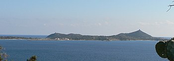
It is situated within the communal territory of Villasimius, c. 6 km from the town's center. The promontory has a length of some 3.5 km and a maximum width of 1.8 km.
Sights include the remains of a fortress on the western side, and the beaches Punta Molentis, Is Traias and Porto Giunco, as well as the Stagno di Notteri with a colony of pink flamingos along the Tyrrhenian Sea on the eastern side.
The promontory also has a lighthouse, run by the Italian Air Force.
Climate edit
The Climate is warm and semi-arid, classified as BSh in Köppen climate classification, with low precipitation throughout the year.
| Climate data for Capo Carbonara (1991-2020 normals and extremes) [i] | |||||||||||||
|---|---|---|---|---|---|---|---|---|---|---|---|---|---|
| Month | Jan | Feb | Mar | Apr | May | Jun | Jul | Aug | Sep | Oct | Nov | Dec | Year |
| Record high °C (°F) | 21.2 (70.2) |
23.2 (73.8) |
25.2 (77.4) |
27.0 (80.6) |
32.8 (91.0) |
35.6 (96.1) |
37.6 (99.7) |
39.0 (102.2) |
34.2 (93.6) |
30.4 (86.7) |
26.8 (80.2) |
23.0 (73.4) |
39.0 (102.2) |
| Mean daily maximum °C (°F) | 14.9 (58.8) |
15.1 (59.2) |
16.7 (62.1) |
18.8 (65.8) |
22.4 (72.3) |
27.1 (80.8) |
30.4 (86.7) |
31.3 (88.3) |
27.8 (82.0) |
24.2 (75.6) |
19.4 (66.9) |
16.0 (60.8) |
22.0 (71.6) |
| Daily mean °C (°F) | 12.3 (54.1) |
12.2 (54.0) |
13.7 (56.7) |
15.5 (59.9) |
19.0 (66.2) |
23.4 (74.1) |
26.6 (79.9) |
27.5 (81.5) |
24.3 (75.7) |
21.1 (70.0) |
16.8 (62.2) |
13.5 (56.3) |
18.8 (65.9) |
| Mean daily minimum °C (°F) | 9.9 (49.8) |
9.5 (49.1) |
10.8 (51.4) |
12.6 (54.7) |
15.9 (60.6) |
19.9 (67.8) |
22.9 (73.2) |
23.9 (75.0) |
21.0 (69.8) |
18.1 (64.6) |
14.2 (57.6) |
11.1 (52.0) |
15.8 (60.5) |
| Average precipitation mm (inches) | 24.5 (0.96) |
20.4 (0.80) |
25.6 (1.01) |
27.6 (1.09) |
20.7 (0.81) |
4.5 (0.18) |
2.8 (0.11) |
7.8 (0.31) |
30.9 (1.22) |
33.1 (1.30) |
48.6 (1.91) |
32.5 (1.28) |
279 (10.98) |
| Average precipitation days (≥ 1.0 mm) | 4.75 | 4.79 | 4 | 4.48 | 3 | 1.2 | 0.4 | 1.07 | 3.53 | 4.14 | 6.03 | 5.89 | 43.28 |
| Average relative humidity (%) | 76.4 | 75.2 | 75.3 | 73.2 | 71.0 | 69.1 | 67.9 | 69.0 | 71.2 | 73.2 | 75.6 | 75.5 | 72.7 |
| Average dew point °C (°F) | 8.2 (46.8) |
7.6 (45.7) |
8.9 (48.0) |
10.4 (50.7) |
13.5 (56.3) |
17.4 (63.3) |
18.9 (66.0) |
20.9 (69.6) |
17.9 (64.2) |
17.8 (64.0) |
12.5 (54.5) |
8.8 (47.8) |
13.6 (56.4) |
| Source: NOAA,[1] (Dew Point 1981-2010)[2] | |||||||||||||
References edit
- ^ Dew Point temperatures are for the 1981-2010 period
- ^ "World Meteorological Organization Climate Normals for 1991-2020: Capo Carbonara-16564" (CSV). ncei.noaa.gov. NOAA. Retrieved 28 February 2024.
{{cite web}}: CS1 maint: postscript (link) - ^ "WMO Climate Normals for 1981-2010: Capo Carbonara". ncei.noaa.gov. NOAA. Retrieved 28 February 2024.
Parameter Code: 39 Dew Point Temperature
External links edit
- Capo Carbonara Protected Area official website (in Italian)
 Media related to Capo Carbonara at Wikimedia Commons
39°6′18″N 9°30′53″E / 39.10500°N 9.51472°E