
KNOWPIA
WELCOME TO KNOWPIA

Cape Cruz 
Summary
Cape Cruz, (Spanish: Cabo Cruz), is a cape that forms the western extremity of the Granma Province in southern Cuba. It extends into the Caribbean sea and marks the eastern border of the Gulf of Guacanayabo.[1] Cape Cruz is located in the municipality of Niquero and is part of the Desembarco del Granma National Park.
Cabo Cruz | |
|---|---|
 | |
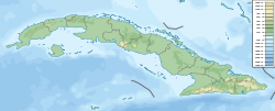 Cabo Cruz Location of Cape Cruz in Cuba | |
| Coordinates: 19°50′30.58″N 77°43′40.28″W / 19.8418278°N 77.7278556°W | |
| Offshore water bodies | Caribbean Sea |
Architecture edit
The southernmost tip of Cape Cruz is marked by Faro Vargas, a nineteenth-century lighthouse with a height of 32 metres (105 ft).
Transport edit
The cape is the endpoint of the Niquero branch of the "Circuito Sur de Oriente" (CSO) highway.
Notes edit
- ^ Hernández 2001
References edit
- Hernández Sabourín, Elsa Lázara; Sergio Alfredo Torres Zamora; Herlinda F. Remón Castillo (2001). "Biodiversidad de la Reserva Natural de Cabo Cruz (provincia de Granma), Cuba". Cuadernos de biodiversidad (Nº. 7). Centro Iberoamericano de la Biodiversidad: 11–13. ISSN 1575-5495.