
KNOWPIA
WELCOME TO KNOWPIA

Capitale-Nationale 
Summary
Capitale-Nationale (French pronunciation: [kapital nɑsjɔnal]; English: National Capital region) is one of the 17 administrative regions of Quebec. It is anchored by the provincial capital, Quebec City, and is largely coextensive with that city's metropolitan area. It has a land area of 18,797.45 km2. It reported a total resident population of 729,997 as of the Canada 2016 Census,[1] with Quebec City having 73.7 percent of the total.
Capitale-Nationale | |
|---|---|
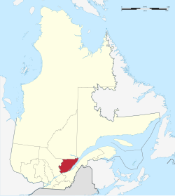 | |
| Coordinates: 47°20′N 71°30′W / 47.333°N 71.500°W | |
| Country | Canada |
| Province | Quebec |
| Regional County Municipalities (RCM) and Equivalent Territories (ET) | |
| Government | |
| • Forum des élus de la région de la Capitale-Nationale (Regional conference of elected officers) | Jean Fortin (President) |
| Area | |
| • Land | 18,797.45 km2 (7,257.74 sq mi) |
| Population | |
| • Total | 729,997 |
| • Density | 38.8/km2 (100/sq mi) |
| Time zone | UTC-5 (EST) |
| • Summer (DST) | UTC-4 (EDT) |
| Postal code | |
| Area code | 418, 581 |
| Website | www |
Prior to January 2000, it was known as the Québec administrative region.[2]
Administrative divisions edit
Regional county municipalities edit
| Regional County Municipality (RCM) | Population 2016 Canadian Census[3] |
Land Area | Density (pop. per km2) |
Seat of RCM |
|---|---|---|---|---|
| Charlevoix | 12,997 | 3,763.22 km2 (1,452.99 sq mi) | 3.5 | Baie-Saint-Paul |
| Charlevoix-Est | 15,509 | 2,307.23 km2 (890.83 sq mi) | 6.7 | Clermont |
| La Côte-de-Beaupré | 28,199 | 4,865.97 km2 (1,878.76 sq mi) | 5.8 | Château-Richer |
| L'Île-d'Orléans | 7,082 | 192.85 km2 (74.46 sq mi) | 36.7 | Sainte-Famille-de-l'Île-d'Orléans |
| La Jacques-Cartier | 43,485 | 3,195.75 km2 (1,233.89 sq mi) | 13.6 | Shannon |
| Portneuf | 53,008 | 3,923.70 km2 (1,514.95 sq mi) | 13.5 | Cap-Santé |
Equivalent territory edit
| Territory Equivalent to a RCM (TE) | Population Canada 2016 Census[3] |
Land Area | Density (pop. per km2) |
Seat of RCM |
|---|---|---|---|---|
| Agglomeration of Quebec City | 551,508 | 547.49 km2 (211.39 sq mi) | 1,007.3 | Quebec City |
Independent parish municipality edit
Native People's Reserve edit
Major communities edit
School Districts edit
25 Districts Francophones manage by 5 school service centres :
- 5 of Commission scolaire de Charlevoix (Charlevoix and Charlevoix-Est).[4]
- 5 of Commission scolaire des Découvreurs
- 5 of Commission scolaire de la Capitale
- 5 of Commission scolaire de Portneuf
- 5 of Commission scolaire des Premières-Seigneuries
District Anglophone:
See also edit
References edit
- ^ a b c "Census Profile, 2016 Census: Capitale-Nationale [Economic region], Quebec". Statistics Canada. 8 February 2017. Retrieved November 22, 2019.
- ^ "Modification aux municipalités du Québec, 2000" (PDF). Plan Stratégique. Institut de la statistique du Québec. ISSN 0843-8250. Archived from the original (PDF) on 2004-05-09.
- ^ a b "Population and Dwelling Count Highlight Tables, 2016 Census". Statistics Canada. 8 February 2017. Retrieved November 26, 2019.
- ^ "Gouvernance scolaire".
- Commission de toponymie - Topos sur le Web - Listing for Capitale-Nationale
External links edit
Wikimedia Commons has media related to Capitale-Nationale.
- Portail régional de la Capitale-Nationale Official website
- CRÉ