


Summary
Celaya National Airport (Spanish: Aeropuerto Nacional de Celaya); officially Aeropuerto Nacional Capitán Rogelio Castillo (Capitán Rogelio Castillo National Airport) (IATA: CYW, ICAO: MMCY) is a small airport located in Celaya, Guanajuato, Mexico. It handles domestic air traffic and supports flight training and general aviation activities. The airport does not provide scheduled passenger public services. The nearest airport that serves commercial flights is León/Bajío International Airport. It is operated by Patronato del Aeropuerto de Celaya.[1]
Celaya National Airport Aeropuerto Nacional de Celaya | |||||||||||
|---|---|---|---|---|---|---|---|---|---|---|---|
 | |||||||||||
| Summary | |||||||||||
| Airport type | Public | ||||||||||
| Operator | Patronato del Aeropuerto de Celaya | ||||||||||
| Serves | Celaya, Guanajuato, Mexico | ||||||||||
| Time zone | CST (UTC−06:00) | ||||||||||
| Elevation AMSL | 5,709 ft / 1,740 m | ||||||||||
| Coordinates | 20°32′45″N 100°53′11″W / 20.54583°N 100.88639°W | ||||||||||
| Map | |||||||||||
 CYW Location of airport in Guanajuato 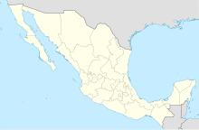 CYW CYW (Mexico) | |||||||||||
| Runways | |||||||||||
| |||||||||||
| Statistics (2021) | |||||||||||
| |||||||||||
Situated at an elevation of 1,740 metres (5,710 ft) above mean sea level, it features a single asphalt runway, designated as 08/26, measuring 1,915 by 30 metres (6,283 by 98 ft). Adjacent facilities include civil aviation hangars, an apron with parking positions for aircraft, and a small terminal building.
Over time, the airfield has had sporadic service from charter and regional airlines, providing seasonal flights within Mexico. Between 1993 and 1995, Aero Sudpacífico, a regional airline, conducted commercial flights to Monterrey, Morelia, Uruapan, Querétaro, and Ixtapa-Zihuatanejo. In the period from 2007 to 2008, Aeromar operated routes from Celaya to Querétaro, Monterrey, and Mexico City. Global Air, a charter company, currently utilizes a maintenance hangar for its Boeing 737-200 aircraft at this airport.[3]

See also edit
References edit
External links edit
- Celaya Airport information at Great Circle Mapper
- Aeronautical chart and airport information for MMCY at SkyVector
- Current weather for MMCY at NOAA/NWS
- Accident history for CYW at Aviation Safety Network