
KNOWPIA
WELCOME TO KNOWPIA

Car Nicobar Subdivision 
Summary
Car Nicobar Tehsil (Pu in the local language) is one of three local administrative divisions of the Indian district of Nicobar, part of the Indian union territory of Andaman and Nicobar Islands.[3] It is a subdivision and also a tehsil, roughly equivalent to a county in its range of administrative powers. It is located in the Northern Nicobar Islands.
Native name: Pu | |
|---|---|
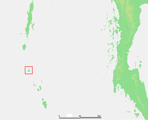
 Car Nicobar Location of Car Nicobar Island in India | |
| Geography | |
| Location | Bay of Bengal |
| Coordinates | 9°10′N 92°47′E / 9.17°N 92.78°E |
| Archipelago | Nicobar Islands |
| Adjacent to | Indian Ocean |
| Total islands | 1 |
| Major islands |
|
| Area | 128.48 km2 (49.61 sq mi)[1] |
| Length | 15 km (9.3 mi) |
| Width | 12 km (7.5 mi) |
| Coastline | 51 km (31.7 mi) |
| Highest elevation | 10 m (30 ft) |
| Administration | |
| District | Nicobar |
| Island group | Nicobar Islands |
| Subdivisions of India | Car Nicobar Subdivision |
| Taluk | Car Nicobar Taluk |
| Largest settlement | Malacca (pop. 4200) |
| Demographics | |
| Population | 17841 (2014) |
| Pop. density | 138.86/km2 (359.65/sq mi) |
| Ethnic groups | Hindu, Nicobarese |
| Additional information | |
| Time zone | |
| PIN | 744301 |
| Telephone code | 03192 |
| ISO code | IN-AN-00[2] |
| Official website | www |
| Literacy | 84.4% |
| Avg. summer temperature | 30.2 °C (86.4 °F) |
| Avg. winter temperature | 23.0 °C (73.4 °F) |
| Sex ratio | 1.2♂/♀ |
| Census Code | 35.638.0001 |
| Official Languages | Hindi, English, Tamil Car (regional) |
Administration edit
Politically, The Tehsil includes the islands of Car Nicobar, along neighboring Battimalv Island.
Image gallery edit
-
 Location of Car Nicobar island

See also edit
References edit
- ^ "Islandwise Area and Population - 2011 Census" (PDF). Government of Andaman. Archived from the original (PDF) on 28 August 2017. Retrieved 3 May 2016.
- ^ Registration Plate Numbers added to ISO Code
- ^ "Village Code Directory: Andaman & Nicobar Islands" (PDF). Census of India. Retrieved 16 January 2011.
 Andaman and Nicobar Islands travel guide from Wikivoyage