


Summary
The barony of Castleknock (Irish: Caisleán Cnucha meaning "Cnucha's Castle")[1][l 1] is one of the baronies of Ireland. Originally part of the Lordship of Meath, it was then constituted as part of County Dublin. Today, it is in the modern county of Fingal, Ireland. The barony was originally also a feudal title, which became one of the subsidiary titles of the Viscounts Gormanston.
History edit
The barony was created by Hugh de Lacy, Lord of Meath, as his own feudal barony, to be held directly from himself in capite (his vassals were commonly called "De Lacy's Barons").[2] The first vassal was Hugh Tyrrel in 1177. It was held for three and a half knight's fees, owed to the superior Lord of Fingal. The title and lands of Castleknock were held by the Tyrell family until 1370 when Robert Tyrell, the eighth Baron and his wife died of the plague, leaving two daughters and co-heiresses, Joan and Matilda. The lands later passed to the Viscount Gormanston.
Location edit
At the heart of the barony is the civil parish of the same name - Castleknock - which is one of eight civil parishes in the barony. In the townland of Castleknock itself is the location of the eponymous "Cnucha's Castle" - Castleknock Castle. The town with the biggest population in the barony is Blanchardstown. It is one of seven and a half baronies that used to comprise the old county of Dublin.[3] It stretches from Cabra to Blanchardstown (from east to west) and from Finglas to Chapelizod (from north to south).
The Castleknock barony is located between the baronies of Coolock to the east, Nethercross to the north and Dublin to the southeast. The River Liffey separates it from the remaining baronies of County Dublin. With the exception of the parish of Chapelizod, the remainder of the barony is contained within the modern county of Fingal and it is subject to Fingal County Council.
Legal context edit
Baronies were created after the Norman invasion of Ireland as subdivisions of counties and were used for administration. At the time of its creation, Castleknock was part of the Lordship of Meath. While baronies continue to be officially defined units, they are no longer used for many administrative purposes. While they have been administratively obsolete since 1898, they continue to be used in land registration, and specifications such as in planning permissions. In many cases, a barony corresponds to an earlier Gaelic túath which had submitted to the Crown. This is probably true in the case of Castleknock.
Civil parishes edit
Civil parish of Castleknock edit
What is now the parish of Castleknock was granted to Hugh Tyrrel by Hugh de Lacy, Lord of Meath. Copies of the grant were discovered in the London Public Records Office in 1933 by Eric St. John Brooks.[4] In English, the grant reads:
Henry, by the grace of God, King of England, Lord of Ireland, Duke of Aquitaine and Normandy and Count of Anjou to the Archbishops, Bishops, Ministers and all Earls, Barons, Justices, Sheriffs, Ministers and all his faithful French, English and Irish, greeting. Know that I have conceded, given, and by present Charter confirmed to Hugh Tirel, the man of Hugh de Lacy, Thwothyn and Thwothrom.[5]
Brooks deduces that "Thwo" is an Anglicisation of the Gaelic word túath and that "throm" is an Anglicisation of the word droma which means ridge or hill - a possible reference to the hill of Castleknock where Tyrrell was to build his castle.[citation needed]
Townlands in the civil parish of Castleknock:[l 2]
| Townland | Acres | Image Description | Image |
|---|---|---|---|
| Abbotstown Baile an Aba [6 1] |
101 | Abbotstown cemetery | 
|
| Annfield Gort Anna [6 2] |
351 | Apartment buildings in Annfield |

|
| Ashtown Baile an Ásaigh [6 3] |
285 | Moorings on the Royal Canal | 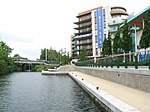
|
| Astagob Steach Gob [6 4] |
76 | The Wren's Nest pub | 
|
| Blanchardstown Baile Bhlainséir [6 5] |
351 | Village crossroads in 2020 |

|
| Cabragh An Chabrach [6 6] |
351 | Primary Care Centre on the Navan Road |

|
| Carpenterstown Baile an Chairpintéaraigh [6 7] |
166 | Stone placename on the Carpeterstown Road |

|
| Cappoge or Cappagh Ceapach [6 8] |
698 | Halting site | 
|
| Castleknock Caisleán Cnucha [6 9] |
1020 | St Bridget's Church of Ireland |

|
| Castleknock (incl. part of Phoenix Park) Caisleán Cnucha (cuid de Pháirc an Fhionnuisce) [6 10] |
787 | Dawn, Mountjoy Cross towards Castleknock gate |

|
| Corduff An Chorr Dhubh [6 11] |
353 | A "fairy fort" in the townland |

|
| Deanestown Baile an Déanaigh [6 12] |
173 | Entrance to Waterville Park |

|
| Diswellstown Baile an Diosualaigh [6 13] |
418 | Diswellstown stream in the south-eastern corner of the townland |

|
| Dunsink Dún Sinche [6 14] |
351 | Dunsink observatory | 
|
| Huntstown * Baile an Huntaigh [6 15] |
299 | ||
| Johnstown Baile Sheáin [6 16] |
67 | ||
| Mitchelstown Baile Mhistéil [6 17] |
154 | Car showroom at Mitchelstown Road |

|
| Pelletstown Baile Pheiléid [6 18] |
259 | Sculpture of "The Lock Keeper" Rathborne village, 10th lock Royal Canal |

|
| Porterstown Baile an Phóirtéaraigh [6 19] |
219 | Porterstown Park in lockdown - Apr 2020 |

|
| Scribblestown Baile Scriobail [6 20] |
272 | Candlemaker, Rathbornes Candles |

|
| Sheephill Cnoc na gCaorach [6 21] |
112 | Abbotstown House in Sheephill (not Abbotstown proper) |

|
| Snugborough Snugborough [6 22] |
53 |
- Not to be confused with Huntstown in Mulhuddart.
Civil parish of Chapelizod edit
Chapelizod contains a single townland of the same name. However, 465 acres are within the walls of the Phoenix Park while the village proper, outside the walls, contains only 67 acres. It is the only part of the barony that is not within the modern county of Fingal. It is administered by Dublin City Council.
| Townland | Acres | Image Description | Image |
|---|---|---|---|
| Chapelizod[4 1] | 465 | Within Phoenix Park St Mary's Hospital |

|
| 67 | Outside the walls Chapelizod village |
|
Civil parish of Cloghran edit
The parish of Cloghran consists of three townlands.[l 3] Most of the land in the parish is taken up with the "Ballycoolen Industrial Estate".
| Townland | Acres | Image Description | Image |
|---|---|---|---|
| Ballycoolin[2 1] | 511 | Eastern end | 
|
| Petrol station at the northern end | 
| ||
| Cloghran[2 2] | 95 | ||
| Grange[2 3] | 171 |
Civil parish of Clonsilla edit
Townlands in the civil parish of Clonsilla:[l 4]
| Townland Name English & Irish |
Acres | Image Description | Image |
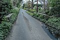
|---|---|---|---|
| Astagob Steach Gob |
162 | Rugged Lane | 
|
| Barberstown[3 1] Baile an Bhearbóraigh |
166 | Before the restoration of the rail spur to Hansfield |

|
| Barnhill Cnoc an Sciobóil |
190 | Packenham Bridge (Royal Canal) |

|
| Blakestown Baile an Bhlácaigh |
104 | ||
| Broomfield Gort na Giolcaí |
24 | Entrance gates | 
|
| Clonsilla Cluain Saileach |
382 | St Mary's (Church of Ireland) |

|
| Casteheany[3 2] Teach Chainnigh |
302 | Coláiste Pobail Setanta | 
|
| Coolmine Cúil Mhín |
609 | Coolmine Community School | 
|
| Hansfield or Phibblestown[3 3] Baile Fiobail nó Páirc Hans |
223 | Ongar Village | 
|
| Hartstown[3 4] Baile an Hartaigh |
181 | Hartstown Community School |

|
| Kellystown Baile Uí Cheallaigh |
174 | ||
| Sheepmoor Móinteán na gCaorach |
161 | Entrance to Portersfield estate |

|
| Woodlands[3 5] Fearann na Coille |
571 | Luttrellstown Golf Club House |

|
- Note 1 The largest population centre in Castaheany / Hansfield is Ongar.
Civil parish of Finglas edit
The 34 townlands of the parish of Finglas are split among two baronies.[l 5] The core village and two smaller parcels of land - exclaves of the village - lie in Castleknock. An additional exclave lies in Nethercross.
-
 Trading estate in the townland of Ballyboggan South
 -
 Ballygall House in the townland of Ballygall
 -
 Old N2 road at the townland of Balseskin
 -
 Breaker's yard in the townland of Cardiffsbridge
 -
 Garda station in the townland of Cardiffscastle
 -
 Charlestown Shopping Centre in the townland of Charlestown
 -
 Old N1 road at the townland of Coldwinters
 -
 Bridge in the townland of Kilreesk
 -
 Old N2 road at the townland of Kilshane
 -
 Seamus Ennis plaque in the townland of Jamestown Little
 -
 IKEA store in the townland of Poppintree
 -
 Prospect apartment blocks in the townland of Tolka


Civil parish of Mulhuddart edit
Mulhuddart has 22 townlands, including:[l 6]
| Townland | Acres | Image Description | Image |
|---|---|---|---|
| Buzzardstown[7 1] | 298 | Institute of Technology Blanchardstown | 
|
| Littlepace[7 2] | 97 | Shopping centre | 
|
| Damastown[7 3] | 351 | IBM car park | 
|
| Gallanstown | Road to Belgree near Hollystown | 
| |
| Huntstown | Road in Deerhaven estate | 
| |
| Hollystown[7 4] | 196 | Hollystown Golf Club | 
|
| Macetown Middle | Damastown Avenue | 
| |
| Macetown South | Damastown Way | 
| |
| Moorestown | Dolly Heffernan's pub | 
| |
| Powerstown[7 5] | 358 | Road in Powerstown | 
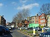
|
| Tyrrelstown[7 6] | 427 | Houses in Tyrrelstown | 
|
| Yellow Walls | Field overlooking housing estate in Hollystown. |
|
Civil parish of Saint James' edit
The bulk of Saint James' parish[l 7] lies south of the River Liffey. A single townland, situated north of the river in the Phoenix Park, is part of the barony of Castleknock.
- Saint James' (part of Phoenix Park);[5 1] the eastern part containing the Magazine Fort, the Zoological Gardens, the Wellington Monument and the Criminal Courts of Justice.

Civil parish of Saint Judes' edit
The bulk of Saint Judes'[l 8] parish lies south of the River Liffey. A single townland, situated north of the river, is part of the barony of Castleknock. It was carved out of the parish of Saint James'.
- Longmeadows[4 2] which is the strip of land between the Park walls and the river from its narrowest pinch point to Islandbridge on the South Circular Road.

Civil parish of Ward edit
Townlands in the parish of Ward: Cherryhound, Irishtown, Killamonan, Newpark, Spricklestown, Ward Lower and Ward Upper.[l 9]
| Townland | Acres | Image Description | Image |
|---|---|---|---|
| Cherryhound[8 1] | 112 | Roundabout at the M2 | 
|
| Newpark[8 2] | 351 | The White House Pub and Restaurant on the N2 road. |

|
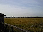
| Ward Lower[8 3] | 285 | Milestone | 
|
| Killamonan[8 4] | 76 | Horses grazing February 2008 |

|
See also edit
References edit
From "Irish placenames database". logainm.ie (in English and Irish). Department of Community, Rural and Gaeltacht Affairs. Retrieved 25 April 2014.:
- Civil parishes
- Townlands of Cloghran
- Townlands of Clonsilla
- Townlands of Mulhuddart
- Townlands of Saint James's
- ^ Saint James' (part of Phoenix Park) townland
- Townlands of Castleknock
- ^ Abbotstown townland
- ^ Annfield townland
- ^ Ashtown townland
- ^ Astagob townland
- ^ Blanchardstown townland
- ^ Cabragh townland
- ^ Carpenterstown townland
- ^ Cappagh townland
- ^ Castleknock townland
- ^ Castleknock (incl. part of Phoenix Park) townland
- ^ Corduff townland
- ^ Deanestown townland
- ^ Diswellstown townland
- ^ Dunsink townland
- ^ Huntstown townland
- ^ Johnstown townland
- ^ Mitchelstown townland
- ^ Pelletstowntownland
- ^ Porterstown townland
- ^ Scribblestown townland
- ^ Sheephill townland
- ^ Snugborough townland
- Townlands of Ward
- Townlands of other parishes
Other sources:
- ^ "History of the name of Castleknock". Archived from the original on 2 June 2006. Retrieved 13 July 2010.
- ^ Vicissitudes of Families by Sir Bernard Burke, Ulster King of Arms, Longman Green Longman and Roberts, Paternoster Row, London, 1861 (pages 363-364)
- ^ According to the "Local Government Act, 2001", section 10(2): "The State continues to stand divided into local government areas to be known as counties and cities which are the areas set out in Parts 1 and 2, respectively, of Schedule 5." It is clear from SCHEDULE 5, Local Government Areas (Counties and Cities, PART 1, that "Dublin" is defined only as a city (as distinct from a county).
- ^ The Barony of Castleknock, A History", Lacey, Jim; The History Press Ireland, 2015, pg 98
- ^ The Grant of Castleknock to Hugh Tyrel., The journal of the Royal Society of Antiquaries of Ireland. 7th series; Royal Society of Antiquaries of Ireland; Dublin Hodges, Figgis; 3v.; English; Holdings: Vol. 1-vol. 3; 1931-1933.; Also numbered vol. 61-63 of consecutive series. Continues 6th series; University of Liverpool Libraries
External links edit
- Local Government Act, 2001
- Walsh, Dennis (2003). "Barony Map of Ireland". Archived from the original on 15 January 2007. Retrieved 13 February 2007. Source given is "Ordnance survey".