KNOWPIA
WELCOME TO KNOWPIA

Celo Knob 
Summary
Celo Knob is the northernmost major peak in the Black Mountains of western North Carolina. It is located just north of Mount Mitchell State Park in the Pisgah National Forest. It is the first peak encountered while hiking the Black Mountain Crest Trail from Bowlens Creek. The trail passes to the southwest of the summit, which can be reached by various herd paths.
| Celo Knob | |
|---|---|
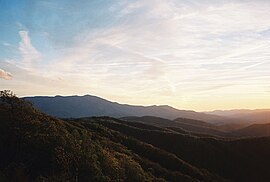
 Celo Knob viewed from Three Knobs Overlook | |
| Highest point | |
| Elevation | 6,327 ft (1,928 m) |
| Prominence | 647 ft (197 m)[1] |
| Coordinates | 35°51′08″N 82°14′55″W / 35.85222°N 82.24861°W |
| Geography | |
 Celo Knob Location of Celo Knob in North Carolina. | |
| Location | Yancey, North Carolina, United States |
| Climbing | |
| Access | Hike |
See also edit
References edit
- ^ "Celo Knob, North Carolina". Peakbagger.com. 2008-07-08.
External links edit
Wikimedia Commons has media related to Celo Knob.
- "North Carolina". The Nature Conservancy. Archived from the original on 2008-10-06. Retrieved 2011-05-09.
- "Travel, Attractions and Points of Interest near Celo Knob, North Carolina". MountainPeaks.net. Archived from the original on 2011-07-19. Retrieved 2011-05-09.
- "4372756 North Carolinas from the East". Flickr. June 2008. Retrieved 2011-05-09.
- "SummitPost.org". SummitPost.org. Retrieved 2011-05-09.
- "Celo Knob". Geographic Names Information System. United States Geological Survey, United States Department of the Interior. Retrieved 2011-05-09.
- http://adventures.garmin.com/en-US/by/mepwoods/black-mountain-crest-trail-traverse-5-october-2013/