KNOWPIA
WELCOME TO KNOWPIA
Summary
9°00′S 159°45′E / 9.000°S 159.750°E
Central Province
Sentrol Provins (Pijin) | |
|---|---|
 Flag | |
 | |
| Coordinates: 9°0′S 159°45′E / 9.000°S 159.750°E | |
| Country | |
| Capital | Tulagi |
| Government | |
| • Premier | Hon. Stanely Manetiva |
| Area | |
| • Total | 615 km2 (237 sq mi) |
| Population (2019 census) | |
| • Total | 30,326 |
| • Density | 49/km2 (130/sq mi) |
| [1] | |
| Time zone | UTC+11 (+11) |
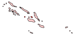
The Central Province is one of the provinces of Solomon Islands, covering the Russell Islands, Nggela Islands (Florida Islands) and Savo Island.[2] Its area comprises 615 square kilometres (237 square miles) and had a population of 26,051 as of 2009[update], rising to 30,326 as of 2019[update]. The provincial capital is Tulagi.[3][4]
Administrative divisions edit
Central Province is sub-divided into the following wards (with populations at the 2009 Census):
- Central Province (26,051)
- Sandfly/Buenavista (3,226)
- West Gela (2,220)
- East Gela (2,026)
- Tulagi (1,251)
- South West Gela (2,586)
- South East Gela (1,662)
- North East Gela (2,118)
- North West Gela (1,722)
- Banika (2,019)
- Pavuvu (1,956)
- Lovukol (2,128)
- North Savo (1,520)
- South Savo (1,617)
Islands and settlements edit
References edit
- ^ Solomon Islands National Statistical Office (web), 2019.
- ^ Planet, Lonely. "Central Province travel | Solomon Islands". Lonely Planet. Retrieved 13 June 2019.
- ^ "Central Province, Solomon Islands | Solomon Airlines". www.flysolomons.com. Solomon Airlines. Retrieved 13 June 2019.
- ^ "PROVINCIAL PROFILE OF THE 2009 POPULATION & HOUSING CENSUS". Retrieved 13 June 2019.
Wikivoyage has a travel guide for Florida and Russell Islands.


