
KNOWPIA
WELCOME TO KNOWPIA

Chaillevette 
Summary
Chaillevette (French pronunciation: [ʃajvɛt]) is a commune in the Charente-Maritime department and Nouvelle-Aquitaine region in southwestern France.
Chaillevette | |
|---|---|
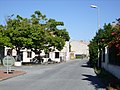
 The moorings in Chatressac | |
Location of Chaillevette .mw-parser-output .locmap .od{position:absolute}.mw-parser-output .locmap .id{position:absolute;line-height:0}.mw-parser-output .locmap .l0{font-size:0;position:absolute}.mw-parser-output .locmap .pv{line-height:110%;position:absolute;text-align:center}.mw-parser-output .locmap .pl{line-height:110%;position:absolute;top:-0.75em;text-align:right}.mw-parser-output .locmap .pr{line-height:110%;position:absolute;top:-0.75em;text-align:left}.mw-parser-output .locmap .pv>div{display:inline;padding:1px}.mw-parser-output .locmap .pl>div{display:inline;padding:1px;float:right}.mw-parser-output .locmap .pr>div{display:inline;padding:1px;float:left}html.skin-theme-clientpref-night .mw-parser-output .od,html.skin-theme-clientpref-night .mw-parser-output .od .pv>div,html.skin-theme-clientpref-night .mw-parser-output .od .pl>div,html.skin-theme-clientpref-night .mw-parser-output .od .pr>div{background:#000;color:#fff}html.skin-theme-clientpref-night .mw-parser-output .locmap{filter:grayscale(0.6)}@media(prefers-color-scheme:dark){html.skin-theme-clientpref-os .mw-parser-output .locmap{filter:grayscale(0.6)}html.skin-theme-clientpref-os .mw-parser-output .od,html.skin-theme-clientpref-os .mw-parser-output .od .pv>div,html.skin-theme-clientpref-os .mw-parser-output .od .pl>div,html.skin-theme-clientpref-os .mw-parser-output .od .pr>div{background:#000;color:#fff}}  Chaillevette  Chaillevette | |
| Coordinates: 45°43′48″N 1°02′35″W / 45.73°N 1.0431°W | |
| Country | France |
| Region | Nouvelle-Aquitaine |
| Department | Charente-Maritime |
| Arrondissement | Rochefort |
| Canton | La Tremblade |
| Intercommunality | CA Royan Atlantique |
| Government | |
| • Mayor (2020–2026) | Guy Mary[1] |
| Area 1 | 10.03 km2 (3.87 sq mi) |
| Population (2021)[2] | 1,633 |
| • Density | 160/km2 (420/sq mi) |
| Time zone | UTC+01:00 (CET) |
| • Summer (DST) | UTC+02:00 (CEST) |
| INSEE/Postal code | 17079 /17890 |
| Elevation | 0–28 m (0–92 ft) |
| 1 French Land Register data, which excludes lakes, ponds, glaciers > 1 km2 (0.386 sq mi or 247 acres) and river estuaries. | |
Population edit
| Year | Pop. | ±% p.a. |
|---|---|---|
| 1968 | 1,073 | — |
| 1975 | 1,011 | −0.85% |
| 1982 | 1,019 | +0.11% |
| 1990 | 1,031 | +0.15% |
| 1999 | 1,082 | +0.54% |
| 2009 | 1,390 | +2.54% |
| 2014 | 1,513 | +1.71% |
| 2020 | 1,628 | +1.23% |
| Source: INSEE[3] | ||
Gallery edit


See also edit
References edit
- ^ "Répertoire national des élus: les maires". data.gouv.fr, Plateforme ouverte des données publiques françaises (in French). 2 December 2020.
- ^ "Populations légales 2021". The National Institute of Statistics and Economic Studies. 28 December 2023.
- ^ Population en historique depuis 1968, INSEE
External links edit
 Media related to Chaillevette at Wikimedia Commons