


Summary
Challakere is a city municipality (taluk) in Chitradurga district in the state of Karnataka, India. It is called Oil City with numerous edible oil mills around the city and also Science City as several science and research organizations such as IISc, DRDO, BARC and ISRO have set up their establishments here.
Challakere | |
|---|---|
City | |
| Nickname: Science City/Oil City | |
 Challakere Location in Karnataka, India | |
| Coordinates: 14°18′43″N 76°39′04″E / 14.312°N 76.651°E | |
| Country | |
| State | Karnataka |
| District | Chitradurga |
| Region | Bayaluseemē |
| Government | |
| • Body | City Municipality Council |
| Area | |
| • City | 30.71 km2 (11.86 sq mi) |
| • Rural | 2,032.13 km2 (784.61 sq mi) |
| Elevation | 585 m (1,919 ft) |
| Population (2001) | |
| • City | 55,194 |
| • Density | 1,800/km2 (4,700/sq mi) |
| Languages | |
| • Official | Kannada |
| Time zone | UTC+5:30 (IST) |
| PIN | 577 522 |
| Telephone code | 08195 |
| Vehicle registration | KA-16 |
| Website | www |
Geography edit
Challakere is located at 14°18′43″N 76°39′04″E / 14.312°N 76.651°E.[1] It has an average elevation of 585 metres (1919 ft).
Demographics edit
Challakere is the largest taluk of Chitradurga District. As of 2011[update] India census,[2] Challakere has a population of 55,194.
Science and research organizations edit
Challakere is 200 km from Bangalore where an integrated township spread over 8,000 acres (32 km2) has been set up by Indian Space Research Organization (ISRO), Defence Research and Development Organization (DRDO), Indian Institute of Science (IISc) and Bhabha Atomic Research Centre (BARC). [3][4] [5]

Oil industry edit
Challakere is also known as the 'oil city' or "second mumbai" of India because it is the second largest producer/supplier of edible oil after Mumbai. There are as many as 60+ oil industries in Challakere. Not only oil, several other industries like dal, fried gram, rice, etc. are also present. The commercial activity in the town is comparable to that of a standard district and the district enjoys a huge business turnover out of town's business.
Spiritual places edit
- Datta Mandira - located in Tyagaraja Nagar, and traditional practices of Datta Sampradaya, can be seen at this temple.
- Jagalurajja temple (Ajjana Gudi) - located beside the Ajjana Kere, which is the main water source for surrounding wells and drinking water for challakere.
- Challekeramma temple - Challakeramma Jathre is conducted once every five years.
- Bhavani Shankara temple - situated at Lakshmipura, was bought from Varanasi more than 200 years back without being kept on the floor to maintain the sanctity of the idol.[citation needed]
Transport edit
Road connection edit
Challakere is well connected to Bangalore, Bellary, Pavagada, and Chitradurga by road. NH 150A which connects Chamarajanagara and Jevargi passes through the city. Chitradurga, which is the district headquarters, is 30 km from this city.
Education edit
- VEDA SCHOOL, Sanikere
- VEDA residential PU College, Sanikere
- Government Engineering College
- Government First Grade College
- Government P. U. College
- Government Tool Room And Training Centre (GTTC)
- Mahatma Gandhi English Medium High School (MGEMHS)
- Vinod English School (VES)
- Warriors English School
- Warriors P. U. College
- BMGHS
- Vasavi English Medium High School
Notable people edit
- C. K. Jaffer Sharief
- Ta Ra Subba Rao - renowned Kannada novelist
- Challakere Brothers - known for chanting of Vedas[6]
Gallery edit
-
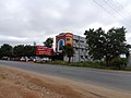
 Challakere Town
 -
 Rose Cafe
 -
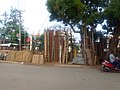 Bamboo Craft
 -
 Railway Station
 -
 Rathotsava
 -
 Warriors School
 -
 School Inspector Office
 -
 Gandharva Cafe


References edit
- ^ Falling Rain Genomics, Inc - Challakere
- ^ "Census of India 2001: Data from the 2001 Census, including cities, villages and towns (Provisional)". Census Commission of India. Archived from the original on 16 June 2004. Retrieved 1 November 2008.
- ^ "IISc Challakere Campus1". IISc.
- ^ "IISc Challakere Campus2". IISc.
- ^ "All Science & Research Organizations". NewIndianExpress.
- ^ "What the Vedas teach". The Hindu. 14 March 2011. Retrieved 31 October 2018.
External links edit
Official website ![]()