
KNOWPIA
WELCOME TO KNOWPIA

Chartrettes 
Summary
Chartrettes (French pronunciation: [ʃaʁtʁɛt] ⓘ) is a commune in the Seine-et-Marne department in the Île-de-France region in north-central France.
Chartrettes | |
|---|---|
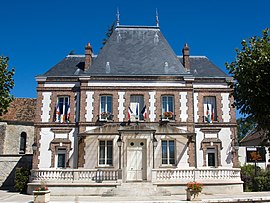 The town hall in Chartrettes | |
 Coat of arms | |
Location of Chartrettes .mw-parser-output .locmap .od{position:absolute}.mw-parser-output .locmap .id{position:absolute;line-height:0}.mw-parser-output .locmap .l0{font-size:0;position:absolute}.mw-parser-output .locmap .pv{line-height:110%;position:absolute;text-align:center}.mw-parser-output .locmap .pl{line-height:110%;position:absolute;top:-0.75em;text-align:right}.mw-parser-output .locmap .pr{line-height:110%;position:absolute;top:-0.75em;text-align:left}.mw-parser-output .locmap .pv>div{display:inline;padding:1px}.mw-parser-output .locmap .pl>div{display:inline;padding:1px;float:right}.mw-parser-output .locmap .pr>div{display:inline;padding:1px;float:left}html.skin-theme-clientpref-night .mw-parser-output .od,html.skin-theme-clientpref-night .mw-parser-output .od .pv>div,html.skin-theme-clientpref-night .mw-parser-output .od .pl>div,html.skin-theme-clientpref-night .mw-parser-output .od .pr>div{background:#000;color:#fff}html.skin-theme-clientpref-night .mw-parser-output .locmap{filter:grayscale(0.6)}@media(prefers-color-scheme:dark){html.skin-theme-clientpref-os .mw-parser-output .locmap{filter:grayscale(0.6)}html.skin-theme-clientpref-os .mw-parser-output .od,html.skin-theme-clientpref-os .mw-parser-output .od .pv>div,html.skin-theme-clientpref-os .mw-parser-output .od .pl>div,html.skin-theme-clientpref-os .mw-parser-output .od .pr>div{background:#000;color:#fff}}  Chartrettes  Chartrettes | |
| Coordinates: 48°29′24″N 2°42′02″E / 48.49°N 2.7006°E | |
| Country | France |
| Region | Île-de-France |
| Department | Seine-et-Marne |
| Arrondissement | Fontainebleau |
| Canton | Nangis |
| Intercommunality | CA Pays de Fontainebleau |
| Government | |
| • Mayor (2020–2026) | Pascal Gros[1] |
| Area 1 | 10.10 km2 (3.90 sq mi) |
| Population (2021)[2] | 2,543 |
| • Density | 250/km2 (650/sq mi) |
| Time zone | UTC+01:00 (CET) |
| • Summer (DST) | UTC+02:00 (CEST) |
| INSEE/Postal code | 77096 /77590 |
| Elevation | 37–94 m (121–308 ft) |
| 1 French Land Register data, which excludes lakes, ponds, glaciers > 1 km2 (0.386 sq mi or 247 acres) and river estuaries. | |
Weather edit
During winter the expected temperature for Chartrettes is 0–7 °C (33–43 °F.) During spring and autumn it is 5–11 °C (38–58 °F.) During summer it has a huge bracket from 7–30 °C (44.6–86 °F.) It is highly unlikely to snow. It is very humid and sunny. It hardly ever rains and winds reach 32 kmh (20 mph).
Population edit
| Year | Pop. | ±% p.a. |
|---|---|---|
| 1968 | 1,115 | — |
| 1975 | 1,135 | +0.25% |
| 1982 | 1,561 | +4.66% |
| 1990 | 2,114 | +3.86% |
| 1999 | 2,391 | +1.38% |
| 2007 | 2,527 | +0.69% |
| 2012 | 2,588 | +0.48% |
| 2017 | 2,554 | −0.26% |
| Source: INSEE[3] | ||
The inhabitants are called Chartrettois in French.
See also edit
References edit
- ^ "Répertoire national des élus: les maires" (in French). data.gouv.fr, Plateforme ouverte des données publiques françaises. 13 September 2022.
- ^ "Populations légales 2021". The National Institute of Statistics and Economic Studies. 28 December 2023.
- ^ Population en historique depuis 1968, INSEE
External links edit
Wikimedia Commons has media related to Chartrettes.
- 1999 Land Use, from IAURIF (Institute for Urban Planning and Development of the Paris-Île-de-France région) (in English)
- Base Mérimée: Search for heritage in the commune, Ministère français de la Culture. (in French)