
KNOWPIA
WELCOME TO KNOWPIA

Chetla 
Summary
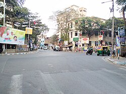
Chetla is a neighbourhood of South Kolkata in Kolkata district of the Indian state of West Bengal.
Chetla | |
|---|---|
Neighbourhood in Kolkata (Calcutta) | |
 | |
 Chetla Location in Kolkata | |
| Coordinates: 22°31′06″N 88°20′15″E / 22.518345°N 88.337611°E | |
| Country | |
| State | West Bengal |
| City | Kolkata |
| District | Kolkata |
| Metro Station | Kalighat and Majerhat(under construction) |
| Municipal Corporation | Kolkata Municipal Corporation |
| KMC ward | 82 |
| Population | |
| • Total | For population see linked KMC ward page |
| Time zone | UTC+5:30 (IST) |
| Area code | +91 33 |
| Lok Sabha constituency | Kolkata Dakshin |
| Vidhan Sabha constituency | Bhabanipur |
Geography edit
Police district edit
Chetla police station is part of the South division of Kolkata Police and is located at 19/4 Pitamber Ghatak Lane, Kolkata-700027.[1]
See also – Chetla police station boundary map
Tollygunge Womens police station has jurisdiction over all the police districts in the South Division, i.e. Park Street, Shakespeare Sarani, Alipore, Hastings, Maidan, Bhowanipore, Kalighat, Tollygunge, Charu Market, New Alipur and Chetla.[1]
Culture edit
The renovated nabaratna temple of the Mandal family in Chetla is the largest and most important temple of this type in south Kolkata.[2]
References edit
External links edit
 Kolkata/South travel guide from Wikivoyage