


Summary
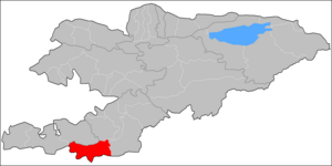
Chong-Alay District (big Alay) (Kyrgyz: Чоң Алай району; Russian: Чон-Алайский район) is a district of Osh Region in far south-western Kyrgyzstan. The administrative seat lies at Daroot-Korgon.[2] Its area is 4,857 square kilometres (1,875 sq mi),[3] and its resident population was 32,140 in 2021.[1] The Chong-Alay District include 3 rural communities (Kyrgyz: айыл аймагы, romanized: ayyl aymagy): Chong-Alay, Kashka-Suu, and Jekendi.[4]
Chong-Alay
Чоң Алай району | |
|---|---|
 The border between Chong-Alay district and Alay district | |
 Flag  Seal | |
 | |
| Country | Kyrgyzstan |
| Region | Osh Region |
| Area | |
| • Total | 4,857 km2 (1,875 sq mi) |
| Population (2021)[1] | |
| • Total | 32,140 |
| • Density | 6.6/km2 (17/sq mi) |
| Time zone | UTC+6 |
History edit
Eurasianet reported that on September 17, 2022, as part of the 2022 Kyrgyzstan-Tajikistan clashes, Chong-Alay District was the site of an exchange of mortar fire with Tajikistani troops.[5]
Geography edit
Chong-Alay District occupies the western part of Alay Valley. The northern boundary of the district is located at Alay Mountains, and southern - at Trans-Alay Range. The valley is inclined from east to west, with the lowest point at 1560 meters above sea level.[6]
Climate is sharply continental with cold winters. Annual precipitation is 500–650 mm. Average temperature in July is +19-22C, and December -10-15C.[7]
The hydrology is dominated by the river Kyzyl-Suu (flowing towards the west) and its tributaries.
Demographics edit
According to the 2009 Census, the ethnic composition (de jure population) of the Chong-Alay District was 99.9% Kyrgyz and 0.1% other groups.[3]
| Year | Pop. | ±% p.a. |
|---|---|---|
| 1970 | 7,877 | — |
| 1979 | 10,084 | +2.78% |
| 1989 | 14,616 | +3.78% |
| 1999 | 21,759 | +4.06% |
| 2009 | 25,039 | +1.41% |
| 2021 | 32,140 | +2.10% |
| Note: resident population; Sources:[3][1] | ||
Populated places edit
In total Chong-Alay District comprised 22 settlements in 3 rural communities (ayyl aymagy). Each rural community can consist of one or several villages. The rural communities and settlements in the Chong-Alay District are:[2][8]
- Jekendi (seat: Karamyk; incl. Jekendi, Kara-Teyit, Shibee and Chuluk)
- Kashka-Suu (seat: Kashka-Suu; incl. Achyk-Suu, Kabyk, Kara-Kabak, Burgan-Suu, Jayylma and Kichi-Jayylma)
- Chong-Alay (seat: Daroot-Korgon; incl. Jar-Bashy, Jash-Tilek, Jaman-Jar, Kochkorchu, Kulchu, Kyzyl-Tuu, Sary-Bulak, Chak, Kyzyl-Eshme and Kara-Shybak)

Kichi-Jayylma
Kochkorchu
Sary-
Bulak
References edit
- ^ a b c "Population of regions, districts, towns, urban-type settlements, rural communities and villages of Kyrgyz Republic" (XLS) (in Russian). National Statistics Committee of the Kyrgyz Republic. 2021. Archived from the original on 10 November 2021.
- ^ a b "Classification system of territorial units of the Kyrgyz Republic" (in Kyrgyz). National Statistics Committee of the Kyrgyz Republic. May 2021. pp. 62–63.
- ^ a b c "2009 population and housing census of the Kyrgyz Republic: Osh Region" (PDF) (in Russian). National Statistics Committee of the Kyrgyz Republic. 2010. pp. 12, 17, 53.
- ^ "List of rural communities of Kyrgyzstan". Archived from the original on 2010-02-09. Retrieved 2010-03-14.
- ^ Usmanov, Danil (2022-09-18). "Kyrgyzstan-Tajikistan: The terror and death of a fruitless border conflict | Eurasianet". Eurasianet. Retrieved 2022-09-18.
- ^ Ошская область:Энциклопедия [Encyclopedia of Osh Oblast] (in Russian). Bishkek: Chief Editorial Board of Kyrgyz Soviet Encyclopedia. 1987. p. 446.
- ^ "State Administration of Osh Oblast (in Russian)". Archived from the original on 2009-01-05. Retrieved 2010-03-14.
- ^ List of Rural Communities of Kyrgyzstan Archived 2010-02-09 at the Wayback Machine
39°33′07″N 72°12′00″E / 39.5520°N 72.2001°E