


Summary
Chwarel y Fan is a peak in the Black Mountains in south-eastern Wales. It is the highest rise on the long ridge which extends southeastwards from Rhos Dirion. The ridge continues southeastwards to the lesser summit of Bal-Mawr whose top is adorned by a trig point at 607 metres (1,991 ft) above sea level. About one km (0.62 mi) southeast along the ridge is the lesser top of Bal-Bach at a height of just over 520 metres (1,710 ft). Chwarel y Fan is the county top of the historic county of Monmouthshire, and is also the highest point in the current local government area of Monmouthshire.
| Chwarel y Fan | |
|---|---|
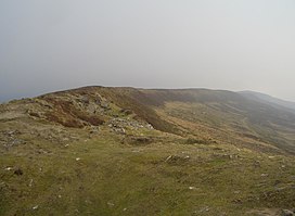 The Chwarel y Fan summit ridge | |
| Highest point | |
| Elevation | 679 m (2,228 ft) |
| Prominence | 72 m (236 ft) |
| Parent peak | Waun Fach |
| Listing | Hewitt, Nuttall, County top |
| Coordinates | 51°57′30″N 3°04′51″W / 51.95826°N 3.080948°W |
| Naming | |
| English translation | quarry of the beacon |
| Language of name | Welsh |
| Geography | |
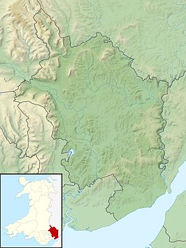 Chwarel y Fan Within Monmouthshire | |
| Location | Black Mountains, South Wales |
| OS grid | SO258294 |
| Topo map | OS Landranger 161 |
The summit is on a thin ridge and is crowned by a cairn. On the other sides of the valleys: to the west is Pen Twyn Mawr and to the east is Black Mountain.[1]
References edit
External links edit
- www.geograph.co.uk : photos of Waun Fach and surrounding area