
KNOWPIA
WELCOME TO KNOWPIA

Cisneros, Antioquia 
Summary
Cisneros is a town and municipality in the Antioquia Department, Colombia. Part of the subregion of Northeastern Antioquia, it lies at an altitude of 1,050 m (3,440 ft) above sea level.
Cisneros, Antioquia | |
|---|---|
Municipality and town | |
 | |
 Flag | |
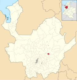 Location of the municipality and town of Cisneros, Antioquia in the Antioquia Department of Colombia | |
 Cisneros, Antioquia Location in Colombia | |
| Coordinates: 6°32′18″N 75°05′19″W / 6.53833°N 75.08861°W | |
| Country | |
| Department | |
| Subregion | Northeastern |
| Elevation | 1,050 m (3,440 ft) |
| Population (2015) | |
| • Total | 9,058 |
| Time zone | UTC-5 (Colombia Standard Time) |
Climate edit
Cisneros has a tropical rainforest climate (Af) with heavy rainfall year-round.
| Climate data for Cisneros | |||||||||||||
|---|---|---|---|---|---|---|---|---|---|---|---|---|---|
| Month | Jan | Feb | Mar | Apr | May | Jun | Jul | Aug | Sep | Oct | Nov | Dec | Year |
| Mean daily maximum °C (°F) | 28.2 (82.8) |
28.7 (83.7) |
28.8 (83.8) |
28.3 (82.9) |
28.2 (82.8) |
28.2 (82.8) |
28.4 (83.1) |
28.4 (83.1) |
27.9 (82.2) |
27.3 (81.1) |
27.2 (81.0) |
27.5 (81.5) |
28.1 (82.6) |
| Daily mean °C (°F) | 22.9 (73.2) |
23.3 (73.9) |
23.5 (74.3) |
23.4 (74.1) |
23.3 (73.9) |
23.1 (73.6) |
23.1 (73.6) |
23.2 (73.8) |
22.8 (73.0) |
22.4 (72.3) |
22.5 (72.5) |
22.4 (72.3) |
23.0 (73.4) |
| Mean daily minimum °C (°F) | 17.7 (63.9) |
17.9 (64.2) |
18.3 (64.9) |
18.6 (65.5) |
18.5 (65.3) |
18.1 (64.6) |
17.9 (64.2) |
18.0 (64.4) |
17.8 (64.0) |
17.6 (63.7) |
17.8 (64.0) |
17.3 (63.1) |
18.0 (64.3) |
| Average rainfall mm (inches) | 81 (3.2) |
87 (3.4) |
158 (6.2) |
277 (10.9) |
365 (14.4) |
271 (10.7) |
261 (10.3) |
303 (11.9) |
332 (13.1) |
367 (14.4) |
238 (9.4) |
112 (4.4) |
2,852 (112.3) |
| Source: Climate-Data.org[1] | |||||||||||||
References edit
- ^ "Climate: Cisneros". Climate-Data.org. Retrieved September 4, 2020.
External links edit
- (in Spanish) Cisneros official website