
KNOWPIA
WELCOME TO KNOWPIA

Clackamas Wilderness 
Summary
The Clackamas Wilderness is a wilderness area located in the Mount Hood National Forest in the northwestern Cascades of Oregon, United States. Created by the Omnibus Public Land Management Act of 2009, it consists of 9,470 acres (3,830 ha).[2][3] The wilderness is made up of five different tracts of lands with no roads on a 50-mile (80 km) stretch on both sides of the Clackamas River. These areas include Big Bottom, Memaloose Lake, Clackamas Canyon, Sisi Butte and South Fork Clackamas. It has some of the biggest trees in northwest Oregon. Memaloose Lake is a very popular hiking trail that leads through a forest to the lake, and then continues a mile up to a viewpoint on to up South Fork Mountain.[3][4]
| Clackamas Wilderness | |
|---|---|
 Field in the Clackamas Wilderness, June 2008 | |
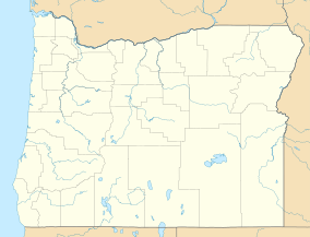 Location in Oregon  Location in United States | |
| Location | Clackamas County, Oregon, USA |
| Nearest city | Detroit, Oregon |
| Coordinates | 44°54′N 121°50′W / 44.9°N 121.83°W |
| Area | 9,470 acres (3,830 ha) |
| Established | 2009 |
| Governing body | U.S. Forest Service |
References edit
- ^ Protected Planet Website- Retrieved March 24, 2023
- ^ "Clackamas Wilderness, Oregon". Public Lands Information Center. Retrieved January 27, 2012.
- ^ a b "Clackamas Wilderness". Wilderness.net. Retrieved January 27, 2012.
- ^ Sullivan, William L. (April 21, 2009). "Into the Wilds: A look around the state at the new wilderness areas designated by Congress". The Register-Guard. Retrieved January 27, 2012.
External links edit
- Photo of Whale Creek in the wilderness by Philip A. Knouf
- U.S. Geological Survey Map at the U.S. Geological Survey Map Website. Retrieved March 30, 2023.