


Summary
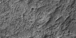
The common surface features of Mars include dark slope streaks, dust devil tracks, sand dunes, Medusae Fossae Formation, fretted terrain, layers, gullies, glaciers, scalloped topography, chaos terrain, possible ancient rivers, pedestal craters, brain terrain, and ring mold craters.
Slope streaks edit

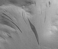
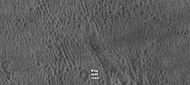
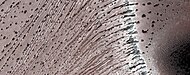
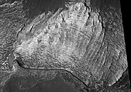
A new phenomenon known as slope streaks has been uncovered by the HiRISE camera on the Mars Reconnaissance Orbiter. These features appear on crater walls and other slopes, and they are thin and many hundreds of metres long. The streaks have been observed to grow slowly over the course of a year or so, always beginning at a point source. Newly formed streaks are dark in colour but fade as they age until white. The cause is unknown, but theories range from dry dust avalanches (the favoured theory) to brine seepage.[1]
Examples of dark slope streaks from various parts of Mars are shown below. Click on image to get a better view.
-
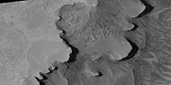
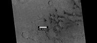
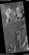
 Tikonravev Crater floor in Arabia quadrangle, as seen by Mars Global Surveyor. Click on image to see dark slope streaks and layers.
 -
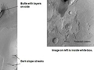
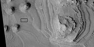
 Close-up of some layers under cap rock of a pedestal crater and a dark slope streak, as seen by HiRISE under HiWish program.
 -
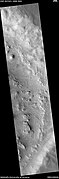
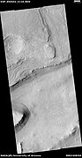
 Dark streaks in Diacria quadrangle, as seen by Mars Global Surveyor.
 -
 Layers and dark slope streaks, as seen by HiRISE under HiWish program
 -
 Dark slope streaks on mesa, as seen by HiRISE under HiWish program Location is Amazonis quadrangle.


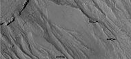
Recurrent slope lineae edit
Recurrent slope lineae are small dark streaks on slopes that elongate in warm seasons. They may be evidence of liquid water.[2][3][4][5]
-
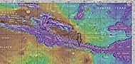
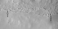
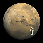 Image of disk of Mars taken by Viking. Arrow shows location of recurrent slope lineae in following HiRISE images.
 -
 Labeled map of features near to Coprates Chasma. Arrow shows location of recurrent slope lineae in following HiRISE images.
 -
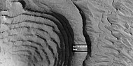
 Wide view of part of Valles Marineris, as seen by HiRISE under HiWish program Box shows location of recurrent slope lineae that are enlarged in next image.
 -
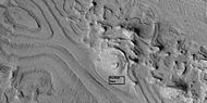
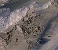 Close, color view of recurrent slope lineae, as seen by HiRISE under HiWish program Arrows point to some of the recurrent slope lineae. Fan may have been built up by past recurrent slope lineae.
 -
 Recurrent slope lineae elongate when the slopes are at their warmest. Near the equator, RSL elongate on northern slopes in the northern summer and on the southern slopes in the southern summer.


Dust devil tracks edit
Many areas on Mars experience the passage of giant dust devils. A thin coating of fine bright dust covers most of the Martian surface. When a dust devil travels by, it blows away the coating and exposes the underlying dark surface. These dust devils have been seen both from the ground and from orbit. They have even blown the dust off the solar panels of the Spirit and Opportunity Rovers on Mars, greatly extending their lives.[6] The twin Rovers were designed to last for 3 months; instead, Spirit lasted for 6 years, 77 days, while Opportunity continued to operate for a staggering 14 years, 136 days. The pattern of the tracks have been shown to change every few months.[7]
-
 Pattern of large and small tracks made by giant dust devils, as seen by under the MOC Public Targeting Program
 -
 Dust devil tracks, as seen by HiRISE under HiWish program
 -
 Dust devil tracks, as seen by HiRISE under HiWish program.
 -
 Russell Crater Dust Devil Changes in Noachis quadrangle, as seen by HiRISE. Click on image to see changes in dust devil tracks in just 3 months.


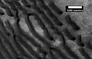
Layers edit
Many places on Mars show rocks arranged in layers. Rock can form layers in a variety of ways. Volcanoes, wind, or water can produce layers.[8] A detailed discussion of layering with many Martian examples can be found in Sedimentary Geology of Mars.[9] Layers can be hardened by the action of groundwater. Martian ground water probably moved hundreds of kilometers, and in the process it dissolved many minerals from the rock it passed through. When ground water surfaces in low areas containing sediments, water evaporates in the thin atmosphere and leaves behind minerals as deposits and/or cementing agents. Consequently, layers of dust could not later easily erode away since they were cemented together.
-
 Layered mound on floor of Danielson Crater, as seen by HiRISE under HiWish program
 -
 Close, color view of layers and dark dust on floor of Danielson Crater, as seen by HiRISE under HiWish program
 -
 Close, color view of layers and dark dust on floor of Danielson Crater, as seen by HiRISE under HiWish program Boulders are visible in the image.
 -
 Close view of layers on floor of Danielson Crater, as seen by HiRISE under HiWish program Some faults are visible in image.


-
 Close up view of southern part of Firsoff Crater showing layers, as seen by CTX camera (on Mars Reconnaissance Orbiter).
 -
 Layers in Firsoff Crater, as seen by HiRISE under HiWish program Note: this image field can be found in the previous image of the layers in Firsoff Crater, as seen by CTX camera (on Mars Reconnaissance Orbiter).
 -
 Close-up of layers in Firsoff Crater, as seen by HiRISE Note: this is an enlargement of the previous image of Firsoff Crater.
 -
 Faults and layers in Firsoff Crater, as seen by HiRISE under HiWish program. Arrows show location of faults.
 -
 Wide-view of layers, as seen by HiRISE under HiWish program. Box shows location of next image. Dark parts of image are dark, basalt sand sitting on level places.
 -
 Enlargement of previous image showing a fault and layers. Image taken with HiRISE, under HiWish program.
 -
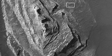
 Layers in Firsoff crater with a box showing the size of a football field Picture taken by HiRISE under HiWish program.
 -
 Layers and faults in Firsoff Crater, as seen by HiRISE under HiWish program. Arrows show one large fault, but there are other smaller ones in the picture.


-
 Light toned butte on floor of crater, as seen by HiRISE under HiWish program. Arrows show outcrops of light toned material. Light toned material is probably sulfate-rich and similar to material examined by Spirit Rover, and it once probably covered the whole floor. Other images below show enlargements of the butte. Location is Margaritifer Sinus quadrangle.
 -
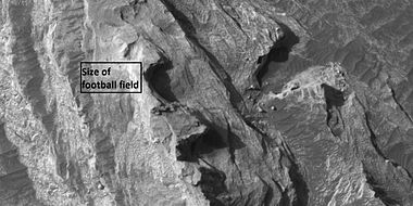
 Enlargement of white butte, as seen by HiRISE under HiWish program Box shows size of a football field.
 -
 Closer view towards top of white butte, as seen by HiRISE under HiWish program Box shows size of a football field.
 -
 Top of white butte, as seen by HiRISE under HiWish program Box shows size of a football field.


-
 Layered terrain in Aeolis quadrangle, as seen by HiRISE under HiWish program.
 -
 Wide view of layered terrain, as seen by HiRISE under HiWish program Location is northeast of Gale Crater in Aeolis quadrangle.
 -
 Close view of mound with layers, as seen by HiRISE under HiWish program Note: this is an enlargement from the previous image.
 -
 Close view of mound with layers, as seen by HiRISE under HiWish program Note: this is an enlargement from a previous image.
 -
 Layers exposed at the base of a group of buttes in Mangala Valles in Memnonia quadrangle, as seen by HiRISE under HiWish program. Arrows point to boulders sitting in pits. The pits may have formed by winds, heat from the boulders melting ground ice, or some other process.
 -
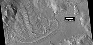
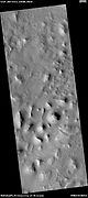
 Layers under cap rock of a pedestal crater, as seen by HiRISE under HiWish program. Pedestal crater is within the much larger Tikhonravov Crater.
 -
 Close-up of some layers under cap rock of a pedestal crater, as seen by HiRISE under HiWish program.
 -
 Layers in a butte in Arabia, as seen by HiRISE under HiWish program.
 -
 Layers in Arabia, as seen by HiRISE under HiWish program.
 -
 Butte in Crommelin Crater, as seen by HiRISE under HiWish program. Location is Oxia Palus quadrangle.
 -
 Layers in Crommelin Crater, as seen by HiRISE under HiWish program. Location is Oxia Palus quadrangle.
 -
 Layers in Crommelin Crater, as seen by HiRISE under HiWish program. Arrow indicates fault. Location is Oxia Palus quadrangle.
 -
 Layers, as seen by HiRISE under HiWish program Location is Tempe Terra
 -
 Layers, as seen by HiRISE under HiWish program Location is Tempe Terra Note: this is an enlargement of the previous image.


-
 Layers breaking up into boulders in Galle Crater, as seen by HiRISE under HiWish program Location is Argyre quadrangle.
 -
 Layers and gullies in Galle Crater, as seen by HiRISE under HiWish program Location is Argyre quadrangle.
 -
 Layered mesa in mound in Galle Crater, as seen by HiRISE under HiWish program Location is Argyre quadrangle.
 -
 Layers and polygons in mound in Galle Crater, as seen by HiRISE under HiWish program Location is Argyre quadrangle.
 -
 Close view of layers in mound in Galle Crater, as seen by HiRISE under HiWish program Location is Argyre quadrangle.


-
 Close view of layers, as seen by HiRISE under HiWish program At least one layer is light-toned which may indicated hydrated minerals. Location is Arabia quadrangle.
 -
 Close view of layers, as seen by HiRISE under HiWish program Location is Arabia quadrangle.


-
 Wide view of layers in crater, as seen by HiRISE under HiWish program parts of this image are enlarged in other images that follow.
 -
 Close view of layers, as seen by HiRISE under HiWish program Box shows the size of a football field.
 -
 Close view of layers, as seen by HiRISE under HiWish program Box shows the size of a football field.
 -
 Close view of layers, as seen by HiRISE under HiWish program Box shows the size of a football field.
 -
 Close view of layers, as seen by HiRISE under HiWish program
 -
 Close view of layers, as seen by HiRISE under HiWish program
 -
 Close view of layers, as seen by HiRISE under HiWish program
 -
 Close view of layers, as seen by HiRISE under HiWish program
 -
 Close view of layers, as seen by HiRISE under HiWish program


-
 Wide view of layers, as seen by HiRISE under HiWish program
 -
 Close view of layers, as seen by HiRISE under HiWish program A ridge cuts across the layers at a right angle.
 -
 Close view of layers, as seen by HiRISE under HiWish program A ridge cuts across the layers at a right angle.
 -
 Close view of layers, as seen by HiRISE under HiWish program Part of picture is in color. A ridge cuts across the layers at a right angle.


Layers in Ice Cap edit
-
 Layers in northern ice cap with an angular unconformity, as seen by HiRISE under HiWish program
 -
 Close view of layers in northern ice cap, as seen by HiRISE under HiWish program Arrows point to an angular unconformity.
 -
 Close, color view of layers in northern ice cap, as seen by HiRISE under HiWish program
 -
 Layers exposed in northern ice cap, as seen by HiRISE under HiWish program
 -
 Close view of layers exposed in northern ice cap, as seen by HiRISE under HiWish program


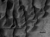
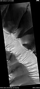
Sand dunes edit
Many locations on Mars have sand dunes. An erg (or sand sea), made up of aeolian dune fields referred to as the Circumpolar Dune Field[10] surrounds most of the north polar cap.[11] The dunes are covered by a seasonal carbon dioxide frost that forms in early autumn and remains until late spring.[11] Many martian dunes strongly resemble terrestrial dunes but images acquired by the High-Resolution Imaging Science Experiment on the Mars Reconnaissance Orbiter have shown that martian dunes in the north polar region are subject to modification via grainflow triggered by seasonal CO2 sublimation, a process not seen on Earth.[12] Many dunes are black because they are derived from the dark volcanic rock basalt. Extraterrestrial sand seas such as those found on Mars are referred to as "undae" from the Latin for waves.
-
 Dark dunes (probably basalt) which form a dark spot in Noachis. Picture from Mars Global Surveyor.
 -
 Wide view of dunes in Noachis, as seen by HiRISE.
 -
 Close-up View of dunes in previous image, as seen by HiRISE. Note how sand barely covers some boulders.
 -
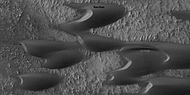
 Proctor Crater Ripples and Dunes, as seen by HiRISE.
 -
 Dunes among craters, as seen by HiRISE under HiWish program. Some of these are barchans.
 -
 Dunes in two craters, as seen by HiRISE under the HiWish program.
 -
 Dunes and craters, as seen by HiRISE under HiWish program
 -
 Dunes on a crater floor, as seen by HiRISE under HiWish program. Most of these are barchans. Box shows location of next image.
 -
 Dunes on a crater floor, as seen by HiRISE under HiWish program. Most of these are barchans. Note: this is an enlargement of the center of the previous image.
 -
 Dunes, as seen by HiRISE under HiWish program. Location is Eridania quadrangle.
 -
 Dunes in Mare Tyrrhenum quadrangle, as seen by HiRISE under HiWish program
 -
 Close view of dunes Mare Tyrrhenum quadrangle, as seen by HiRISE under HiWish program
 -
 Close, color view of dunes Mare Tyrrhenum quadrangle, as seen by HiRISE under HiWish program Ripples are visible on dune surface.


-
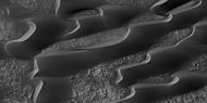
 Wide view of a field of sand dunes, as seen by HiRISE under HiWish program
 -
 Close view of sand dunes, as seen by HiRISE under HiWish program A birchen dune is labeled.
 -
 Close view of sand dunes, as seen by HiRISE under HiWish program
 -
 Close view of sand dunes, as seen by HiRISE under HiWish program A birchen dune is labeled.
 -
 Close, color view of sand dunes, as seen by HiRISE under HiWish program


Gullies edit
Martian gullies are small, incised networks of narrow channels and their associated downslope sediment deposits, found on the planet of Mars. They are named for their resemblance to terrestrial gullies. First discovered on images from Mars Global Surveyor, they occur on steep slopes, especially on the walls of craters. Usually, each gully has a dendritic alcove at its head, a fan-shaped apron at its base, and a single thread of incised channel linking the two, giving the whole gully an hourglass shape.[13] They are believed to be relatively young because they have few, if any craters.
On the basis of their form, aspects, positions, and location amongst and apparent interaction with features thought to be rich in water ice, many researchers believed that the processes carving the gullies involve liquid water. However, this remains a topic of active research.
-
 Gullies with alcove, channel, apron—the parts of a complete gully. Picture taken with HiRISE under HiWish program.
 -
 Gullies with remains of a former glacier in crater in Terra Sirenum, as seen by HiRISE under HiWish program. Location is the Phaethontis quadrangle.
 -
 Gullies near Newton Crater, as seen by HiRISE under the HiWish Program. Location is the Phaethontis quadrangle.
 -
 Gullies in a crater in Terra Sirenum, as seen by HiRISE under the HiWish Program. Location is the Phaethontis quadrangle.
 -
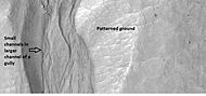 Close-up of gully showing multiple channels and patterned ground, as seen by HiRISE under the HiWish program. Location is the Phaethontis quadrangle.
 -
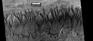
 Group of gullies in Thaumasia quadrangle, as seen by HiRISE under the HiWish program.
 -
 Enlargement of part of previous image showing smaller gullies inside larger ones. Water probably flowed in these gullies more than once.
 -
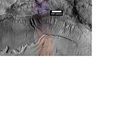
 Gullies and massive flow of material, as seen by HiRISE under HiWish program. Gullies are enlarged in next image. Location is Bamberg crater
 -
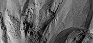
 Close up view of some gullies, as seen by HiRISE under the HiWish program.
 -
 Gullies in a crater, as seen by HiRISE under HiWish program. Location is in the Mare Acidalium quadrangle.
 -
 Close-up of gullies in a crater from previous image. Image taken by HiRISE under HiWish program.
 -
 Wide view of group of gullies, as seen by HiRISE under HiWish program. Note that part of this image is enlarged in the following image. Location is Diacria quadrangle.
 -
 Close-up of gullies, as seen by HiRISE under HiWish program. Streamlined features in the channels are suggestive of a formation by running water. Location is Diacria quadrangle.


-
 Gullies in crater in Phaethontis quadrangle, as seen by HiRISE under HiWish program
 -
 Floor of crater from previous image in Phaethontis quadrangle, as seen by HiRISE under HiWish program Ring mold crater is caused by asteroid reaching an ice layer. Pits on floor may be from ice escaping the ground.
 -
 Gullies in crater, as seen by HiRISE under HiWish program. Location is Eridania quadrangle.
 -
 Close-up of gullies in crater showing channels within larger valleys and curves in channels. These characteristics suggest they were made by flowing water. Note: this is an enlargement of the previous image by HiRISE under HiWish program. Location is Eridania quadrangle.
 -
 Close-up of gully network showing branched channels and curves; these characteristics suggest creation by a fluid. Note: this is an enlargement of a previous wide view of gullies in a crater, as seen by HiRISE under HiWish program. Location is Eridania quadrangle.
 -
 Gullies in two levels of a crater wall, as seen by HiRISE under HiWish program. Gullies at two levels suggests they were not made with an aquifer, as was first suggested. Location is Phaethontis quadrangle.
 -
 Image of gullies with main parts labeled. The main parts of a Martian gully are alcove, channel, and apron. Since there are no craters on this gully, it is thought to be rather young. Picture was taken by HiRISE under HiWish program. Location is Phaethontis quadrangle.
 -
 Close-up of gully aprons showing they are free of craters; hence very young. Location is Phaethontis quadrangle. Picture was taken by HiRISE under HiWish program.
 -
 Gullies on wall of crater, as seen by HiRISE under HiWish program Location is the Mare Acidalium quadrangle.
 -
 Close-up of gully channels, as seen by HiRISE under HiWish program. This image shows many streamlined forms and some benches along a channel. These features suggest formation by running water. Benches are usually formed when the water level goes down a bit and stays at that level for a time. Picture was taken with HiRISE under HiWish program. Location is the Mare Acidalium quadrangle. Note this is an enlargement of a previous image.


-
 Gullies in crater, as seen by HiRISE under HiWish program
 -
 Close view of gullies from previous image The channels are quite curved. Because channels of gullies often form curves, it was thought that they were made by flowing water. Today, it is thought that they could be produced with chunks of dry ice. The image is from HiRISE under HiWish program.


Gullies on Dunes edit
Gullies are found on some dunes. These are somewhat different from gullies in other places, like the walls of craters. Gullies on dunes seem to keep the same width for a long distance and often just end with a pit, instead of an apron. They are often just a few meters across with raised banks along the sides.[14][15] Many of these gullies are found on dunes in Russell (Martian crater). In the winter dry ice accumulates on the dunes and then in the spring dark spots appear and dark-toned streaks grow downhill. After the dry ice is gone, new channels are visible. These gullies may be caused by blocks of dry ice moving down the steep slope or perhaps from dry ice starts the sand moving.[16] In the thin atmosphere of mars, dry ice will expel carbon dioxide with vigor.[17][14]
-
 Wide view of dunes in Russell Crater, as seen by HiRISE Many narrow gullies are visible.
 -
 Close view of the end of gullies in Russell Crater, as seen by HiRISE Note: These type of gullies do not usually end with an apron. The location is Noachis quadrangle.
 -
 Close view of the end of gullies in Russell Crater, as seen by HiRISE
 -
 Close, color view of the end of gullies in Russell Crater, as seen by HiRISE


Medusae Fossae Formation edit
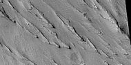
The Medusae Fossae Formation is a soft, easily eroded deposit that extends for nearly 1,000 km along the equator of Mars. Sometimes the formation appears as a smooth and gently undulating surface; however, in places it is wind-sculpted into ridges and grooves.[18] Radar imaging has suggested that the region may contain either extremely porous rock (for example volcanic ash) or deep layers of glacier-like ice deposits amounting to about the same quantity as is stored in Mars' south polar cap.[19][20]
The lower portion (member) of Medusae Fossae Formation contains many patterns and shapes that are thought to be the remains of streams. It is believed that streams formed valleys that were filled and became resistant to erosion by cementation of minerals or by the gathering of a coarse covering layer. These inverted stream beds are sometimes called sinuous ridges or raised curvilinear features. They may be a kilometer or so in length. Their height ranges from a meter to greater than 10 meters, while the width of the narrow ones is less than 10 meters.[21]
The wind has eroded the surface of the formation into a series of linear ridges called yardangs. These ridges generally point in the direction of the prevailing winds that carved them and demonstrate the erosive power of martian winds. The easily eroded nature of the Medusae Fossae Formation suggests that it is composed of weakly cemented particles, and was most likely formed by the deposition of wind-blown dust or volcanic ash. Layers are seen in parts of the formation. A resistant caprock on the top of yardangs has been observed in Viking,[22] Mars Global Surveyor,[23] and HiRISE photos.[24] Very few impact craters are visible throughout the area so the surface is relatively young.[25]
-
 Medusae Fossae Formation as seen with Mars Odyssey's THEMIS. Notice elongated formations called yardangs.
 -
 Yardangs of various sizes, as seen by HiRISE under HiWish program.
 -
 Yardangs of various sizes, as seen by HiRISE under HiWish program.
 -
 Yardangs formed in light-toned material and surrounded by dark, volcanic basalt sand, as seen by HiRISE under HiWish program.
 -
 Close-up image of yardangs, as seen by HiRISE under HiWish program. Arrows point to transverse aeolian ridges, TAR's, a type of dune. Note this is an enlargement of the previous image from HiRISE.
 -
 Layers in lower member of Medusae Fossae Formation, as seen by HiRISE. Location is Aeolis quadrangle.


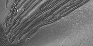
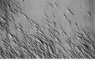
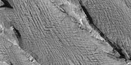
Yardangs edit
Yardangs are common in some regions on Mars, especially in the Medusae Fossae Formation of the Amazonis quadrangle and near the equator.[26] They are formed by the action of wind on sand sized particles; hence they often point in the direction that the winds were blowing when they were formed.[27] Because they exhibit very few impact craters they are believed to be relatively young.[25]
-
 Yardangs, as seen by HiRISE under HiWish program Location is near Gordii Dorsum in the Amazonis quadrangle. These yardangs are in the upper member of the Medusae Fossae Formation.
 -
 Yardangs, as seen by HiRISE under HiWish program Location is near Gordii Dorsum in the Amazonis quadrangle. Note: this is an enlargement of previous image.
 -
 Yardangs, as seen by HiRISE under HiWish program Location is near Gordii Dorsum in the Amazonis quadrangle. Note: this is an enlargement of previous image.


Fretted terrain edit
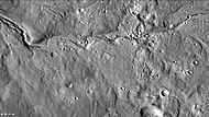
Fretted terrain is a type of surface feature common to certain areas of Mars and discovered in Mariner 9 images. It lies between two different surfaces. The surface of Mars can be divided into two parts: low, young, uncratered plains that cover most of the northern hemisphere, and high-standing, old, heavily cratered areas that cover the southern hemisphere and a small part of the northern hemisphere. Between these two zones is the fretted terrain, containing a complicated mix of cliffs, mesas, buttes, and straight-walled and sinuous canyons. Fretted terrain contains smooth, flat lowlands along with steep cliffs. The scarps or cliffs are usually 1 to 2 km high. Channels in the area have wide, flat floors and steep walls.[28] Fretted terrain is most common in northern Arabia, between latitudes 30°N and 50°N and longitudes 270°W and 360°W.[29] Parts of the fretted terrain are called Deuteronilus Mensae and Protonilus Mensae.
In fretted terrain, the land seems to transition from narrow straight valleys to isolated mesas. Most of the mesas are surrounded by forms that have been called a variety of names (circum-mesa aprons, debris aprons, rock glaciers, and lobate debris aprons).[30] At first they appeared to resemble rock glaciers on Earth, but scientists could not be sure. Eventually, proof of their true nature was discovered by radar studies with the Mars Reconnaissance Orbiter and showed that they contain pure water ice covered with a thin layer of rocks that insulated the ice.[31][32][33][34][35][36]
In addition to rock covered glaciers around mesas, the region has many steep-walled valleys with lineations—ridges and grooves—on their floors. The material comprising these valley floors is called lineated valley fill. In some of the best images taken by the Viking Orbiters, some of the valley fill appeared to resemble alpine glaciers on Earth. Given this similarity, some scientists assumed that the lineations on these valley floors might have formed by flow of ice in (and perhaps through) these canyons and valleys. Today, it is generally agreed that glacial flow caused the lineations.
-
 Fretted terrain of Ismenius Lacus showing flat floored valleys and cliffs. Photo taken with Mars Orbiter Camera (MOC)on the Mars Global Surveyor.
 -
 Enlargement of the photo on the left showing cliff. Photo taken with high resolution camera of Mars Global Surveyor (MGS).
 -
 The arrow in the left picture points to a possibly valley carved by a glacier. The image on the right shows the valley greatly enlarged in a Mars Global Surveyor image.
 -
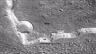 Wide view of mesa with CTX showing Cliff face and location of lobate debris apron (LDA). Location is Ismenius Lacus quadrangle.
 -
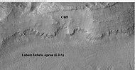 Enlargement of previous CTX image of mesa This image shows the cliff face and detail in the LDA. Image taken with HiRISE under HiWish program. Location is Ismenius Lacus quadrangle.
 -
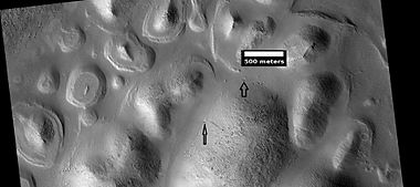
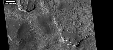
 Lobate debris apron in Phlegra Montes, as seen by HiRISE. The debris apron is probably mostly ice with a thin covering of rock debris, so it could be a source of water for future Martian colonists. Image from the Cebrenia quadrangle. Scale bar is 500 meters long.
 -
 Reull Vallis with lineated floor deposits, as seen by THEMIS. Image located in Hellas quadrangle. Click on image to see relationship to other features.


-
 Wide CTX view showing mesa and buttes with lobate debris aprons and lineated valley fill around them. Location is Ismenius Lacus quadrangle.
 -
 Close-up of lineated valley fill (LVF), as seen by HiRISE under HiWish program Note: this is an enlargement of the previous CTX image.


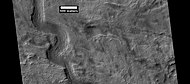
Glaciers edit
Glaciers, loosely defined as patches of currently or recently flowing ice, are thought to be present across large but restricted areas of the modern Martian surface, and are inferred to have been more widely distributed at times in the past.[37][38]

|
-
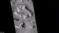
 Mesa in Ismenius Lacus quadrangle, as seen by CTX. Mesa has several glaciers eroding it. One of the glaciers is seen in greater detail in the next two images from HiRISE. Image from Ismenius Lacus quadrangle.
 -
 Glacier as seen by HiRISE under the HiWish program. Area in rectangle is enlarged in the next photo. Zone of accumulation of snow at the top. Glacier is moving down valley, then spreading out on plain. Evidence for flow comes from the many lines on surface. Location is in Protonilus Mensae in Ismenius Lacus quadrangle.
 -
 Enlargement of area in rectangle of the previous image. On Earth the ridge would be called the terminal moraine of an alpine glacier. Picture taken with HiRISE under the HiWish program. Image from Ismenius Lacus quadrangle.
 -
 Glacier coming out of valley, as seen by HiRISE under HiWish program Location is rim of Moreux Crater. Location is Ismenius Lacus quadrangle.
 -
 Probable glacier as seen by HiRISE under HiWish program. Radar studies have found that it is made up of almost totally of pure ice. It appears to be moving from the high ground (a mesa) on the right. Location is Ismenius Lacus quadrangle.


-
 Lobate debris aprons (LDAs) around a mesa, as seen by CTX. Mesa and LDAs are labeled so one can see their relationship. Radar studies have determined that LDAs contain ice; therefore, these can be important for future colonists of Mars. Location is Ismenius Lacus quadrangle.
 -
 Close-up of lobate debris apron (LDA), as seen by HiRISE under HiWish program


-
 Wide CTX view of mesa showing lobate debris apron (LDA) and lineated valley fill. Both are believed to be debris covered glaciers. Location is Ismenius Lacus quadrangle.
 -
 Close-up of lobate debris apron from the previous CTX image of a mesa. Image shows open-cell brain terrain and closed-cell brain terrain, which is more common. Open-cell brain terrain is thought to hold a core of ice. Image is from HiRISE under HiWish program.


Concentric crater fill edit
Concentric crater fill, like lobate debris aprons and lineated valley fill, is believed to be ice-rich.[39] Based on accurate topography measures of height at different points in these craters and calculations of how deep the craters should be based on their diameters, it is thought that the craters are 80% filled with mostly ice.[40][41][42][43] That is, they hold hundreds of meters of material that probably consists of ice with a few tens of meters of surface debris.[44][45] The ice accumulated in the crater from snowfall in previous climates.[46][47][48] Recent modeling suggests that concentric crater fill develops over many cycles in which snow is deposited, then moves into the crater. Once inside the crater, shade and dust preserve the snow. The snow changes to ice. The many concentric lines are created by the many cycles of snow accumulation. Generally snow accumulates whenever the axial tilt reaches 35 degrees.[49]
-
 Crater showing concentric crater fill, as seen by CTX (on Mars Reconnaissance Orbiter). Location is Phaethontis quadrangle.
 -
 Close-up view of concentric crater fill, as seen by HiRISE under HiWish program Note: this is an enlargement of previous image of a concentric crater. Location is Phaethontis quadrangle.
 -
 Crater with concentric crater fill, as seen by CTX (on Mars Reconnaissance Orbiter). Location is Casius quadrangle.
 -
 Well-developed hollows, as seen by HiRISE under the HiWish program. Location is the Casius quadrangle. Note: this is an enlargement of the previous image that was taken by CTX.


Mesas edit
-
 Wide view of Buttes and Mesas, as seen by HiRISE under HiWish program Location is Elysium quadrangle.
 -
 Buttes and mesas, as seen by HiRISE under HiWish program Note: this is an enlargement of the previous image.
 -
 Mesas, as seen by HiRISE under HiWish program Note: this is an enlargement of a previous image.


-
 Layers in mesa, as seen by HiRISE under HiWish program Location is Mare Acidalium quadrangle.
 -
 Close view of layers in mesa, as seen by HiRISE under HiWish program


-
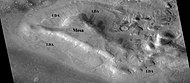
 Wide view of layered buttes and small mesas, as seen by HiRISE under HiWish program Some dark slope streaks are visible. Location is Aeolis quadrangle. Note: Parts of this image are enlarged in next three pictures.
 -
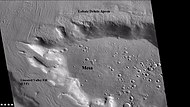
 Layered mesa and mounds with dark slope streaks, as seen by HiRISE under HiWish program
 -
 Close view of layered small mesa with dark slope streak, as seen by HiRISE under HiWish program Box shows the size of a football field.
 -
 Very close view of individual blocks breaking off layer in a butte, as seen by HiRISE under HiWish program Blocks have angular shapes. Box shows size of football field.


Chaos terrain edit
Chaos terrain is believed to be associated with the release of huge amounts of water. The chaotic features may have collapsed when water came out of the surface. Martian outflow channels commonly begin with a Chaos region. A chaotic region can be recognized by a tangle of mesas, buttes, and hills, all chopped through with valleys which in places look almost patterned. Some parts of this chaotic area have not collapsed completely—they are still formed into large mesas, so they may still contain water ice.[50] Chaotic terrain occurs in numerous locations on Mars, and always gives the strong impression that something abruptly disturbed the ground. Chaos regions formed long ago. By counting craters (more craters in any given area means an older surface) and by studying the valleys' relations with other geological features, scientists have concluded the channels formed 2.0 to 3.8 billion years ago.[51]
-
 Huge canyons in Aureum Chaos, as seen by THEMIS. Gullies are rare at this latitude. Image from Margaritifer Sinus quadrangle.
 -
 Iani Chaos, as seen by THEMIS. Sand from eroding mesas is covering brighter floor material. Click on image to see relationship of Iani Chaos to other local features. Image from Margaritifer Sinus quadrangle.
 -

-
 Blocks in Aram showing possible source of water, as seen by THEMIS. Image in Oxia Palus quadrangle.
 -
-
 Ister Chaos, as seen by HiRISE.
 -
 Close-up of Ister Chaos, as seen by HiRISE.


-
 THEMIS image of wide view of following HiRISE images. Black box shows approximate location of HiRISE images. This image is just a part of the vast area known as Aureum Chaos. Click on image to see more details.
 -
 Aureum Chaos, as seen by HiRISE, under the HiWish program.
 -
 Close up view of previous image, as seen by HiRISE under HiWish program. Small round dots are boulders.


-
 Wide view of layers in wall of Aurorae Chaos, as seen by HiRISE under HiWish program
 -
 Close view of layers from previous image, as seen by HiRISE under HiWish program
 -
 Close view of layers from a previous image, as seen by HiRISE under HiWish program Box shows the size of football field.
 -
 Close view of layers from a previous image, as seen by HiRISE under HiWish program


Upper plains unit edit
-
 Layered feature probably formed by the erosion of the upper plains unit, as seen by HiRISE under HiWish program.
 -
 Layered feature in Red Rocks Park, Colorado. This has a different origin than ones on Mars, but it has a similar shape. Features in Red Rocks region were caused by uplift of mountains.


-
![Layered feature that is probably the remains of a once widespread unit that fell from the sky, as seen by HiRISE under the HiWish program. Dipping layers are common in some regions of Mars. They may be the remains of mantle layers. Another idea for their origin was presented at 55th LPSC (2024) by an international team of researchers. They suggest that the layers are from past ice sheets.[52]](//upload.wikimedia.org/wikipedia/commons/thumb/c/c2/ESP_028692_1395pyramidcropped.jpg/380px-ESP_028692_1395pyramidcropped.jpg) Layered feature that is probably the remains of a once widespread unit that fell from the sky, as seen by HiRISE under the HiWish program. Dipping layers are common in some regions of Mars. They may be the remains of mantle layers. Another idea for their origin was presented at 55th LPSC (2024) by an international team of researchers. They suggest that the layers are from past ice sheets.[52]
Layered feature that is probably the remains of a once widespread unit that fell from the sky, as seen by HiRISE under the HiWish program. Dipping layers are common in some regions of Mars. They may be the remains of mantle layers. Another idea for their origin was presented at 55th LPSC (2024) by an international team of researchers. They suggest that the layers are from past ice sheets.[52] -
 Layered feature, as seen by HiRISE under the HiWish program
 -
 Layered feature in crater, as seen by HiRISE under the HiWish program
 -
 Layered feature in crater, as seen by HiRISE under the HiWish program
![Layered feature that is probably the remains of a once widespread unit that fell from the sky, as seen by HiRISE under the HiWish program. Dipping layers are common in some regions of Mars. They may be the remains of mantle layers. Another idea for their origin was presented at 55th LPSC (2024) by an international team of researchers. They suggest that the layers are from past ice sheets.[52]](http://upload.wikimedia.org/wikipedia/commons/thumb/c/c2/ESP_028692_1395pyramidcropped.jpg/380px-ESP_028692_1395pyramidcropped.jpg)


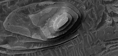
Remnants of a 50–100 meter thick mantling, called the upper plains unit, has been discovered in the mid-latitudes of Mars. First investigated in the Deuteronilus Mensae region, but it occurs in other places as well. The remnants consist of sets of dipping layers in craters and along mesas.[53] Sets of dipping layers may be of various sizes and shapes—some look like Aztec pyramids from Central America. Another idea for their origin was presented at 55th LPSC (2024) by an international team of researchers. They suggest that the layers are from past ice sheets.[54]
-
 Layered structure in crater that is probably what is left of a layered unit that once covered a much larger area. Material for this unit fell from the sky as ice-coated dust. The picture was taken by HiRISE, under the HiWish program.
 -
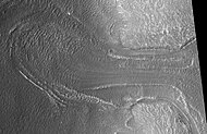
 Wide view of dipping layers along mesa walls, as seen by HiRISE under HiWish program Location is Ismenius Lacus quadrangle.
 -
 Close view of dipping layers along a mesa wall, as seen by HiRISE under HiWish program Location is Ismenius Lacus quadrangle.


This unit also degrades into brain terrain. Brain terrain is a region of maze-like ridges 3–5 meters high. Some ridges may consist of an ice core, so they may be sources of water for future colonists.
-
 Brain terrain, as seen by HiRISE under HiWish program Location is Ismenius Lacus quadrangle.
 -
 Small, layered structure, as seen by HiRISE under the HiWish program Picture also shows brain terrain forming.


Some regions of the upper plains unit display large fractures and troughs with raised rims; such regions are called ribbed upper plains. Fractures are believed to have started with small cracks from stresses. Stress is suggested to initiate the fracture process since ribbed upper plains are common when debris aprons come together or near the edge of debris aprons—such sites would generate compressional stresses. Cracks exposed more surfaces, and consequently more ice in the material sublimates into the planet's thin atmosphere. Eventually, small cracks become large canyons or troughs. Small cracks often contain small pits and chains of pits; these are thought to be from sublimation of ice in the ground.[55][56] Large areas of the Martian surface are loaded with ice that is protected by a meters thick layer of dust and other material. However, if cracks appear, a fresh surface will expose ice to the thin atmosphere.[57][58] In a short time, the ice will disappear into the cold, thin atmosphere in a process called sublimation. Dry ice behaves in a similar fashion on the Earth. On Mars sublimation has been observed when the Phoenix lander uncovered chunks of ice that disappeared in a few days.[59][60] In addition, HiRISE has seen fresh craters with ice at the bottom. After a time, HiRISE saw the ice deposit disappear.[61]
-
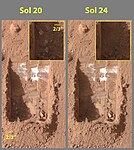
![Die-sized clumps of bright material in the enlarged "Dodo-Goldilocks" trench vanished over the course of four days, implying that they were composed of ice which sublimated following exposure.[60]](//upload.wikimedia.org/wikipedia/commons/thumb/1/1d/Ice_sublimating_in_the_Dodo-Goldilocks_trench.gif/75px-Ice_sublimating_in_the_Dodo-Goldilocks_trench.gif) Die-sized clumps of bright material in the enlarged "Dodo-Goldilocks" trench vanished over the course of four days, implying that they were composed of ice which sublimated following exposure.[60]
Die-sized clumps of bright material in the enlarged "Dodo-Goldilocks" trench vanished over the course of four days, implying that they were composed of ice which sublimated following exposure.[60] -
 Color versions of the photos showing ice sublimation, with the lower left corner of the trench enlarged in the insets in the upper right of the images.
![Die-sized clumps of bright material in the enlarged "Dodo-Goldilocks" trench vanished over the course of four days, implying that they were composed of ice which sublimated following exposure.[60]](http://upload.wikimedia.org/wikipedia/commons/thumb/1/1d/Ice_sublimating_in_the_Dodo-Goldilocks_trench.gif/75px-Ice_sublimating_in_the_Dodo-Goldilocks_trench.gif)

The upper plains unit is thought to have fallen from the sky. It drapes various surfaces, as if it fell evenly. As is the case for other mantle deposits, the upper plains unit has layers, is fine-grained, and is ice-rich. It is widespread; it does not seem to have a point source. The surface appearance of some regions of Mars is due to how this unit has degraded. It is a major cause of the surface appearance of lobate debris aprons.[56] The layering of the upper plains mantling unit and other mantling units are believed to be caused by major changes in the planet's climate. Models predict that the obliquity or tilt of the rotational axis has varied from its present 25 degrees to maybe over 80 degrees over geological time. Periods of high tilt will cause the ice in the polar caps to be redistributed and change the amount of dust in the atmosphere.[62][63][64]
Latitude dependent mantle edit
Much of the Martian surface is covered with a thick ice-rich, mantle layer that has fallen from the sky a number of times in the past.[65][66][67] In some places a number of layers are visible in the mantle.
-
 Surface showing appearance with and without mantle covering, as seen by HiRISE, under the HiWish program. Location is Terra Sirenum in Phaethontis quadrangle.
 -
 Mantle layers, as seen by HiRISE under HiWish program. Location is Eridania quadrangle
 -
 Close up view of mantle, as seen by HiRISE under the HiWish program. Mantle may be composed of ice and dust that fell from the sky during past climatic conditions. Location is Cebrenia quadrangle.
 -
 Smooth mantle with layers in Hellas quadrangle, as seen by HiRISE under HiWish program
 -
 Close view of mantle, as seen by HiRISE under HiWish program Arrows show craters along edge which highlight the thickness of mantle. Location is Ismenius Lacus quadrangle.
 -
 Close view that displays the thickness of the mantle, as seen by HiRISE under HiWish program Location is Ismenius Lacus quadrangle.


It fell as snow and ice-coated dust. There is good evidence that this mantle is ice-rich. The shapes of the polygons common on many surfaces suggest ice-rich soil. High levels of hydrogen (probably from water) have been found with Mars Odyssey.[68][69][70][71][72] Thermal measurements from orbit suggest ice.[73][74] The Phoenix Lander found water ice directly since it landed in a field of polygons and its landing rockets exposed a pure ice surface.[59][75] Theory had predicted that ice would be found under a few cm of soil. This mantle layer is called "latitude dependent mantle" because its occurrence is related to the latitude. It is this mantle that cracks and then forms polygonal ground. This cracking of ice-rich ground is predicted based on physical processes.[76][77] [78][79][80][81][82]
,
Polygonal patterned ground edit
Polygonal, patterned ground is quite common in some regions of Mars.[83][84][85][86][81][87][88] It is commonly believed to be caused by the sublimation of ice from the ground. Sublimation is the direct change of solid ice to a gas. This is similar to what happens to dry ice on the Earth. Places on Mars that display polygonal ground may indicate where future colonists can find water ice. Patterned ground forms in a mantle layer, called latitude dependent mantle, that fell from the sky when the climate was different.[65][66][89][90]
-
 High center polygons, shown with arrows, as seen by HiRISE under HiWish program. Location is Casius quadrangle. Image enlarged with HiView.
 -
 Scalloped terrain labeled with both low center polygons and high center polygons, as seen by HiRISE under HiWish program Location is Casius quadrangle. Image enlarged with HiView.
 -
 High and low center polygons, as seen by HiRISE under HiWish program Location is Casius quadrangle. Image enlarged with HiView.
 -
 Close-up of high center polygons seen by HiRISE under HiWish program Troughs between polygons are easily visible in this view. Location is Ismenius Lacus quadrangle.
 -
 Low center polygons, as seen by HiRISE under HiWish program Location is Casius quadrangle. Image enlarged with HiView. Location is Casius quadrangle.
 -
 Close view of snout of glacier, as seen by HiRISE under the HiWish program High center polygons are visible. Box shows size of football field.
 -
 Close view of high center polygons near glacier, as seen by HiRISE under the HiWish program
 -
 Close view of high center polygons near glacier, as seen by HiRISE under the HiWish program Box shows size of football field.


-
 Wide view of a group of channels, as seen by HiRISE under HiWish project Some parts of the surface show patterned ground when enlarged.
 -
 Patterned ground, as seen by HiRISE under HiWish program This is a close up from previous image.
 -
 Ridges, as seen by HiRISE under HiWish program This is a close up from a previous image.
 -
 Color image of patterned ground, enlarged from a previous image, as seen by HiRISE under HiWish program


,
Scalloped topography edit
Scalloped topography is common in the mid-latitudes of Mars, between 45° and 60° north and south. It is particularly prominent in the region of Utopia Planitia[91][92] in the northern hemisphere and in the region of Peneus and Amphitrites Patera[93][94] in the southern hemisphere. Such topography consists of shallow, rimless depressions with scalloped edges, commonly referred to as "scalloped depressions" or simply "scallops". Scalloped depressions can be isolated or clustered and sometimes seem to coalesce. A typical scalloped depression displays a gentle equator-facing slope and a steeper pole-facing scarp. This topographic asymmetry is probably due to differences in insolation. Scalloped depressions are believed to form from the removal of subsurface material, possibly interstitial ice, by sublimation. This process may still be happening at present.[95]
On November 22, 2016, NASA reported finding a large amount of underground ice in the Utopia Planitia region of Mars.[96] The volume of water detected has been estimated to be equivalent to the volume of water in Lake Superior.[97][98] The volume of water ice in the region were based on measurements from the ground-penetrating radar instrument on Mars Reconnaissance Orbiter, called SHARAD. From the data obtained from SHARAD, “dielectric permittivity”, or the dielectric constant was determined. The dielectric constant value was consistent with a large concentration of water ice.[99][100][101]
,
-
 Scalloped ground, as seen by HiRISE under HiWish program.
 -
 Close-up of scalloped ground, as seen by HiRISE under HiWish program. Surface is divided into polygons; these forms are common where ground freezes and thaws. Note: this is an enlargement of a previous image.
 -
 Scalloped ground, as seen by HiRISE under HiWish program.
 -
 Close-up of scalloped ground, as seen by HiRISE under HiWish program. Surface is divided into polygons; these forms are common where ground freezes and thaws. Note: this is an enlargement of a previous image.
 -
 Stages in scallop formation, as seen by HiRISE. Location is Hellas quadrangle.
 -
 Periglacial Scallops and polygons, as seen by HiRISE under HiWish program.


Ancient rivers? edit
There is great deal of evidence that water once flowed in river valleys on Mars. Pictures from orbit show winding valleys, branched valleys, and even meanders with oxbow lakes.[102] Some are visible in the pictures below.
-
 Channel within a larger channel, as seen by HiRISE under HiWish program
 -
 Channels in Arabia, as seen by CTX This channel winds along for a good distance and has branches. It ends in a depression that may have been a lake at one time.
 -
 Channel in Arabia, as seen by HiRISE under HiWish program. This is an enlargement of the previous image that was taken with CTX to give a wide view.
 -
 Channels in Sklodowska Crater, as seen by HiRISE under the HiWish program.
 -
 Stream meander and cutoff, as seen by HiRISE under HiWish program.
 -
 Oxbow lake, as seen by HiRISE under HiWish program.
 -
 Channel, as seen by HiRISE under HiWish program
 -
 Valleys as seen by HiRISE under HiWish program
 -
 Channel on floor of Newton Crater, as seen by HiRISE under HiWish program.
 -
 Branched channel, as seen by HiRISE under HiWish program.
 -
 Branched channel, as seen by HiRISE under HiWish program.
 -
 Channel showing an old oxbow and a cutoff, as seen by HiRISE under HiWish program. Location is Memnonia quadrangle.
 -
 Channels, as seen by HiRISE under HiWish program. Stream appears to have eroded through a hill.
 -
 Channel, as seen by HiRISE under HiWish program Location is the Cebrenia quadrangle.


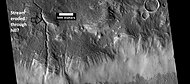
Streamlined shapes edit
Streamlined shapes represent more evidence of past flowing water on Mars. Water shaped features into streamlined shapes.
-
 Streamlined feature, as seen by HiRISE under HiWish program Location is Memnonia quadrangle.

-
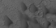
 Wide view of streamlined shapes in Amenthes quadrangle, as seen by HiRISE under HiWish program
 -
 Close view of streamlined shapes, as seen by HiRISE under HiWish program Arrow indicates the direction of past flowing water.
 -
 Close view of streamlined shapes, as seen by HiRISE under HiWish program
 -
 Close view of streamlined shapes, as seen by HiRISE under HiWish program
 -
 Close view of streamlined shapes, as seen by HiRISE under HiWish program
 -
 Close view of streamlined shape, as seen by HiRISE under HiWish program
 -
 Streamlined shapes, as seen by HiRISE under HiWish program Location is the Elysium quadrangle.


Deltas edit
-
 Wide view of a delta in Holden Crater, as seen by CTX
 -
 Part of delta, as seen by HiRISE under HiWish program Note: this is a portion of the previous CTX image.
 -
 Close view of previous image showing layers, as seen by HiRISE under HiWish program and enlarged with HiView


Pedestal crater edit
Pedestal craters are believed to be caused by a crater's ejecta protecting the material beneath it from eroding. The underlying material is probably ice-rich; hence these craters indicate where and how much ice was present in the ground.[103][104][105][106]
-
 Pedestal crater, as seen by HiRISE under HiWish program. Top layer has protected the lower material from being eroded.
 -
 Pedestal craters and layers in Tikonravev Crater in Arabia, as seen by Mars Global Surveyor (MGS), under the MOC Public Targeting Program. Layers may form from volcanoes, the wind, or by deposition under water. Some researchers believe this crater once held a massive lake.
 -
 Pedestal craters form when the ejecta from impacts protect the underlying material from erosion. As a result of this process, craters appear perched above their surroundings.
 -
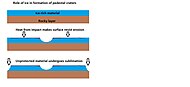 Drawing shows a later idea of how some pedestal craters form. In this way of thinking, an impacting projectile goes into an ice-rich layer—but no further. Heat and wind from the impact hardens the surface against erosion. This hardening can be accomplished by the melting of ice which produces a salt/mineral solution thereby cementing the surface.
 -
 Dark slope streaks near the top of a pedestal crater, as seen by HiRISE under the HiWish program. Note in the middle of the picture, one can see the track of a boulder that rolled down a slope.
 -
 Pedestal crater, as seen by HiRISE under HiWish program The ejecta is not symmetrical around crater because the asteroid came at a low angle out of the North East. The ejecta protected the underlying material from erosion; hence the crater looks elevated. The location is Casius quadrangle.
 -
 Close-up of East side (right side) of previous image of pedestal crater showing polygons on lobe. Since the margin of the crater has lobes and polygons, it is believed there is ice under the protective top. Picture taken with HiRISE under HiWish program. Note: this is an enlargement of the previous image.
 -
 Dark slope streaks and layers near a pedestal crater, as seen by HiRISE under the HiWish program.
 -
 Pedestal crater with layers, as seen by HiRISE under HiWish program Location is Amazonis quadrangle.


Halo Craters edit
-
![Pedestal crater with boulders along rim. Such craters are called "halo craters."[107] Picture taken with HiRISE under HiWish program.](//upload.wikimedia.org/wikipedia/commons/thumb/7/78/ESP_044939_2390pedestalhalocrater.jpg/190px-ESP_044939_2390pedestalhalocrater.jpg) Pedestal crater with boulders along rim. Such craters are called "halo craters."[107] Picture taken with HiRISE under HiWish program.
Pedestal crater with boulders along rim. Such craters are called "halo craters."[107] Picture taken with HiRISE under HiWish program. -
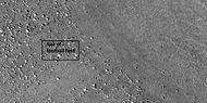 Close view of boulders on lower left of crater rim Box is the size of a football field, so boulders are roughly the size of cars or small houses. Picture taken with HiRISE under HiWish program.
 -
 Close view of boulders along crater rim Boulders are roughly the size of cars or small houses. Picture taken with HiRISE under HiWish program.
![Pedestal crater with boulders along rim. Such craters are called "halo craters."[107] Picture taken with HiRISE under HiWish program.](http://upload.wikimedia.org/wikipedia/commons/thumb/7/78/ESP_044939_2390pedestalhalocrater.jpg/190px-ESP_044939_2390pedestalhalocrater.jpg)


Boulders edit
-
 Boulders, as seen by HiRISE under HiWish program Location is Ismenius Lacus quadrangle.
 -
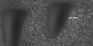 Boulder and boulder tracks, as seen by HiRISE under HiWish program The arrow shows a boulder that has made a track in the sand as it rolled down dune. Location is Mare Boreum quadrangle.
 -
 Boulders and tracks, as seen by HiRISE under HiWish program The arrows show a boulders that have produced a track by rolling down dune. Location is Mare Boreum quadrangle.


Brain terrain edit
Brain terrain is a feature of the Martian surface, consisting of complex ridges found on lobate debris aprons, lineated valley fill and concentric crater fill. It is so named because it suggests the ridges on the surface of the human brain. Wide ridges are called closed-cell brain terrain, and the less common narrow ridges are called open-cell brain terrain.[108] It is thought that the wide closed-cell terrain contains a core of ice, and when the ice disappears the center of the wide ridge collapses to produce the narrow ridges of the open-cell brain terrain.
-
 Closed-cell brain terrain, as seen by HiRISE under the HiWish program. This type of surface is common on lobate debris aprons, concentric crater fill, and lineated valley fill.
 -
 Context picture showing origin of next picture. The location is a region of lineated valley fill. Image from HiRISE under HiWish program.
 -
 Open and closed-cell brain terrain, as seen by HiRISE, under HiWish program.


-
 Wide view of brain terrain being formed, as seen by HiRISE under HiWish program
 -
 Brain terrain being formed, as seen by HiRISE under HiWish program Note: this is an enlargement of the previous image using HiView. Arrows indicate spots where brain terrain is beginning to form.
 -
 Brain terrain being formed, as seen by HiRISE under HiWish program Note: this is an enlargement of a previous image using HiView. Arrows indicate spots where brain terrain is beginning to form.
 -
 Brain terrain being formed, as seen by HiRISE under HiWish program Note: this is an enlargement of a previous image using HiView.
 -
 Brain terrain being formed, as seen by HiRISE under HiWish program Note: this is an enlargement of a previous image using HiView.
 -
 Open and closed brain terrain with labels, as seen by HiRISE under HiWish program
 -
 Open and closed brain terrain with labels, as seen by HiRISE under HiWish program
 -
 Brain terrain being formed, as seen by HiRISE under HiWish program
 -
 Brain terrain being formed, as seen by HiRISE under HiWish program Arrows point to locations where the brain terrain is starting to form.


-
 Wide view of brain terrain being formed, as seen by HiRISE under HiWish program
 -
 Brain terrain being formed, as seen by HiRISE under HiWish program Note: this is an enlargement of the previous image using HiView.
 -
 Brain terrain being formed, as seen by HiRISE under HiWish program Note: this is an enlargement of a previous image using HiView.


Ring mold craters edit
Ring mold craters are believed to be formed from asteroid impacts into ground that has an underlying layer of ice. The impact produces a rebound of the ice layer to form a "ring-mold" shape.
-
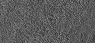 Ring mold craters on floor of a crater, as seen by HiRISE under HiWish program Location is Ismenius Lacus quadrangle.
 -
 Ring mold craters of various sizes on floor of a crater, as seen by HiRISE under HiWish program Location is Ismenius Lacus quadrangle.
 -
 Wide view of a field of ring mold craters, as seen by HiRISE under HiWish program
 -
 Close view of ring mold crater, as seen by HiRISE under HiWish program Note: this is an enlargement of the previous image of a field of ring mold craters.


Rootless Cones edit
Rootless cones are caused by explosions of lava with ground ice under the flow. The ice melts and turns into a vapor that expands in an explosion that produces a cone or ring. Features like these are found in Iceland, when lavas cover water-saturated substrates.[109][110][111]
-
 Wide view of field of rootless cones, as seen by HiRISE under HiWish program
 -
 Close view of rootless cones with tails that suggest lava was moving toward the Southwest over ice-rich ground, as seen by HiRISE under HiWish program
 -
 Close view of cones with the size of a football field shown, as seen by HiRISE under HiWish program


Mud volcanoes edit
Some features look like volcanoes. Some of them may be mud volcanoes where pressurized mud is forced upward forming cones. These features may be places to look for life as they bring to the surface possible life that has been protected from radiation.
-
 Large field of cones that may be mud volcanoes, as seen by HiRISE under HiWish program
 -
 Close-up of possible mud volcanoes, as seen by HiRISE under HiWish program Note: this is an enlargement of the previous image.
 -
 Possible mud volcano, as seen by HiRISE under HiWish program


Lava flows edit
-
 Lava flow in Tharsis quadrangle, as seen by HiRISE under HiWish program
 -
 Close-up of lava flow with labels, as seen by HiRISE under HiWish program Note: this is an enlargement of the previous image of lava flows.
 -
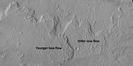 Lava flows with older and younger flows labeled, as seen by HiRISE under HiWish program
 -
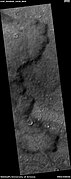 Edge of lava flow, as seen by HiRISE under HiWish program Location is Solis Planum in Phoenicis Lacus quadrangle.
 -
 Wide view of streamlined shape and rafts of lava, as seen by HiRISE under HiWish program Location is Amazonis quadrangle.
 -
 Close view of lava rafts from previous image, as seen by HiRISE under HiWish program


Linear Ridge Networks edit
Linear ridge networks are found in various places on Mars in and around craters.[112] Ridges often appear as mostly straight segments that intersect in a lattice-like manner. They are hundreds of meters long, tens of meters high, and several meters wide. It is thought that impacts created fractures in the surface, these fractures later acted as channels for fluids. Fluids cemented the structures. With the passage of time, surrounding material was eroded away, thereby leaving hard ridges behind. Since the ridges occur in locations with clay, these formations could serve as a marker for clay which requires water for its formation.[113][114][115]
-
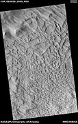 Wide view of large ridge network, as seen by HiRISE under HiWish program
 -
 Close view of ridge network, as seen by HiRISE under HiWish program Box shows size of football field.
 -
 Close, color view of ridges, as seen by HiRISE under HiWish program


-
 Wide view of ridge networks, as seen by HiRISE under HiWish program Parts of this are enlarged in next three images.
 -
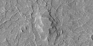 Close view of ridge networks, as seen by HiRISE under HiWish program
 -
 Close view of ridge networks, as seen by HiRISE under HiWish program
 -
 Close view of ridge networks, as seen by HiRISE under HiWish program Since some ridges are at the bottom of the depression, the ridges may be from a lower layer.


-
 Wide view of network of ridges, as seen by HiRISE under HiWish program Portions of this image are enlarged in following images. Location is the Casius quadrangle.
 -
 Close view of network of ridges, as seen by HiRISE under HiWish program This is an enlargement of a previous image.
 -
 Close view of network of ridges, as seen by HiRISE under HiWish program This is an enlargement of a previous image. Box shows the size of a football field.
 -
 Close view of network of ridges, as seen by HiRISE under HiWish program This is an enlargement of a previous image.
 -
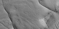 Close view of ridges, as seen by HiRISE under HiWish program This is an enlargement of a previous image. A small mesa in the image displays layers.
 -
 Close, color view of network of ridges, as seen by HiRISE under HiWish program This is an enlargement of a previous image.


Fractures forming blocks edit
In places large fractures break up surfaces. Sometimes straight edges are formed and large cubes are created by the fractures.
-
 Wide view of mesas that are forming fractures, as seen by HiRISE under HiWish program. Location is North Arabia Terra in Ismenius Lacus quadrangle.
 -
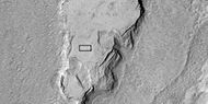 Enlarged view of a part of previous image, as seen by HiRISE under HiWish program. The rectangle represents the size of a football field.
 -
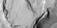 Close-up of blocks being formed, as seen by HiRISE under HiWish program as seen by HiRISE under HiWish program.
 -
 Close-up of blocks being formed, as seen by HiRISE under HiWish program The rectangle represents the size of a football field, so blocks are the size of buildings.
 -
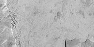 Close-up of blocks being formed, as seen by HiRISE under HiWish program as seen by HiRISE under HiWish program. Many long fractures are visible on the surface.
 -
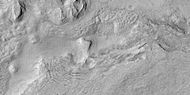 Surface breaking up, as seen by HiRISE under HiWish program as seen by HiRISE under HiWish program. Near the top the surface is eroding into brain terrain.
 -
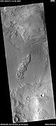 Wide view showing light-toned feature that is breaking into blocks, as seen by HiRISE under HiWish program
 -
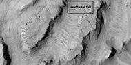 Close view showing blocks being formed, as seen by HiRISE under HiWish program Note: this is an enlargement of the previous image. Box represents size of football field.


Volcanoes under ice edit
There is evidence that volcanoes sometimes erupt under ice, as they do on Earth at times. What seems to happen it that much ice melts, the water goes away, and then the surface cracks and collapses. These exhibit concentric fractures and large pieces of ground that seemed to have been pulled apart. Sites like this may have recently had held liquid water, hence they may be fruitful places to search for evidence of life.[116][117]
-
![Large group of concentric cracks, as seen by HiRISE, under HiWish program Location is Ismenius Lacus quadrangle. Cracks were formed by a volcano under ice.[116]](//upload.wikimedia.org/wikipedia/commons/thumb/9/93/25755concentriccracks.jpg/190px-25755concentriccracks.jpg) Large group of concentric cracks, as seen by HiRISE, under HiWish program Location is Ismenius Lacus quadrangle. Cracks were formed by a volcano under ice.[116]
Large group of concentric cracks, as seen by HiRISE, under HiWish program Location is Ismenius Lacus quadrangle. Cracks were formed by a volcano under ice.[116] -
 Tilted layers formed when ground collapsed, as seen by HiRISE, under HiWish program
 -
 Tilted layers formed from ground collapse, as seen by HiRISE, under HiWish program.
 -
 Mesas breaking up into blocks, as seen by HiRISE, under HiWish program.
![Large group of concentric cracks, as seen by HiRISE, under HiWish program Location is Ismenius Lacus quadrangle. Cracks were formed by a volcano under ice.[116]](http://upload.wikimedia.org/wikipedia/commons/thumb/9/93/25755concentriccracks.jpg/190px-25755concentriccracks.jpg)


Noctis Labyrinthus edit
-
 Moasic of Viking 1 Orbiter pictures showing location of Noctus Labyrinthus
 -
 Noctis Labyrinthus, as seen by Viking 1
 -
 Part of Noctis Labyrinthus as seen by CTX Box shows the area covered by the following HiRISE image
 -
 North and south walls of part of Noctis Labyrinthus, as seen by HiRISE under HiWish program
 -
 Wide view of north wall of part of Noctis Labyrinthus, as seen by HiRISE under HiWish program
 -
 Close view of north wall of part of Noctis Labyrinthus, as seen by HiRISE under HiWish program
 -
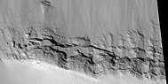 Close view of south wall of part of Noctis Labyrinthus, as seen by HiRISE under HiWish program


Defrosting edit
In the spring, various shapes appear because frost is disappearing from the surface, exposing the underling dark soil. Also, in some places dust is blown out of in geyser-like eruptions that are sometimes called "spiders." If a wind is blowing, the material creates a long, dark streak or fan.
During the winter, much frost accumulates. It freezes out directly onto the surface of the permanent polar cap, which is made of water ice covered with layers of dust and sand. The deposit begins as a layer of dusty CO2 frost. Over the winter, it recrystallizes and becomes denser. The dust and sand particles caught in the frost slowly sink. By the time temperatures rise in the spring, the frost layer has become a slab of semi-transparent ice about 3 feet thick, lying on a substrate of dark sand and dust. This dark material absorbs light and causes the ice to sublimate (turn directly into a gas). Eventually much gas accumulates and becomes pressurized. When it finds a weak spot, the gas escapes and blows out the dust. Speeds can reach 100 miles per hour.[118] Dark channels can sometimes be seen; they are called "spiders."[119][120][121] The surface appears covered with dark spots when this process is occurring.[118][122]
Many ideas have been advanced to explain these features.[123][124][125][126][127][128] These features can be seen in some of the pictures below.
-
 Spiders and frost in polygons during northern spring, as seen by HiRISE under HiWish program.
 -
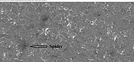 Close-up view of spider among polygons or patterned ground, as seen by HiRISE under HiWish program.
 -
 Spiders shaped by the wind into streak or fans, as seen by HiRISE under HiWish program. Polygon surface has frost in the troughs along the edges.
 -
 Group of dunes with most of the frost gone, as seen by HiRISE under HiWish program. Some ripples are visible.
 -
 Close-up of defrosting dunes, as seen by HiRISE under HiWish program. Some ripples and a small channel are also visible.
 -
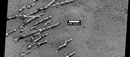 Defrosting dunes and ice in troughs of polygons, as seen by HiRISE under HiWish program
 -
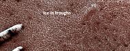 Color view of defrosting dunes and ice in troughs of polygons, as seen by HiRISE under HiWish program
 -
 Defrosting surface, as seen by HiRISE under HiWish program Frost is disappearing in patches from a dune. The trough boundaries around the polygon shapes still contain frost; hence they are white. Note: the north side (side near top) has not defrosted because the sun is coming from the other side.


-
 Wide view of plumes, as seen by HiRISE under HiWish program Many of the plumes show spiders when enlarged.
 -
 Plumes, as seen by HiRISE under HiWish program Arrow shows a double plume. This may have been because of shifting winds.
 -
 Long plume, as seen by HiRISE under HiWish program
 -
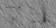 Spiders, as seen by HiRISE under HiWish program
 -
 Plumes and spiders, as seen by HiRISE under HiWish program
 -
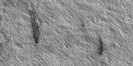 Plumes and spiders, as seen by HiRISE under HiWish program
 -
 Plumes and spiders, as seen by HiRISE under HiWish program
 -
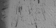 Wide view of plumes and spiders, as seen by HiRISE under HiWish program
 -
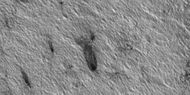 Plumes and spiders, as seen by HiRISE under HiWish program


See also edit
- Barchan – Crescent-shaped dune
- Chaos terrain – Distinctive area of broken or jumbled terrain
- Climate of Mars – Climate patterns of the planet Mars
- Dark slope streak – Surface feature of Mars
- Dust devil tracks – Weather phenomenon on Mars
- Fretted terrain – Surface feature common to certain areas of Mars
- Geology of Mars – Scientific study of the surface, crust, and interior of the planet Mars
- Geysers on Mars – Putative CO2 gas and dust eruptions on Mars
- Glacier – Persistent body of ice that is moving under its own weight
- Glaciers on Mars – Extraterrestrial bodies of ice
- Groundwater on Mars – Water held in permeable ground
- Ismenius Lacus quadrangle – Map of Mars
- Lineated valley fill – Martian geologic feature
- List of areas of chaos terrain on Mars
- Martian chaos terrain – Irregular groups of large blocks of rock
- Martian gullies – Incised networks of narrow channels and sediments on Mars
- Seasonal flows on warm Martian slopes – Surface features on Mars—recurrent slope lineae
- Scalloped topography – Depressions in topography at mid-latitudes of Mars
- Water on Mars – Study of past and present water on Mars
- Yardangs on Mars – Aeolian formation
References edit
- ^ "Newly-Formed Slope Streaks". NASA. Archived from the original on 2007-03-02. Retrieved 2007-03-16.
- ^ McEwen, A.; et al. (2014). "Recurring slope lineae in equatorial regions of Mars". Nature Geoscience. 7 (1): 53–58. Bibcode:2014NatGe...7...53M. doi:10.1038/ngeo2014.
- ^ Ojha, L.; et al. (2014). "HiRISE observations of Recurring Slope Lineae (RSL) during southern summer on Mars". Icarus. 231: 365–376. Bibcode:2014Icar..231..365O. doi:10.1016/j.icarus.2013.12.021.
- ^ McEwen, A.; et al. (2011). "Seasonal Flows on Warm Martian Slopes". Science. 333 (6043): 740–743. Bibcode:2011Sci...333..740M. doi:10.1126/science.1204816. PMID 21817049. S2CID 10460581.
- ^ recurring slope lineae | Red Planet Report
- ^ "Mars Exploration Rover Mission: Press Release Images: Spirit". Marsrovers.jpl.nasa.gov. Retrieved 2012-01-16.
- ^ "Ken Edgett". NASA's Mars Exploration Program. Archived from the original on October 28, 2011. Retrieved January 19, 2012.
- ^ "HiRISE | High Resolution Imaging Science Experiment". Hirise.lpl.arizona.edu?psp_008437_1750. Retrieved 2012-08-04.
- ^ Grotzinger, J. and R. Milliken (eds.). 2012. Sedimentary Geology of Mars. SEPM.
- ^ Massé, M.; Bourgeois, O; Le Mouélic, S.; Verpoorter, C.; Le Deit, L. (March 2011). "Distribution and Origin of Polar Gypsum on Mars" (PDF). 42nd Lunar and Planetary Science Conference. Lunar and Planetary Institute. Retrieved 2015-02-20.
- ^ a b Schatz, Volker; H. Tsoar; K. S. Edgett; E. J. R. Parteli; H. J. Herrmann (2006). "Evidence for indurated sand dunes in the Martian north polar region". Journal of Geophysical Research. 111 (E04006): E04006. Bibcode:2006JGRE..111.4006S. doi:10.1029/2005JE002514.
- ^ Hansen, C. J.; Bourke, M.; Bridges, N. T.; Byrne, S.; Colon, C.; Diniega, S.; Dundas, C.; Herkenhoff, K.; McEwen, A.; Mellon, M.; Portyankina, G.; Thomas, N. (4 February 2011). "Seasonal Erosion and Restoration of Mars' Northern Polar Dunes" (PDF). Science. 331 (6017): 575–578. Bibcode:2011Sci...331..575H. doi:10.1126/science.1197636. PMID 21292976. S2CID 33738104. Retrieved 2015-02-20.
- ^ Malin, M.; Edgett, K. (2000). "Evidence for recent groundwater seepage and surface runoff on Mars". Science. 288 (5475): 2330–2335. Bibcode:2000Sci...288.2330M. doi:10.1126/science.288.5475.2330. PMID 10875910.
- ^ a b "Linear Gullies on Mars Caused by Sliding Dry-Ice". 12 June 2013.
- ^ Dundas, C., et al. 2012. Seasonal activity and morphological changes in martian gullies. Icarus: 220, 124–143.
- ^ McEwen, A., et al. 2017. Mars The Pristine Beauty of the Red Planet. University of Arizona Press. Tucson.
- ^ NASA.gov
- ^ Fraser Cain (2005-03-29). "Medusa Fossae Region on Mars". Universetoday.com. Retrieved 2012-01-16.
- ^ Shiga, David (1 November 2007). "Vast amount of water ice may lie on Martian equator". New Scientist Space. Retrieved 20 January 2011.
- ^ Watters, T. R.; Campbell, B.; Carter, L.; Leuschen, C. J.; Plaut, J. J.; Picardi, G.; Orosei, R.; Safaeinili, A.; et al. (2007). "Radar Sounding of the Medusae Fossae Formation Mars: Equatorial Ice or Dry, Low-Density Deposits?". Science. 318 (5853): 1125–8. Bibcode:2007Sci...318.1125W. doi:10.1126/science.1148112. PMID 17975034. S2CID 25050428.
- ^ Zimbelman, James R.; Griffin, Lora J. (2010). "HiRISE images of yardangs and sinuous ridges in the lower member of the Medusae Fossae Formation, Mars". Icarus. 205 (1): 198–210. Bibcode:2010Icar..205..198Z. doi:10.1016/j.icarus.2009.04.003.
- ^ Scott, David H.; Tanaka, Kenneth L. (1982). "Ignimbrites of Amazonis Planitia Region of Mars". Journal of Geophysical Research. 87 (B2): 1179–1190. Bibcode:1982JGR....87.1179S. doi:10.1029/JB087iB02p01179.
- ^ Malin, MC; Carr, MH; Danielson, GE; Davies, ME; Hartmann, WK; Ingersoll, AP; James, PB; Masursky, H; et al. (March 1998). "Early views of the martian surface from the Mars Orbiter Camera of Mars Global Surveyor". Science. 279 (5357): 1681–5. Bibcode:1998Sci...279.1681M. doi:10.1126/science.279.5357.1681. PMID 9497280.
- ^ Mandt, Kathleen E.; De Silva, Shanaka L.; Zimbelman, James R.; Crown, David A. (2008). "The origin of the Medusae Fossae Formation, Mars: Insights from a synoptic approach". Journal of Geophysical Research. 113 (E12): 12011. Bibcode:2008JGRE..11312011M. doi:10.1029/2008JE003076. hdl:10088/7052.
- ^ a b Medusae Fossae Formation | Mars Odyssey Mission THEMIS
- ^ SAO/NASA ADS Astronomy Abstract Service: Yardangs on Mars
- ^ ESA - 'Yardangs' on Mars
- ^ Strom, R.G.; Croft, S.K.; Barlow, N.G. (1992). "The Martian Impact Cratering Record". In Kieffer, H.H.; Jakosky, B.M.; Snyder, C.W.; Matthews, M.S. (eds.). Mars. Tucson: University of Arizona Press. pp. 384–385. ISBN 978-0-8165-1257-7.
- ^ "Catalog Page for PIA01502". Photojournal.jpl.nasa.gov. Retrieved 2012-01-16.
- ^ http://www.lpi.usra.edu/meetings/lpsc2000/pdf/1053.pdf [bare URL PDF]
- ^ Head, J.; Neukum, G.; Jaumann, R.; Hiesinger, H.; Hauber, E.; Carr, M.; Masson, P.; Foing, B.; Hoffmann, H.; Kreslavsky, M.; Werner, S.; Milkovich, S.; Van Gasselt, S.; Co-Investigator Team, The Hrsc; et al. (2005). "Tropical to mid-latitude snow and ice accumulation, flow and glaciation on Mars". Nature. 434 (7031): 346–50. Bibcode:2005Natur.434..346H. doi:10.1038/nature03359. PMID 15772652. S2CID 4363630.
- ^ Plaut, J.; et al. (2008). "Radar Evidence for Ice in Lobate Debris Aprons in the Mid-Northern Latitudes of Mars". Lunar and Planetary Science. XXXIX: 2290.
- ^ Holt, J.; et al. (2008). "Radar Sounding Evidence for Ice within Lobate Debris Aprons near Hellas Basin, Mid-Southern Latitudes of Mars". Lunar and Planetary Science. XXXIX (1391): 2441. Bibcode:2008LPI....39.2441H.
- ^ Plaut Jeffrey J.; Safaeinili, Ali; Holt, John W.; Phillips, Roger J.; Head, James W.; Seu, Roberto; Putzig, Nathaniel E.; Frigeri, Alessandro; et al. (28 January 2009). "Radar evidence for ice in lobate debris aprons in the mid-northern latitudes of Mars" (PDF). Geophysical Research Letters. 36 (2): L02203. Bibcode:2009GeoRL..36.2203P. doi:10.1029/2008GL036379. S2CID 17530607.
- ^ "Mars' climate in flux: Mid-latitude glaciers | Mars Today – Your Daily Source of Mars News". Mars Today. Archived from the original on 2012-12-05. Retrieved 2012-01-16.
- ^ "Glaciers Reveal Martian Climate Has Been Recently Active". Providence, RI: Brown University. April 23, 2008. Retrieved 2015-02-20.
- ^ "The Surface of Mars" Series: Cambridge Planetary Science (No. 6) ISBN 978-0-511-26688-1 Michael H. Carr, United States Geological Survey, Menlo Park
- ^ Hugh H. Kieffer (1992). Mars. University of Arizona Press. ISBN 978-0-8165-1257-7. Retrieved March 7, 2011.
- ^ Levy, J.; et al. (2009). "Concentric crater fill in Utopia Planitia: History and interaction between glacial "brain terrain" and periglacial processes". Icarus. 202 (2): 462–476. Bibcode:2009Icar..202..462L. doi:10.1016/j.icarus.2009.02.018.
- ^ Levy, J.; Head, J.; Marchant, D. (2010). "Concentric Crater fill in the northern mid-latitudes of Mars: Formation process and relationships to similar landforms of glacial origin". Icarus. 209 (2): 390–404. Bibcode:2010Icar..209..390L. doi:10.1016/j.icarus.2010.03.036.
- ^ Levy, J.; Head, J.; Dickson, J.; Fassett, C.; Morgan, G.; Schon, S. (2010). "Identification of gully debris flow deposits in Protonilus Mensae, Mars: Characterization of a water-bearing, energetic gully-forming process". Earth Planet. Sci. Lett. 294 (3–4): 368–377. Bibcode:2010E&PSL.294..368L. doi:10.1016/j.epsl.2009.08.002.
- ^ HiRISE | Ice Deposition and Loss in an Impact Crater in Utopia Basin (ESP_032569_2225)
- ^ Garvin, J., S. Sakimoto, J. Frawley. 2003. Craters on Mars: Geometric properties from gridded MOLA topography. In: Sixth International Conference on Mars. July 20–25, 2003, Pasadena, California. Abstract 3277.
- ^ Garvin, J. et al. 2002. Global geometric properties of martian impact craters. Lunar Planet. Sci: 33. Abstract # 1255.
- ^ Catalog Page for PIA09662
- ^ Kreslavsky, M. and J. Head. 2006. Modification of impact craters in the northern planes of Mars: Implications for the Amazonian climate history. Meteorit. Planet. Sci.: 41. 1633–1646
- ^ Madeleine, J. et al. 2007. Exploring the northern mid-latitude glaciation with a general circulation model. In: Seventh International Conference on Mars. Abstract 3096.
- ^ HiRISE | Dissected Mantled Terrain (PSP_002917_2175)
- ^ Fastook, J., J. Head. 2014. Concentric crater fill: Rates of glacial accumulation, infilling and deglaciation in the Amazonian and Noachian of Mars. 45th Lunar and Planetary Science Conference (2014) 1227.pdf
- ^ "Unraveling the Chaos of Aram | Mars Odyssey Mission THEMIS". Themis.asu.edu. Retrieved 2012-01-16.
- ^ "Feature Image: Volcanism and Collapse in Hydraotes". 2008-11-26. Archived from the original on January 20, 2010. Retrieved January 19, 2012.
- ^ Blanc, E., et al. 2024. ORIGIN OF WIDESPREAD LAYERED DEPOSITS ASSOCIATED WITH MARTIAN DEBRIS COVERED GLACIERS. 55th LPSC (2024). 1466.pdf
- ^ Carr, M. 2001.
- ^ Blanc, E., et al. 2024. ORIGIN OF WIDESPREAD LAYERED DEPOSITS ASSOCIATED WITH MARTIAN DEBRIS COVERED GLACIERS. 55th LPSC (2024). 1466.pdf
- ^ Morgenstern, A., et al. 2007
- ^ a b Baker, D.; Head, J. (2015). "Extensive Middle Amazonian mantling of debris aprons and plains in Deuteronilus Mensae, Mars: Implication for the record of mid-latitude glaciation". Icarus. 260: 269–288. Bibcode:2015Icar..260..269B. doi:10.1016/j.icarus.2015.06.036.
- ^ Mangold, N (2003). "Geomorphic analysis of lobate debris aprons on Mars at Mars Orbiter Camera scale: Evidence for ice sublimation initiated by fractures". J. Geophys. Res. 108 (E4): 8021. Bibcode:2003JGRE..108.8021M. doi:10.1029/2002je001885.
- ^ Levy, J. et al. 2009. Concentric
- ^ a b Bright Chunks at Phoenix Lander's Mars Site Must Have Been Ice Archived 2016-03-04 at the Wayback Machine – Official NASA press release (19.06.2008)
- ^ a b "NASA.gov". Archived from the original on 2016-03-04. Retrieved 2016-04-08.
- ^ Byrne, S.; et al. (2009). "Distribution of Mid-Latitude Ground Ice on Mars from New Impact Craters". Science. 325 (5948): 1674–1676. Bibcode:2009Sci...325.1674B. doi:10.1126/science.1175307. PMID 19779195. S2CID 10657508.
- ^ Head, J. et al. 2003.
- ^ Madeleine, et al. 2014.
- ^ Schon; et al. (2009). "A recent ice age on Mars: Evidence for climate oscillations from regional layering in mid-latitude mantling deposits". Geophys. Res. Lett. 36 (15): L15202. Bibcode:2009GeoRL..3615202S. doi:10.1029/2009GL038554.
- ^ a b Hecht, M (2002). "Metastability of water on Mars". Icarus. 156 (2): 373–386. Bibcode:2002Icar..156..373H. doi:10.1006/icar.2001.6794.
- ^ a b Mustard, J.; et al. (2001). "Evidence for recent climate change on Mars from the identification of youthful near-surface ground ice". Nature. 412 (6845): 411–414. Bibcode:2001Natur.412..411M. doi:10.1038/35086515. PMID 11473309. S2CID 4409161.
- ^ Pollack, J.; Colburn, D.; Flaser, F.; Kahn, R.; Carson, C.; Pidek, D. (1979). "Properties and effects of dust suspended in the martian atmosphere". J. Geophys. Res. 84: 2929–2945. Bibcode:1979JGR....84.2929P. doi:10.1029/jb084ib06p02929.
- ^ Boynton, W.; et al. (2002). "Distribution of hydrogen in the nearsurface of Mars: Evidence for sub-surface ice deposits". Science. 297 (5578): 81–85. Bibcode:2002Sci...297...81B. doi:10.1126/science.1073722. PMID 12040090. S2CID 16788398.
- ^ Kuzmin, R; et al. (2004). "Regions of potential existence of free water (ice) in the near-surface martian ground: Results from the Mars Odyssey High-Energy Neutron Detector (HEND)". Solar System Research. 38 (1): 1–11. Bibcode:2004SoSyR..38....1K. doi:10.1023/b:sols.0000015150.61420.5b. S2CID 122295205.
- ^ Mitrofanov, I. et al. 2007a. Burial depth of water ice in Mars permafrost subsurface. In: LPSC 38, Abstract #3108. Houston, TX.
- ^ Mitrofanov, I.; et al. (2007b). "Water ice permafrost on Mars: Layering structure and subsurface distribution according to HEND/Odyssey and MOLA/MGS data". Geophys. Res. Lett. 34 (18): 18. Bibcode:2007GeoRL..3418102M. doi:10.1029/2007GL030030. S2CID 45615143.
- ^ Mangold, N.; et al. (2004). "Spatial relationships between patterned ground and ground ice detected by the neutron spectrometer on Mars" (PDF). J. Geophys. Res. 109 (E8): E8. Bibcode:2004JGRE..109.8001M. doi:10.1029/2004JE002235.
- ^ Feldman, W (2002). "Global distribution of neutrons from Mars: Results from Mars Odyssey". Science. 297 (5578): 75–78. Bibcode:2002Sci...297...75F. doi:10.1126/science.1073541. PMID 12040088. S2CID 11829477.
- ^ Feldman, W.; et al. (2008). "North to south asymmetries in the water-equivalent hydrogen distribution at high latitudes on Mars". J. Geophys. Res. 113 (E8). Bibcode:2008JGRE..113.8006F. doi:10.1029/2007JE003020. hdl:2027.42/95381.
- ^ "Confirmation of Water on Mars". Nasa.gov. 2008-06-20. Archived from the original on 2008-07-01. Retrieved 2012-07-13.
- ^ Mutch, T.A.; et al. (1976). "The surface of Mars: The view from the Viking2 lander". Science. 194 (4271): 1277–1283. Bibcode:1976Sci...194.1277M. doi:10.1126/science.194.4271.1277. PMID 17797083. S2CID 38178368.
- ^ Mutch, T.; et al. (1977). "The geology of the Viking Lander 2 site". J. Geophys. Res. 82 (28): 4452–4467. Bibcode:1977JGR....82.4452M. doi:10.1029/js082i028p04452.
- ^ Levy, J.; et al. (2009). "Thermal contraction crack polygons on Mars: Classification, distribution, and climate implications from HiRISE observations". J. Geophys. Res. 114 (E1): E01007. Bibcode:2009JGRE..114.1007L. doi:10.1029/2008JE003273.
- ^ Washburn, A. 1973. Periglacial Processes and Environments. St. Martin's Press, New York, pp. 1–2, 100–147.
- ^ Mellon, M (1997). "Small-scale polygonal features on Mars: Seasonal thermal contraction cracks in permafrost". J. Geophys. Res. 102 (E11): 25617–25628. Bibcode:1997JGR...10225617M. doi:10.1029/97je02582.
- ^ a b Mangold, N (2005). "High latitude patterned grounds on Mars: Classification, distribution and climatic control". Icarus. 174 (2): 336–359. Bibcode:2005Icar..174..336M. doi:10.1016/j.icarus.2004.07.030.
- ^ Marchant, D.; Head, J. (2007). "Antarctic dry valleys: Microclimate zonation, variable geomorphic processes, and implications for assessing climate change on Mars". Icarus. 192 (1): 187–222. Bibcode:2007Icar..192..187M. doi:10.1016/j.icarus.2007.06.018.
- ^ Refubium – Suche
- ^ Kostama, V.-P.; Kreslavsky, Head (2006). "Recent high-latitude icy mantle in the northern plains of Mars: Characteristics and ages of emplacement". Geophys. Res. Lett. 33 (11): L11201. Bibcode:2006GeoRL..3311201K. doi:10.1029/2006GL025946. S2CID 17229252.
- ^ Malin, M.; Edgett, K. (2001). "Mars Global Surveyor Mars Orbiter Camera: Interplanetary cruise through primary mission". J. Geophys. Res. 106 (E10): 23429–23540. Bibcode:2001JGR...10623429M. doi:10.1029/2000je001455.
- ^ Milliken, R.; et al. (2003). "Viscous flow features on the surface of Mars: Observations from high-resolution Mars Orbiter Camera (MOC) images". J. Geophys. Res. 108 (E6): E6. Bibcode:2003JGRE..108.5057M. doi:10.1029/2002JE002005.
- ^ Kreslavsky, M.; Head, J. (2000). "Kilometer-scale roughness on Mars: Results from MOLA data analysis". J. Geophys. Res. 105 (E11): 26695–26712. Bibcode:2000JGR...10526695K. doi:10.1029/2000je001259.
- ^ Seibert, N.; Kargel, J. (2001). "Small-scale martian polygonal terrain: Implications for liquid surface water". Geophys. Res. Lett. 28 (5): 899–902. Bibcode:2001GeoRL..28..899S. doi:10.1029/2000gl012093. S2CID 129590052.
- ^ Kreslavsky, M.A., Head, J.W., 2002. High-latitude Recent Surface Mantle on Mars: New Results from MOLA and MOC. European Geophysical Society XXVII, Nice.
- ^ Head, J.W.; Mustard, J.F.; Kreslavsky, M.A.; Milliken, R.E.; Marchant, D.R. (2003). "Recent ice ages on Mars". Nature. 426 (6968): 797–802. Bibcode:2003Natur.426..797H. doi:10.1038/nature02114. PMID 14685228. S2CID 2355534.
- ^ Lefort, A.; Russell, P. S.; Thomas, N.; McEwen, A. S.; Dundas, C. M.; Kirk, R. L. (2009). "Observations of periglacial landforms in Utopia Planitia with the High Resolution Imaging Science Experiment (HiRISE)". Journal of Geophysical Research. 114 (E4): E04005. Bibcode:2009JGRE..114.4005L. doi:10.1029/2008JE003264.
- ^ Morgenstern, A; Hauber, E; Reiss, D; van Gasselt, S; Grosse, G; Schirrmeister, L (2007). "Deposition and degradation of a volatile-rich layer in Utopia Planitia, and implications for climate history on Mars". Journal of Geophysical Research: Planets. 112 (E6): E06010. Bibcode:2007JGRE..112.6010M. doi:10.1029/2006JE002869.
- ^ Lefort, A.; Russell, P.S.; Thomas, N. (2010). "Scalloped terrains in the Peneus and Amphitrites Paterae region of Mars as observed by HiRISE". Icarus. 205 (1): 259. Bibcode:2010Icar..205..259L. doi:10.1016/j.icarus.2009.06.005.
- ^ Zanetti, M.; Hiesinger, H.; Reiss, D.; Hauber, E.; Neukum, G. (2009). "Scalloped Depression Development on Malea Planum and the Southern Wall of the Hellas Basin, Mars" (PDF). Lunar and Planetary Science. 40. p. 2178, abstract 2178. Bibcode:2009LPI....40.2178Z.
- ^ http://hiroc.lpl.arizona.edu/images/PSP?diafotizo.php?ID=PSP_002296_1215[permanent dead link]
- ^ Huge Underground Ice Deposit on Mars Is Bigger Than New Mexico | Space
- ^ Staff (November 22, 2016). "Scalloped Terrain Led to Finding of Buried Ice on Mars". NASA. Retrieved November 23, 2016.
- ^ "Lake of frozen water the size of New Mexico found on Mars – NASA". The Register. November 22, 2016. Retrieved November 23, 2016.
- ^ Bramson, A, et al. 2015. Widespread excess ice in Arcadia Planitia, Mars. Geophysical Research Letters: 42, 6566–6574
- ^ "Widespread, Thick Water Ice found in Utopia Planitia, Mars". Archived from the original on 2016-11-30. Retrieved 2016-11-29.
- ^ Stuurman, C., et al. 2016. SHARAD detection and characterization of subsurface water ice deposits in Utopia Planitia, Mars. Geophysical Research Letters: 43, 9484_9491.
- ^ Baker, V. 1982. The Channels of Mars. Univ. of Tex. Press, Austin, TX
- ^ http://hirise.lpl.eduPSP_008508_1870[permanent dead link]
- ^ Bleacher, J. and S. Sakimoto. Pedestal Craters, A Tool For Interpreting Geological Histories and Estimating Erosion Rates. LPSC
- ^ "Feature Image: Pedestal Craters in Utopia". Archived from the original on 2010-01-18. Retrieved 2010-03-26.
- ^ McCauley, J. F. (1973). "Mariner 9 evidence for wind erosion in the equatorial and mid-latitude regions of Mars". Journal of Geophysical Research. 78 (20): 4123–4137. Bibcode:1973JGR....78.4123M. doi:10.1029/JB078i020p04123.
- ^ Levy, J. et al. 2008. Origin and arrangement of boulders on the martian northern plains: Assessment of emplacement and modification environments> In 39th Lunar and Planetary Science Conference, Abstract #1172. League City, TX
- ^ Levy, J.; Head, J.; Marchant, D. (2009). "Concentric crater fill in Utopia Planitia: History and interaction between glacial "brain terrain" and periglacial mantle processes". Icarus. 202 (2): 462–476. Bibcode:2009Icar..202..462L. doi:10.1016/j.icarus.2009.02.018.
- ^ S. Fagents, A., P. Lanagan, R. Greeley. 2002. Rootless cones on Mars: a consequence of lava-ground ice interaction. Geological Society, Londo. Special Publications: 202, 295–317.
- ^ PSR Discoveries: Rootless cones on Mars
- ^ Jaeger, W., L. Keszthelyi, A. McEwen, C. Dundas, P. Russell, and the HiRISE team. 2007. EARLY HiRISE OBSERVATIONS OF RING/MOUND LANDFORMS IN ATHABASCA VALLES, MARS. Lunar and Planetary Science XXXVIII 1955.pdf.
- ^ Head, J., J. Mustard. 2006. Breccia dikes and crater-related faults in impact craters on Mars: Erosion and exposure on the floor of a crater 75 km in diameter at the dichotomy boundary, Meteorit. Planet Science: 41, 1675–1690.
- ^ Mangold; et al. (2007). "Mineralogy of the Nili Fossae region with OMEGA/Mars Express data: 2. Aqueous alteration of the crust". J. Geophys. Res. 112 (E8): E08S04. Bibcode:2007JGRE..112.8S04M. doi:10.1029/2006JE002835. S2CID 15188454.
- ^ Mustard et al., 2007. Mineralogy of the Nili Fossae region with OMEGA/Mars Express data: 1. Ancient impact melt in the Isidis Basin and implications for the transition from the Noachian to Hesperian, J. Geophys. Res., 112.
- ^ Mustard; et al. (2009). "Composition, Morphology, and Stratigraphy of Noachian Crust around the Isidis Basin". J. Geophys. Res. 114 (7): E00D12. Bibcode:2009JGRE..114.0D12M. doi:10.1029/2009JE003349.
- ^ a b Levy, J., et al. 2017. Candidate volcanic and impact-induced ice depressions on Mars. Icarus: 285, 185–194.
- ^ University of Texas at Austin. "A funnel on Mars could be a place to look for life." ScienceDaily. ScienceDaily, 10 November 2016. <www.sciencedaily.com/releases/2016/11/161110125408.htm>.
- ^ a b Gas jets spawn dark 'spiders' and spots on Mars icecap | Mars Odyssey Mission THEMIS
- ^ Benson, M. 2012. Planetfall: New Solar System Visions
- ^ Spiders Invade Mars
- ^ Kieffer H, Christensen P, Titus T. 2006 Aug 17. CO2 jets formed by sublimation beneath translucent slab ice in Mars' seasonal south polar ice cap. Nature: 442(7104):793-6.
- ^ NASA.gov
- ^ Kieffer, H. H. (2000). "Mars Polar Science 2000 – Annual Punctuated CO2 Slab-ice and Jets on Mars" (PDF). Retrieved 6 September 2009.
{{cite journal}}: Cite journal requires|journal=(help) - ^ Kieffer, Hugh H. (2003). "Third Mars Polar Science Conference (2003)- Behavior of Solid CO" (PDF). Retrieved 6 September 2009.
{{cite journal}}: Cite journal requires|journal=(help) - ^ Portyankina, G., ed. (2006). "Fourth Mars Polar Science Conference – Simulations of Geyser-Type Eruptions in Cryptic Region of Martian South" (PDF). Retrieved 11 August 2009.
{{cite journal}}: Cite journal requires|journal=(help) - ^ Sz. Bérczi; et al., eds. (2004). "Lunar and Planetary Science XXXV (2004) – Stratigraphy of Special Layers – Transient Ones on Permeable Ones: Examples" (PDF). Retrieved 12 August 2009.
{{cite journal}}: Cite journal requires|journal=(help) - ^ "NASA Findings Suggest Jets Bursting From Martian Ice Cap". Jet Propulsion Laboratory. NASA. 16 August 2006. Archived from the original on 10 October 2009. Retrieved 11 August 2009.
- ^ C.J. Hansen; N. Thomas; G. Portyankina; A. McEwen; T. Becker; S. Byrne; K. Herkenhoff; H. Kieffer; M. Mellon (2010). "HiRISE observations of gas sublimation-driven activity in Mars' southern polar regions: I. Erosion of the surface" (PDF). Icarus. 205 (1): 283–295. Bibcode:2010Icar..205..283H. doi:10.1016/j.icarus.2009.07.021. Retrieved 26 July 2010.
Recommended reading edit
- Lorenz, R. 2014. The Dune Whisperers. The Planetary Report: 34, 1, 8–14
- Lorenz, R., J. Zimbelman. 2014. Dune Worlds: How Windblown Sand Shapes Planetary Landscapes. Springer Praxis Books / Geophysical Sciences.
- Grotzinger, J. and R. Milliken (eds.). 2012. Sedimentary Geology of Mars. SEPM.