
KNOWPIA
WELCOME TO KNOWPIA

Condette 
Summary
Condette (French pronunciation: [kɔ̃dɛt]) is a commune in the Pas-de-Calais department in the Hauts-de-France region of France.[3]
Condette | |
|---|---|
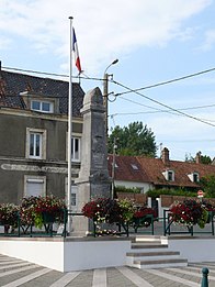
 The town hall of Condette | |
 Coat of arms | |
Location of Condette .mw-parser-output .locmap .od{position:absolute}.mw-parser-output .locmap .id{position:absolute;line-height:0}.mw-parser-output .locmap .l0{font-size:0;position:absolute}.mw-parser-output .locmap .pv{line-height:110%;position:absolute;text-align:center}.mw-parser-output .locmap .pl{line-height:110%;position:absolute;top:-0.75em;text-align:right}.mw-parser-output .locmap .pr{line-height:110%;position:absolute;top:-0.75em;text-align:left}.mw-parser-output .locmap .pv>div{display:inline;padding:1px}.mw-parser-output .locmap .pl>div{display:inline;padding:1px;float:right}.mw-parser-output .locmap .pr>div{display:inline;padding:1px;float:left}html.skin-theme-clientpref-night .mw-parser-output .od,html.skin-theme-clientpref-night .mw-parser-output .od .pv>div,html.skin-theme-clientpref-night .mw-parser-output .od .pl>div,html.skin-theme-clientpref-night .mw-parser-output .od .pr>div{background:#000;color:#fff}html.skin-theme-clientpref-night .mw-parser-output .locmap{filter:grayscale(0.6)}@media(prefers-color-scheme:dark){html.skin-theme-clientpref-os .mw-parser-output .locmap{filter:grayscale(0.6)}html.skin-theme-clientpref-os .mw-parser-output .od,html.skin-theme-clientpref-os .mw-parser-output .od .pv>div,html.skin-theme-clientpref-os .mw-parser-output .od .pl>div,html.skin-theme-clientpref-os .mw-parser-output .od .pr>div{background:#000;color:#fff}}  Condette  Condette | |
| Coordinates: 50°39′18″N 1°38′03″E / 50.655°N 1.6342°E | |
| Country | France |
| Region | Hauts-de-France |
| Department | Pas-de-Calais |
| Arrondissement | Boulogne-sur-Mer |
| Canton | Outreau |
| Intercommunality | CA du Boulonnais |
| Government | |
| • Mayor (2020–2026) | Hervé Leclercq[1] |
| Area 1 | 16.26 km2 (6.28 sq mi) |
| Population (2021)[2] | 2,469 |
| • Density | 150/km2 (390/sq mi) |
| Time zone | UTC+01:00 (CET) |
| • Summer (DST) | UTC+02:00 (CEST) |
| INSEE/Postal code | 62235 /62360 |
| Elevation | 6–106 m (20–348 ft) (avg. 35 m or 115 ft) |
| 1 French Land Register data, which excludes lakes, ponds, glaciers > 1 km2 (0.386 sq mi or 247 acres) and river estuaries. | |
Geography edit
A large farming, forestry and tourist village, some 6 miles (9.7 km) south of Boulogne-sur-Mer, at the junction of the D240 and the D940 roads. The river Liane forms the northeast commune border and the A16 autoroute passes through the commune.
Population edit
| Year | Pop. | ±% p.a. |
|---|---|---|
| 1968 | 1,611 | — |
| 1975 | 1,869 | +2.14% |
| 1982 | 2,084 | +1.57% |
| 1990 | 2,392 | +1.74% |
| 1999 | 2,675 | +1.25% |
| 2007 | 2,585 | −0.43% |
| 2012 | 2,574 | −0.09% |
| 2017 | 2,506 | −0.53% |
| Source: INSEE[4] | ||
Places of interest edit
- The church of St.Martin, dating from the fifteenth century.
- The neo-Gothic Château d’Hardelot, dating from the middle of the nineteenth century.
- The manorhouse of the Grand Moulin.
See also edit
References edit
- ^ "Répertoire national des élus: les maires". data.gouv.fr, Plateforme ouverte des données publiques françaises (in French). 9 August 2021.
- ^ "Populations légales 2021". The National Institute of Statistics and Economic Studies. 28 December 2023.
- ^ INSEE commune file
- ^ Population en historique depuis 1968, INSEE
External links edit
Wikimedia Commons has media related to Condette.
- Official town website (in French)
- Official website: Tourism in Boulogne and the Boulonnais region
Gallery edit
-
 Chateau d'Hardelot
 -
 Memorial to the fallen
 -
 The reflecting lakes of Condette


