
KNOWPIA
WELCOME TO KNOWPIA

Cormont 
Summary
Cormont (French pronunciation: [kɔʁmɔ̃]) is a commune in the Pas-de-Calais department in the Hauts-de-France region of France.[3]
Cormont | |
|---|---|
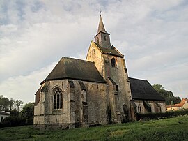 The church of Cormont | |
 Coat of arms | |
Location of Cormont .mw-parser-output .locmap .od{position:absolute}.mw-parser-output .locmap .id{position:absolute;line-height:0}.mw-parser-output .locmap .l0{font-size:0;position:absolute}.mw-parser-output .locmap .pv{line-height:110%;position:absolute;text-align:center}.mw-parser-output .locmap .pl{line-height:110%;position:absolute;top:-0.75em;text-align:right}.mw-parser-output .locmap .pr{line-height:110%;position:absolute;top:-0.75em;text-align:left}.mw-parser-output .locmap .pv>div{display:inline;padding:1px}.mw-parser-output .locmap .pl>div{display:inline;padding:1px;float:right}.mw-parser-output .locmap .pr>div{display:inline;padding:1px;float:left}html.skin-theme-clientpref-night .mw-parser-output .od,html.skin-theme-clientpref-night .mw-parser-output .od .pv>div,html.skin-theme-clientpref-night .mw-parser-output .od .pl>div,html.skin-theme-clientpref-night .mw-parser-output .od .pr>div{background:#000;color:#fff}html.skin-theme-clientpref-night .mw-parser-output .locmap{filter:grayscale(0.6)}@media(prefers-color-scheme:dark){html.skin-theme-clientpref-os .mw-parser-output .locmap{filter:grayscale(0.6)}html.skin-theme-clientpref-os .mw-parser-output .od,html.skin-theme-clientpref-os .mw-parser-output .od .pv>div,html.skin-theme-clientpref-os .mw-parser-output .od .pl>div,html.skin-theme-clientpref-os .mw-parser-output .od .pr>div{background:#000;color:#fff}}  Cormont  Cormont | |
| Coordinates: 50°33′44″N 1°44′10″E / 50.5622°N 1.7361°E | |
| Country | France |
| Region | Hauts-de-France |
| Department | Pas-de-Calais |
| Arrondissement | Montreuil |
| Canton | Étaples |
| Intercommunality | CA Deux Baies en Montreuillois |
| Government | |
| • Mayor (2020–2026) | Emile Crepin[1] |
| Area 1 | 9.71 km2 (3.75 sq mi) |
| Population (2021)[2] | 310 |
| • Density | 32/km2 (83/sq mi) |
| Time zone | UTC+01:00 (CET) |
| • Summer (DST) | UTC+02:00 (CEST) |
| INSEE/Postal code | 62241 /62630 |
| Elevation | 30–119 m (98–390 ft) (avg. 45 m or 148 ft) |
| 1 French Land Register data, which excludes lakes, ponds, glaciers > 1 km2 (0.386 sq mi or 247 acres) and river estuaries. | |
Geography edit
A village situated some 12 miles (19 km) southeast of Boulogne-sur-Mer on the D147 and D146 road junction.
History edit
Mentioned first in 826, as "Curmons".
Places of interest edit
The twelfth century church of St. Michel.
Population edit
| Year | Pop. | ±% p.a. |
|---|---|---|
| 1968 | 237 | — |
| 1975 | 230 | −0.43% |
| 1982 | 236 | +0.37% |
| 1990 | 227 | −0.48% |
| 1999 | 250 | +1.08% |
| 2007 | 281 | +1.47% |
| 2012 | 318 | +2.50% |
| 2017 | 319 | +0.06% |
| Source: INSEE[4] | ||
See also edit
References edit
- ^ "Répertoire national des élus: les maires" (in French). data.gouv.fr, Plateforme ouverte des données publiques françaises. 13 September 2022.
- ^ "Populations légales 2021". The National Institute of Statistics and Economic Studies. 28 December 2023.
- ^ INSEE commune file
- ^ Population en historique depuis 1968, INSEE
Wikimedia Commons has media related to Cormont.