
KNOWPIA
WELCOME TO KNOWPIA

Cotmanhay 
Summary
Cotmanhay is a village in Derbyshire, England,[1][2] and used to be a Viking settlement. Cotmanhay is in the Erewash Borough Council area, north of Ilkeston. Recently a flint implement was found at the edge of Cotmanhay Wood, indicating that the area was inhabited several thousand years BC.[3] The Erewash ward population at the 2011 Census was 4,531.[4]
| Cotmanhay | |
|---|---|
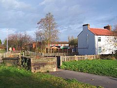 Cotmanhay linear park | |
 Cotmanhay Location within Derbyshire | |
| Population | 4,530 (Erewash Ward population. 2011) |
| District | |
| Shire county | |
| Region | |
| Country | England |
| Sovereign state | United Kingdom |
| Post town | Ilkeston |
| Postcode district | DE7 |
| Police | Derbyshire |
| Fire | Derbyshire |
| Ambulance | East Midlands |
| UK Parliament | |
The neighbourhood's two main industries were textiles and coal mining, the latter from 1848 until 1880.
The 2019 Multiple deprivation index found the area around Skeavingtons Lane to be the most deprived area in Derbyshire.[5][6]
See also edit
References edit
- ^ Ordnance Survey: Landranger map sheet 129 Nottingham & Loughborough (Melton Mowbray) (Map). Ordnance Survey. 2014. ISBN 9780319231623.
- ^ "Ordnance Survey: 1:50,000 Scale Gazetteer" (csv (download)). www.ordnancesurvey.co.uk. Ordnance Survey. 1 January 2016. Retrieved 18 February 2016.
- ^ "Derby Communities Cotmanhay".
- ^ "Erewash ward population 2011". Neighbourhood Statistics. Office for National Statistics. Retrieved 22 March 2016.
- ^ Miller, Claire; Sutherland, Rachel (27 October 2019). "Allenton and Derwent among 'most deprived neighbourhoods' in England". Derbyshire Live. Retrieved 22 February 2021.
- ^ Sutherland, Rachel (16 December 2019). "This is what residents really think of 'most deprived' streets in Derbyshire". Derbyshire Live. Retrieved 22 February 2021.
External links edit
Wikimedia Commons has media related to Cotmanhay.
- Cotmanhay Neighbourhood Management
- Cotmanhay Junior School