


Summary
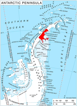
Crane Glacier (65°20′S 62°15′W / 65.333°S 62.250°W), is a narrow glacier which flows 30 miles (50 km) in an east-northeasterly direction along the northwest side of Aristotle Mountains to enter Spillane Fjord south of Devetaki Peak, on the east coast of the Antarctic Peninsula. Sir Hubert Wilkins photographed this feature from the air in 1928 and gave it the name "Crane Channel", after C.K. Crane of Los Angeles, reporting that it appeared to be a channel cutting in an east-west direction across the peninsula. The name was altered to "Crane Inlet" following explorations along the west coast of the peninsula in 1936 by the British Graham Land Expedition, which proved that no through channel from the east coast existed as indicated by Wilkins. Comparison of Wilkins' photograph of this feature with those taken in 1947 by the Falklands Islands Dependencies Survey shows that Wilkins' "Crane Channel" is this glacier, although it lies about 75 miles (120 km) northeast of the position originally reported by Wilkins.[1]
| Crane Glacier | |
|---|---|
 Location of Oscar II Coast on Antarctic Peninsula | |
 Location of Crane Glacier in Antarctica | |
| Location | Graham Land |
| Coordinates | 65°20′S 62°15′W / 65.333°S 62.250°W |
| Length | 50 km (31 mi) |
| Thickness | unknown |
| Terminus | Spillane Fjord |
| Status | unknown |
The speed of Crane Glacier increased threefold after the collapse of the Larsen B Ice Shelf in 2002 and this is likely to be due to the removal of a buttressing effect of the ice shelf.[2]
Tributary glaciers edit
See also edit
Further reading edit
- Rignot, E.; Casassa, G.; Gogineni, P.; Krabill, W.; Rivera, A.; Thomas, R. (2004), Accelerated ice discharge from the Antarctic Peninsula following the collapse of Larsen B ice shelf[permanent dead link], Geophysical Research Letters. 31 (18): L18401. Bibcode:2004GeoRL..3118401R. doi:10.1029/2004GL020697
- Campbell, A. J.; Hulbe, C. L.; Sergienko, O., Investigating the response of Crane Glacier, Antarctic Peninsula to the disintegration of the Larsen B ice shelf using a 2-D flowline model, American Geophysical Union, Fall Meeting 2009, abstract id. C21D-0463
- T. A. Scambos, J. A. Bohlander, C. A. Shuman, and P. Skvarca, Glacier acceleration and thinning after ice shelf collapse in the Larsen B embayment, Antarctica, GEOPHYSICAL RESEARCH LETTERS, VOL. 31, L18402, doi:10.1029/2004GL020670, 2004
- J. Wuite, H. Rott, M. Hetzenecker, D. Floricioiu, J. De Rydt, G. H. Gudmundsson, T. Nagler, and M. Kern, Evolution of surface velocities and ice discharge of Larsen B outlet glaciers from 1995 to 2013, The Cryosphere, 9, 957–969, 2015 www.the-cryosphere.net/9/957/2015/ doi:10.5194/tc-9-957-2015
- United States. Defense Mapping Agency. Hydrographic Center, Sailing Directions for Antarctica: Includes Islands South of Latitude 60°, P 332
References edit
- ^ "Crane Glacier". Geographic Names Information System. United States Geological Survey. Retrieved 2011-12-02.
- ^ Rignot, E.; Casassa, G.; Gogineni, P.; Krabill, W.; Rivera, A.; Thomas, R. (2004). "Accelerated ice discharge from the Antarctic Peninsula following the collapse of Larsen B ice shelf". Geophysical Research Letters. 31 (18): L18401. Bibcode:2004GeoRL..3118401R. doi:10.1029/2004GL020697.
External links edit
- Retreat of Crane Glacier at the NASA Earth Observatory
![]() This article incorporates public domain material from "Crane Glacier". Geographic Names Information System. United States Geological Survey.
This article incorporates public domain material from "Crane Glacier". Geographic Names Information System. United States Geological Survey.