
KNOWPIA
WELCOME TO KNOWPIA

Craywick 
Summary
Craywick (French pronunciation: [kʁɛwik]; French Flemish: Craeywyck and Dutch: Kraaiwijk) is a commune in the Nord department in northern France.[3]
Craywick | |
|---|---|
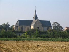 The church in Craywick | |
 Flag  Coat of arms | |
Location of Craywick .mw-parser-output .locmap .od{position:absolute}.mw-parser-output .locmap .id{position:absolute;line-height:0}.mw-parser-output .locmap .l0{font-size:0;position:absolute}.mw-parser-output .locmap .pv{line-height:110%;position:absolute;text-align:center}.mw-parser-output .locmap .pl{line-height:110%;position:absolute;top:-0.75em;text-align:right}.mw-parser-output .locmap .pr{line-height:110%;position:absolute;top:-0.75em;text-align:left}.mw-parser-output .locmap .pv>div{display:inline;padding:1px}.mw-parser-output .locmap .pl>div{display:inline;padding:1px;float:right}.mw-parser-output .locmap .pr>div{display:inline;padding:1px;float:left}html.skin-theme-clientpref-night .mw-parser-output .od,html.skin-theme-clientpref-night .mw-parser-output .od .pv>div,html.skin-theme-clientpref-night .mw-parser-output .od .pl>div,html.skin-theme-clientpref-night .mw-parser-output .od .pr>div{background:#000;color:#fff}html.skin-theme-clientpref-night .mw-parser-output .locmap{filter:grayscale(0.6)}@media(prefers-color-scheme:dark){html.skin-theme-clientpref-os .mw-parser-output .locmap{filter:grayscale(0.6)}html.skin-theme-clientpref-os .mw-parser-output .od,html.skin-theme-clientpref-os .mw-parser-output .od .pv>div,html.skin-theme-clientpref-os .mw-parser-output .od .pl>div,html.skin-theme-clientpref-os .mw-parser-output .od .pr>div{background:#000;color:#fff}}  Craywick  Craywick | |
| Coordinates: 50°58′16″N 2°14′13″E / 50.971°N 2.237°E | |
| Country | France |
| Region | Hauts-de-France |
| Department | Nord |
| Arrondissement | Dunkerque |
| Canton | Grande-Synthe |
| Intercommunality | CU de Dunkerque |
| Government | |
| • Mayor (2020–2026) | Pierre Desmadrille[1] |
| Area 1 | 7.73 km2 (2.98 sq mi) |
| Population (2021)[2] | 749 |
| • Density | 97/km2 (250/sq mi) |
| Time zone | UTC+01:00 (CET) |
| • Summer (DST) | UTC+02:00 (CEST) |
| INSEE/Postal code | 59159 /59279 |
| Elevation | 0–8 m (0–26 ft) (avg. 2 m or 6.6 ft) |
| 1 French Land Register data, which excludes lakes, ponds, glaciers > 1 km2 (0.386 sq mi or 247 acres) and river estuaries. | |
Heraldry edit
 |
The arms of Craywick are blazoned : Gules, an escarbuncle pommy and fleury Or, the middle branch ending in a crozier Or, all within a bordure compony argent and sable. (Craywick and Saint-Momelin use the same arms.)
|
One of the very few places in France with an English name.
Gallery edit

See also edit
References edit
- ^ "Répertoire national des élus: les maires". data.gouv.fr, Plateforme ouverte des données publiques françaises (in French). 2 December 2020.
- ^ "Populations légales 2021". The National Institute of Statistics and Economic Studies. 28 December 2023.
- ^ INSEE commune file
Wikimedia Commons has media related to Craywick.