
KNOWPIA
WELCOME TO KNOWPIA

Criquetot-l'Esneval 
Summary
Criquetot-l'Esneval (French pronunciation: [kʁikto lɛnval]) is a commune in the Seine-Maritime department in the Normandy region in northern France. The physician and erudite Louis-Henri Baratte was born in Criquetot-l'Esneval in 1803.
Criquetot-l'Esneval | |
|---|---|
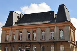 Town hall | |
Location of Criquetot-l'Esneval .mw-parser-output .locmap .od{position:absolute}.mw-parser-output .locmap .id{position:absolute;line-height:0}.mw-parser-output .locmap .l0{font-size:0;position:absolute}.mw-parser-output .locmap .pv{line-height:110%;position:absolute;text-align:center}.mw-parser-output .locmap .pl{line-height:110%;position:absolute;top:-0.75em;text-align:right}.mw-parser-output .locmap .pr{line-height:110%;position:absolute;top:-0.75em;text-align:left}.mw-parser-output .locmap .pv>div{display:inline;padding:1px}.mw-parser-output .locmap .pl>div{display:inline;padding:1px;float:right}.mw-parser-output .locmap .pr>div{display:inline;padding:1px;float:left}html.skin-theme-clientpref-night .mw-parser-output .od,html.skin-theme-clientpref-night .mw-parser-output .od .pv>div,html.skin-theme-clientpref-night .mw-parser-output .od .pl>div,html.skin-theme-clientpref-night .mw-parser-output .od .pr>div{background:#000;color:#fff}html.skin-theme-clientpref-night .mw-parser-output .locmap{filter:grayscale(0.6)}@media(prefers-color-scheme:dark){html.skin-theme-clientpref-os .mw-parser-output .locmap{filter:grayscale(0.6)}html.skin-theme-clientpref-os .mw-parser-output .od,html.skin-theme-clientpref-os .mw-parser-output .od .pv>div,html.skin-theme-clientpref-os .mw-parser-output .od .pl>div,html.skin-theme-clientpref-os .mw-parser-output .od .pr>div{background:#000;color:#fff}}  Criquetot-l'Esneval  Criquetot-l'Esneval | |
| Coordinates: 49°38′40″N 0°16′01″E / 49.6444°N 0.2669°E | |
| Country | France |
| Region | Normandy |
| Department | Seine-Maritime |
| Arrondissement | Le Havre |
| Canton | Octeville-sur-Mer |
| Intercommunality | Le Havre Seine Métropole |
| Government | |
| • Mayor (2020–2026) | Alain Fleuret[1] |
| Area 1 | 13.47 km2 (5.20 sq mi) |
| Population (2021)[2] | 2,567 |
| • Density | 190/km2 (490/sq mi) |
| Time zone | UTC+01:00 (CET) |
| • Summer (DST) | UTC+02:00 (CEST) |
| INSEE/Postal code | 76196 /76280 |
| Elevation | 94–136 m (308–446 ft) (avg. 122 m or 400 ft) |
| 1 French Land Register data, which excludes lakes, ponds, glaciers > 1 km2 (0.386 sq mi or 247 acres) and river estuaries. | |
Geography edit
A small farming town situated in the Pays de Caux, some 15 miles (24 km) northeast of Le Havre, at the junction of the D139, D239 and D79 roads.
Population edit
| Year | Pop. | ±% p.a. |
|---|---|---|
| 1968 | 1,253 | — |
| 1975 | 1,386 | +1.45% |
| 1982 | 1,663 | +2.64% |
| 1990 | 1,979 | +2.20% |
| 1999 | 2,149 | +0.92% |
| 2007 | 2,249 | +0.57% |
| 2012 | 2,367 | +1.03% |
| 2017 | 2,567 | +1.64% |
| Source: INSEE[3] | ||
Places of interest edit
- The two 16th century manorhouses.
- The church of Notre-Dame, dating from the eleventh century.
See also edit
References edit
- ^ "Répertoire national des élus: les maires" (in French). data.gouv.fr, Plateforme ouverte des données publiques françaises. 13 September 2022.
- ^ "Populations légales 2021". The National Institute of Statistics and Economic Studies. 28 December 2023.
- ^ Population en historique depuis 1968, INSEE
External links edit
Wikimedia Commons has media related to Criquetot-l'Esneval.
- Criquetot-l'Esneval official website