


Summary
Dadeng Subdistrict (Chinese: 大嶝街道; pinyin: Dàdèng Jiēdào) is a group of three islands under the de facto administration of the People's Republic of China as part of Xiang'an District of Xiamen in southern Fujian, but is also claimed by the Republic of China and historically constituted as an insular subdistrict in Kinmen County (Quemoy).[4][5][6][7]
Dadeng Subdistrict
大嶝街道 (Chinese) Tateng | |
|---|---|
 View of Jiaoyu from Mashan Broadcasting and Observation Station, Jinsha, Kinmen (Quemoy) | |
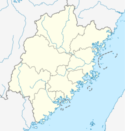 Dadeng Subdistrict Location in Fujian  Dadeng Subdistrict Dadeng Subdistrict (China) | |
| Coordinates: 24°34′16″N 118°19′6″E / 24.57111°N 118.31833°E | |
| Administered by | |
| Claimed by | |
| PRC Province | Fujian |
| Sub-provincial city | Xiamen |
| District | Xiang'an |
| Village-level divisions | 9 residential communities |
| Established | 2005 |
| Area | |
| • Total | 13.2 km2 (5.1 sq mi) |
| Population | |
| • Total | 18,328 |
| • Density | 1,400/km2 (3,600/sq mi) |
| Time zone | UTC+8 (China Standard) |
| Disputed island | |
|---|---|
 | |
| Administration | |
| PRC Province | Fujian |
| Sub-provincial city | Xiamen |
| District | Xiang'an |
| Claimed by | |
| ROC Province | Fujian |
| County | Kinmen |
| Dadeng Subdistrict | |||||||||
|---|---|---|---|---|---|---|---|---|---|
| Chinese | 大嶝街道 | ||||||||
| |||||||||
History edit

(labelled as 大嶝㠘 and 小嶝㠘)
From the Song Dynasty to the early Republican China period, the area was part of Xiangfeng Li (翔風里).[8]: 99
In 1914, the present-day Dadeng Subdistrict area became part of Xiamen's Siming County.[8]: 99
In 1915, the present-day Dadeng Subdistrict area became part of Kinmen County (Quemoy).[8]: 99 [9]
Japan occupied Kinmen County (Quemoy) during the Second Sino-Japanese War from 1937 to 1945. During this period, the county government was moved to Dadeng.[9]
The islands have been under PRC control since October 9[10] or October 15, 1949[6] initially as part of Nan'an County.[8]: 99 On the day of Qingming Festival in 2005, a monument to the more than 300 PLA soldiers who died during the struggle was erected on Dadeng Island.[11]
In the lead-up to the Battle of Kuningtou in late October 1949, the PLA gathered forces in Aotou (澳頭) (in Xindian, Xiamen), Dadeng (Tateng) and Lianhe (Lienho) (蓮河) (then part of Nan'an County, now also in Xindian).[6][12]
Dadeng District (大嶝區) was established in 1949.[2]
On September 3, 1954, fourteen 120mm and 155mm Chinese Communist artillery in Xiamen (Amoy) and Dadeng (Tateng) fired six thousand rounds at the Kinmen (Quemoy) Islands in a five-hour period. Two Americans of the US Military Assistance Advisory Group, Lieutenant Colonel Alfred Medendorp and Lieutenant Colonel Frank Lynn,[13] were killed in the shelling. On the morning of September 5, three carriers, a cruiser and three destroyers from the United States Seventh Fleet were standing by, patrolling the Taiwan Strait (Formosa Strait) a few miles from Kinmen (Quemoy). On September 7, the Chinese Nationalists responded to the attack with a seventy-six plane air raid on coastal mainland targets, claiming to destroy five of fourteen Chinese Communist artillery pieces, with (ROC) damaged sustained to only three Nationalist planes or (PRC) six Nationalist planes downed and twenty-five damaged. Beijing (Peiping) reported at least sixty deaths as a result of Nationalist bombing. Taipei reported, "great fires at storage points, hundred of junks sunk, and blows at Communist troop concentrations".[14]
In November 1955, a 6,300-foot causeway between Dadeng Island (Tateng Island) and the mainland was under construction by the PRC. On November 28, 1955, Chinese Nationalist 155mm howitzers fired 240 rounds at the causeway. Communist artillery responded with 680 rounds. No major damage was reported.[15][16]
In the Second Taiwan Strait Crisis in 1958, Dadeng was one of the areas from which PLA forces shelled Kinmen County (Quemoy), Republic of China (Taiwan).[6]
In 1958, Dadeng District became Dadeng Combat Zone Commune (大嶝战地公社).[2] During the Second Taiwan Strait Crisis in 1958, the islands were designated by the State Council of the People's Republic of China as the "Hero's Triangle"[17] (英雄三島[1][18]).
In January 1971, Dadeng Combat Zone Commune (along with Xiaodeng and Liuhe) became a part of Tong'an County (later Tong'an District).[2][19][8]: 99
In 1984, Dadeng Combat Zone Commune became Dadeng Township.[2]
In 1991, Dadeng Township became Dadeng Town.[2]
In October 2002, the government of Dadeng Town was moved from Tianqian Village to Xitian (西田).[2]
At the end of 2002, Dadeng was designated a Taiwan Tourism Trade Zone (对台旅游商贸区).[2]
In 2003, Dadeng Town became a part of Xiang'an District.[2]
In September 2005, Dadeng Town became Dadeng Subdistrict.[1][2]
In 2019, plans for a building an airport on Dadeng Island by 2020 involved doubling the size of the island.[20]
Geography edit
Dadeng Subdistrict is made up of offshore islands and islets including:[1][8][21]
- Dadeng[3] (Tateng,[15][16][22] Twalin[23]) (大嶝岛)
- Xiaodeng[3] (Hsiaoteng,[22] Town I.,[23] Siao Deng[24]) (小嶝岛)
- Jiaoyu[3]/Jiao Yu[25] (Chiao I.,[26] Reef I.[23] 角屿)
- Baihajiao (白蛤礁/白哈礁)
Dadeng (大嶝[5][27]/大嶝島[6]), Xiaodeng (小嶝[5][27]/小嶝島[6]) and Jiaoyu (角嶼[5][27][6]) were part of Kinmen County in Republican China and are claimed by modern Kinmen County, Republic of China (Taiwan).[5][6] The islands have been under PRC control since October 9[10] or October 15, 1949.[6]
At low tide, the coast near Mashan (馬山) in northern Jinsha Township, Kinmen County (Quemoy), ROC (Taiwan) is 1.8 kilometres (1.1 mi) from Jiaoyu. Rock-filled waters make passage between the two areas difficult.[28]
Administrative divisions edit
Dadeng Subdistrict administers nine residential communities:[2][29][8]: 94
- Tianqian (T'ien-ch'ien;[23] 田墘社区), Shantou (山头社区), Xunku (𫊻窟社区; traditional characters: 蟳窟社區), Dengqi (嶝崎社区), Shuanghu (Shuang-hu;[23] 双沪社区), Yangtang (Yang-t'ang;[23] 阳塘社区), Beimen (北门社区), Dongcheng (东埕社区), Xiaodeng (Hsiao-teng;[23] 小嶝社区)
See also edit
References edit
- ^ a b c d 大嶝街道. 厦门市翔安区人民政府 PEOPLE'S GOVERNMENT OF XIANG'AN XIAMEN (in Simplified Chinese). 12 July 2019. Retrieved 10 August 2019.
大嶝街道位于厦门市翔安区东南部,隔海北与南安市石井镇毗邻,南与金门岛相对,西南与厦门岛相望,由大嶝、小嶝、角屿三个岛屿组成,总人口约2.6万人,土地面积13.2平方公里,海岸线25.15公里,{...}大嶝,于1958年 "八·二三"炮战中被国务院、中央军委授予"英雄三岛"称号,入编民政部《中国名镇》目录。{...}2005年9月,撤销大嶝镇建制,设立大嶝街道办事处。{...}2002年底中共厦门市市委九届五次全委会通过的《厦门市加快海湾型城市建设实施纲要》,明确把大嶝确定为对台旅游商贸区。{...}一方面加快大嶝战地旅游设施建设,另一方面开辟了"游三岛、登白哈、看金门"的旅游航线,组建了一支豪华舒适的旅游船队。
- ^ a b c d e f g h i j k l 大嶝街道 [Dadeng Subdistrict] (in Simplified Chinese). XZQH.org. 18 December 2015. Retrieved 10 August 2019.
面积13.2平方千米。常住人口18328人(2010年六普)。辖9个社区。{...}1996年,面积13.5平方千米,人口1.9万人,辖田墘、山头、蟳窟、嶝崎、双沪、阳塘、北门、东埕、小嶝9个行政村。{...}【2013年代码及城乡分类】350213001:~001 112田墘社区 ~002 112山头社区 ~003 112蟳窟社区 ~004 112嶝崎社区 ~005 111双沪社区 ~006 112阳塘社区 ~007 112北门社区 ~008 112东埕社区 ~009 112小嶝社区【原大嶝镇代码350213112】
- ^ a b c d e WANG WENJIE (12 August 2009). "Letting Go of the Past". Beijing Review. Retrieved 11 August 2019.
Located in the southeast waters of Xiamen's Xiang'an District, the Dadeng Isles are comprised of three islands—Dadeng, Xiaodeng and Jiaoyu. Known as the Three-Hero Islands, they cover an area of 13.2 square kilometers, with a population of approximately 20,000 people.
- ^ 05-19 臺灣島嶼面積 [Location and Area of Islands in Taiwan]. Ministry of the Interior (in Chinese (Taiwan) and English). Retrieved 20 October 2019.
05-19 金門縣島嶼及面積 Area of Islands in Kinmen County 區域別 Locality 面積(平方公里) Area (km2){...}外圍島嶼 Offshore Islet{...}大嶝 Dadeng 22.7500 小嶝 Xiaodeng 3.3100 角嶝 Jiaodeng 2.4400{...}資料來源:金門縣政府。 Source: Kinmen County Government. 附 註: 1.大嶝、小嶝、角嶝目前由中國大陸管轄,烏坵鄉由金門縣政府代管。 2.總面積151.656平方公里(不含大小嶝角嶝,含烏坵1.2平方公里),部分無人島未列入。 Remark: 1.Dadeng, Xiaodeng, Jiaodeng are governed by Mainland China, Wuqiu belongs to other county but mandated by Kinmen County Government. 2.Total Area of Kinmen is 151.656 km2(Exclude Dadeng, Xiaodeng, Jiaodeng, Include Wuqiu 1.2 km2), some unmanned islands and reefs are not listed.
- ^ a b c d e 行政面積. 金門縣政府民政處 Civil Affairs Department, Kinmen County Government (in Chinese (Taiwan)). 29 January 2019. Retrieved 9 August 2019.
外圍 島嶼 面積單位: (平方公里) 大嶝 22.7500 小嶝 3.3100 角嶼 2.4400{...}附記 本縣縣境總面積153.011平方公里。 (不含中共管轄之大小嶝、角嶼)
- ^ a b c d e f g h i 臺灣歷史地圖 增訂版. [Taiwan Historical Maps, Expanded and Revised Edition] (in Chinese (Taiwan)). Taipei: National Museum of Taiwan History. February 2018. pp. 154, 158–9. ISBN 978-986-05-5274-4.
古寧頭戰役地圖1949年10月 大嶝島(原屬金門縣) 1共軍佔領大嶝、小嶝、角嶼10.15 小嶝島(原屬金門縣)角嶼{...}大嶝島 小嶝島 角嶼 3共軍集結澳頭、大嶝、蓮河 澳頭 蓮河{...}大嶝島{...}共軍主要砲兵陣地{...}2共軍加強沿海戰力,國軍進入緊急戰備狀態 1958.7.15
- ^ Vivien Kim, ed. (2003). Taiwan. Insight Guides. APA Publications. p. 222. ISBN 978-981-234-966-8 – via Internet Archive.
Kinmen is actually an archipelago of 15 islands. Three of them, however, are controlled by China, and only two of the Taiwan-controlled islands - Kinmen main island and Hsiao Kinmen (Little Kinmen) - are open to tourism.
- ^ a b c d e f g 同安县地方志编纂委员会, ed. (October 2000). 同安县志 上册 [Tong'an County Annals, Part 1 of 2] (in Simplified Chinese). Beijing: Zhonghua Book Company. pp. 94, 99. ISBN 7-101-02729-6.
宋至民国初期属翔风里。民国3年起划归思明县(今厦门市),次年由思明县划归金门县。{...}原翔风里一部分,1915年起属金门县。1949年9月起属南安县,1971年划归同安县
(Note: Two maps at the front of this book (namely, 同安县政区图 (Tong'an Xian Zheng Qu Tu, 'Map of the Administrative Divisions of Tong'an County') and 同安县地势图 (Tong'an Xian Dishi Tu, 'Topographical Map of Tong'an County')) show the county boundaries of what was then Tong'an County to include a sliver of maritime areas east of PRC-administered Jiaoyu (角屿) including areas that are north and northeast of ROC-administered Cao Islet in Kinmen County and south of Nan'an and Jinjiang.) - ^ a b "kinmen awareness". 8 December 2017. Retrieved 10 August 2019.
Long belonging to the administration of Tungan Prefecture of Fujian Province, Kinmen had begun its county administration since 1915.{...}In 1937, the County Government was moved to Dadeng for battle and it was later returned to Kinmen after the victory in 1935.
- ^ a b 建治沿革. 泉州市人民政府 [Quanzhou City People's Government] (in Simplified Chinese). Retrieved 10 August 2019.
民国26年4月,南安县治徙溪美。10月,日本侵略军攻陷金门岛及烈屿,金门县政府迁到大嶝乡。{...}1949年8月24日,福建省人民政府(省会福州)成立。8、9月间,南安、永春、惠安、晋江、安溪相继解放。9月, 全省划为八个行政督察区。9月9日,第五行政督察专员公署成立,辖晋江、南安、同安、惠安、安溪、永春、仙游、莆田、金门(待统一)等九县。公署设晋江县城(今泉州市区)。10月9日,金门县大嶝岛、小嶝岛及角屿解放。{...}1970年{...}6月18日,福建省革命委员会决定实行。于是,全区辖有泉州市及晋江、惠安、南安、同安、安溪、永春、德化、金门(待统一)八县。同年12月25日,划金门县大嶝公社归同安县管辖。{...
} - ^ 各界代表大嶝纪念烈士. 国防教育·爱国主义教育 (in Simplified Chinese). 1 October 2014. Archived from the original on 11 August 2019. Retrieved 11 August 2019.
据介绍,建成于2005年清明节的翔安区大嶝浔堀村的这座烈士陵园,是为了纪念1949年解放大嶝岛牺牲的300多位烈士而兴建的。
- ^ Sebastien Roblin (26 February 2017). "Taiwan's Tanks Managed to Do What Hitler's Mighty Panzers Failed to Do at Normandy". The National Interest. Retrieved 11 August 2019.
Calculating that the Republic of China forces had only eleven thousand troops on Kinmen island, the PLA assembled nineteen thousand troops on the mainland and Dadeng Island for the assault.
- ^ "Kinmen unveils monument in honor of US officer". Taipei Times. 8 December 2011. Retrieved 11 August 2019.
The Kinmen Defense Command (KDC) unveiled a cenotaph on Tuesday to commemorate the late Lieutenant Colonel Frank Lynn of the US, who died in a Chinese artillery bombardment on Sept. 3, 1954, on Kinmen.{...}It was placed next to the cenotaph of Lieutenant Colonel Alfred Medendorp, which was installed at the wharf in August 1992. Medendorp was killed in the same bombing.
- ^ "THE CHINESE OFFSHORE ISLANDS". CIA. 8 September 1954. pp. 15, 17–18. Retrieved 11 August 2019.
C. Disposition of Communist Troops and Weapons Chinese Nationalist sources report that fourteen 120 and 155mm Communist guns have been active from Tateng and Amoy Islands, and claim to have destroyed five of these in air attacks since 6 September.{...}B. The 3 September Bombardment On 3 September Communist artillery, located near Amoy and on the Tateng Islands, shelled the northern and western sides of Big Quemoy, saturated Little Quemoy, and hit at Nationalist naval vessels at anchor along the west coast of Big Quemoy and between the Quemoys and Tatan Islands. Six thousand rounds of 120mm and 155mm artillery were poured in during a five-hour barrage. The shelling was unexpectedly accurate and later reports say that the Communist pinpointing was due to Communist agents on Quemoy who directed the Communist shelling. Two Americans of the US Military Assistance Advisory Group were killed in the shelling; Nationalist personnel losses have not been revealed. Several small Nationalist naval vessels were damaged; at least one was sunk. C. American and Nationalist Reaction Reaction was quick. By the morning of 5 September, three carriers, a cruiser and three destroyer divisions of the Seventh Fleet were standing by, patrolling the waters in the Formosa Straits at a distance of several miles from Quemoy; and Nationalist naval and air forces began to strike at targets on the mainland coast in an effort to knock out enemy artillery and disrupt any Communist attempt to assemble an invasion force. D. Results of Nationalist Raids The Nationalists report that a 76-plane air strike on 7 September destroyed 5 of 14 Communist artillery positions, and that only three Nationalist planes were damaged. The Taipei press has made large claims, probably exaggerated, of great fires at storage points, hundred of junks sunk, and blows at Communist troop concentrations. Peiping Radio admits that at least 60 persons in the vicinity of Amoy have been killed by Nationalist bombing. Mainland artillery is said to have shot down at least six Nationalist planes and damaged about 25 others. Peiping on 8 September declared that "anger is aroused" among the Fukien populace.
- ^ a b "IMPLICATIONS OF US-CHICOM GENEVA DEADLOCK". CIA. 29 November 1955. p. 6. Retrieved 9 August 2019.
2. {redacted}ChiComs are building a causeway to link Tateng Island, the Communist territory nearest Quemoy, to mainland. 3.{redacted}several thousand troops (recently arrived in Amoy from Shanghai) will be garrisoned on Tateng after the causeway is completed (in next two months).
- ^ a b "CENTRAL INTELLIGENCE BULLETIN". CIA. 1 December 1955. p. 6. Retrieved 9 August 2019.
After a lull of several weeks in artillery duels in the Quemoy area, Chinese Nationalist 155mm howitzers on 28 November fired 240 rounds at a causeway which the Chinese Communists are constructing between the mainland and Tateng Island, four to five miles north of Quemoy. Communist artillery responded with 680 rounds. No major damage was reported. {redacted} 2. The Chinese Communists began constructing the 6,300-foot causeway to Tateng apparently in early November. Such a link with the mainland would facilitate supply of Communist military positions on Tateng. Communist artillery now on the island is believed to include only 76mm guns, but 122mm or larger weapons could take any point on Quemoy under fire.{redacted}
- ^ Charlie Campbell (24 January 2017). "Donald Trump Could Be Starting a New Cold War With China. But He Has Little Chance of Winning". Time. Retrieved 11 August 2019.
China's State Council designated Xiaodeng and two neighboring islands — Da Deng and Jiao Yu — a "Hero's Triangle" in 1958, owing to their front-line positions. Less than two miles separate Xiaodeng from Kinmen. That's considerably less than the 90 miles from Cuba to Key West, and even narrower than the 2.5-mile Korean DMZ. The peoples of Taiwan and Fujian province, to which Xiaodeng belongs, may have been politically estranged for over half a century, but they share a culture, a cuisine and the Hokkien group of dialects.
- ^ 英雄三岛"霸王花"——中国守岛女兵传奇. China Internet Information Center (in Simplified Chinese). 7 August 2002. Retrieved 11 August 2019.
坐落在厦门同安的大嶝、小嶝、角屿三岛曾因1958年炮击金门而赢得"英雄三岛"的美誉,如今这里早已是一片和平景象,然而在大嶝岛仍有独特的女民兵哨所。
- ^ 南安市历史沿革 [Nan'an City Historical Development] (in Simplified Chinese). XZQH.org. 12 July 2015. Retrieved 15 August 2019.
1971年1月,将大、小嶝及莲河划归同安县。
- ^ Sim Chi Yin (4 March 2019). "Dubai Has Palm Islands, But China Has a Sun, Moon, and Flower". Bloomberg Businessweek. Retrieved 11 August 2019.
Xiamen, a prosperous port city on China's southeast coast across a strait from Taiwan, plans to double the size of a 13-sq.-km island called Dadeng to build a second airport. While Chinese media say the airport is due to be operational by 2020, local officials said in February that the central government has yet to approve it. The photo on the left shows layers of black bags of sand that form a cofferdam—an enclosure built within a body of water to allow the enclosed area to be pumped out. On the right, the site of the future airport.
- ^ 魅力翔安. 厦门市翔安区人民政府 PEOPLE'S GOVERNMENT OF XIANG'AN XIAMEN (in Simplified Chinese). Retrieved 9 August 2019.
翔安区设立于2003年10月19日。陆地总面积420平方公里,海域面积134平方公里,下辖一街(大嶝街道)、四镇(新店、马巷、内厝和新圩),{...}大嶝岛 小嶝岛 角屿 白蛤礁
- ^ a b "CHINESE COMMUNIST ORDER OF BATTLE, EAST CHINA COAST". CIA. 14 August 1950. Retrieved 11 August 2019.
2. The 11 Artillery Regiment is at Ningpo. The 12 and 13 Artillery Regiments moved to South Fukien, and are in Tateng (118-20, 24-35) and Hsiaoteng (118-25, 24-35) Islands and Amoy respectively.
- ^ a b c d e f g "NG 50-15 HSIA-MEN". Washington, D. C.: Army Map Service. 1954 – via Perry–Castañeda Library Map Collection.
Ch'i-k'ou-hsia T'ien-ch'ien 双沪 Shuang-hu 陽塘 Yang-t'ang Ta-teng Tao (Twalin) Hsiao-teng (Town I.) Chiao Hsü (Reef I.)
- ^ 新辰 陳 (11 July 2016). "1607 金門 馬山觀測所 馬山觀測站 馬山播音站 地下坑道 還我河山 望遠鏡瞭望 金門國家公園 台灣金門旅遊53". Flickr. Retrieved 9 May 2020.
小嶝 Siao Deng
- ^ Jiao Yu (Approved - N) at GEOnet Names Server, United States National Geospatial-Intelligence Agency
- ^ DeWitt Copp; Marshall Peck (1962). The Odd Day. New York City: William Morrow & Company. p. 8 – via Internet Archive.
Chiao I.
- ^ a b c 金門縣統計月報 中華民國一Ο六年十二月份 (in Chinese (Taiwan)). 金門縣政府主計處. pp. 5, 6, 8. Retrieved 10 August 2019.
極 北 大嶝田墘 東 經 118 19 6 北 緯 24 34 16{...}區 域 別 面 積 ( 平方公里 ) 佔 總 面 積 百 分 比(%){...} 外 圍 島 嶼 大 嶝 22.7500 16.92 小 嶝 3.3100 1.82 角 嶼 2.4400 1.34{...}說 眀:1.本縣縣境總面積153.0110平方公里(不含中共管轄之大小嶝、角嶼)。{...}說 眀:外圍島嶼土地面積不含中共管轄之大嶝、小嶝及角嶼。
- ^ 金沙鎮-鄉鎮特色. 金門縣金沙鎮公所 Jinsha Township Administration, Kinmen County (in Chinese (Taiwan)). 29 May 2019. Retrieved 21 September 2019.
金沙鎮之馬山為距離大陸最近之地,退潮時與角嶼僅約1,800公尺,其間之海域多為暗礁,不利船隻航行,
- ^ 2018年统计用区划代码和城乡划分代码:大嶝街道 [2018 Statistical Area Numbers and Rural-Urban Area Numbers: Dadeng Subdistrict] (in Simplified Chinese). National Bureau of Statistics of the People's Republic of China. 2018. Retrieved 10 August 2019.
统计用区划代码 城乡分类代码 名称 350213001001 112 田墘社区居委会 350213001002 112 山头社区居委会 350213001003 112 蟳窟社区居委会 350213001004 112 嶝崎社区居委会 350213001005 111 双沪社区居委会 350213001006 112 阳塘社区居委会 350213001007 112 北门社区居委会 350213001008 112 东埕社区居委会 350213001009 112 小嶝社区居委会